Category:Headington
suburb of Oxford, UK  | |||||
| Upload media | |||||
| Instance of | |||||
|---|---|---|---|---|---|
| Location | Oxford, Oxfordshire, South East England, England | ||||
| official website | |||||
 | |||||
Headington, a suburb of Oxford, in Oxfordshire, England
Subcategories
This category has the following 24 subcategories, out of 24 total.
A
B
C
- Churchill Hospital (21 F)
F
- Foresters Tower (3 F)
H
- Headington Cemetery (49 F)
- Headington Library (6 F)
- Headington War Memorial (2 F)
J
- John Radcliffe Hospital (62 F)
K
- The Kilns (4 F)
L
- Lye Valley (17 F)
O
P
- Plowman Tower (5 F)
S
- Headington Shark (33 F)
W
- White Hart, Headington (8 F)
Media in category "Headington"
The following 200 files are in this category, out of 405 total.
(previous page) (next page)-
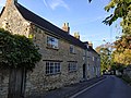 1 And 2, Larkins Lane.jpg 4,000 × 3,000; 5.43 MB
-
 10 Old High Street, Headington, Oxford (42667465175).jpg 2,448 × 3,264; 3.63 MB
-
 A stone pillar and wall on London Road - geograph.org.uk - 6534737.jpg 3,600 × 2,700; 783 KB
-
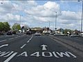
 A40 nears Headington Roundabout - geograph.org.uk - 4853196.jpg 640 × 479; 47 KB
-
 A40, North Way - geograph.org.uk - 4015153.jpg 640 × 430; 70 KB
-
 A40, North Way - geograph.org.uk - 4015163.jpg 640 × 430; 112 KB
-
 A40, North Way - geograph.org.uk - 4015177.jpg 640 × 430; 103 KB
-
 A4142 - geograph.org.uk - 5643480.jpg 640 × 340; 37 KB
-
 A4142 Eastern Bypass Road - geograph.org.uk - 6236967.jpg 1,024 × 684; 300 KB
-
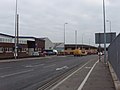
 AlexanderDennis Dart Enviro200 SN63 YPG Headington FoxwellDrive.jpg 1,090 × 727; 571 KB
-
 AlexanderDennis Enviro400 MMC GB14 OXF Headington FoxwellDrive 2 crop.jpg 1,201 × 721; 593 KB
-
 AlexanderDennis Enviro400 MMC GB14 OXF Headington FoxwellDrive 2.jpg 1,100 × 734; 601 KB
-
 AlexanderDennis Enviro400 MMC GB14 OXF Headington FoxwellDrive.jpg 1,072 × 804; 583 KB
-
 AlexanderDennis Enviro400 MMC SN16 OYV Headington.jpg 1,584 × 1,584; 1,017 KB
-
 AlexanderDennis Enviro400 SN15 LPV Headington, Oxford, night.jpg 1,280 × 853; 662 KB
-
 Allotments in Headington - geograph.org.uk - 1399518.jpg 640 × 480; 150 KB
-
 An old stone gatepost in Coppock's Alley - geograph.org.uk - 6531777.jpg 1,980 × 2,640; 560 KB
-
 Approaching Headington Roundabout on the Ring Road - geograph.org.uk - 2483310.jpg 1,600 × 1,200; 569 KB
-
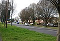
 Autumn colour on Ramsay Road - geograph.org.uk - 5763055.jpg 640 × 360; 99 KB
-
 Barn Of Mathers Farm.jpg 4,000 × 2,000; 3.71 MB
-
 Barton Lane, Headington - geograph.org.uk - 3969464.jpg 3,872 × 2,592; 5.01 MB
-
 Beech Road in Headington - geograph.org.uk - 6124175.jpg 2,700 × 2,025; 419 KB
-
 Bend in the wall - geograph.org.uk - 2439152.jpg 600 × 800; 162 KB
-
 Bend past Manor Farm - geograph.org.uk - 2442305.jpg 1,024 × 768; 241 KB
-
 Bend to St Andrew Road - geograph.org.uk - 2434596.jpg 1,024 × 768; 219 KB
-
 Bending round the wall - geograph.org.uk - 2439522.jpg 1,024 × 768; 224 KB
-
 Blanchford Building Supplies - geograph.org.uk - 3968928.jpg 3,872 × 2,592; 1.3 MB
-
 Boundary Brook - geograph.org.uk - 5413637.jpg 1,125 × 1,500; 391 KB
-
 Boundary Brook - geograph.org.uk - 5413641.jpg 1,125 × 1,500; 403 KB
-
 Boundary Brook - geograph.org.uk - 5413643.jpg 1,125 × 1,500; 375 KB
-
 Boundary stone on north side of Warneford Lane - geograph.org.uk - 3762572.jpg 683 × 1,024; 268 KB
-
 Boundary Wall Of Manor House 01.jpg 4,000 × 3,000; 6.11 MB
-
 Boundary Wall Of Manor House 02.jpg 4,000 × 3,000; 6.15 MB
-
 Boundary Wall Of Number 56 Fronting The Croft.jpg 3,000 × 4,000; 5.35 MB
-
 Boundary Wall Of The Court.jpg 4,032 × 3,024; 5.58 MB
-
 Bowness Avenue, Headington - geograph.org.uk - 2517629.jpg 1,600 × 931; 365 KB
-

-
 Bungalow on Woodlands Road, Headington - geograph.org.uk - 2483259.jpg 1,600 × 1,200; 605 KB
-
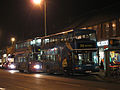 Bus IMG 0896 (15735611524).jpg 2,288 × 1,716; 946 KB
-
 Cars in front - geograph.org.uk - 2439113.jpg 1,024 × 768; 152 KB
-
 Cat in The Croft, Old Headington - geograph.org.uk - 306767.jpg 640 × 431; 114 KB
-
 Cecil Sharp Place, Headington - geograph.org.uk - 1220260.jpg 640 × 480; 69 KB
-
 Churchyard Wall Of The Church Of St Andrew 2.jpg 3,000 × 4,000; 6.6 MB
-
 College entrance on Dunstan Road, Headington - geograph.org.uk - 6274993.jpg 4,319 × 2,973; 3.87 MB
-
 Coming round the bend - geograph.org.uk - 2442263.jpg 1,024 × 768; 247 KB
-

-
 Copse Lane - geograph.org.uk - 6273823.jpg 800 × 600; 143 KB
-
 Corner of London Road and Old High Street, Headington, Oxford, April 2023.jpg 4,032 × 3,024; 7.46 MB
-
 Corner of the Farmhouse - geograph.org.uk - 2442293.jpg 1,024 × 768; 236 KB
-
 Cornerstone Christian Centre - geograph.org.uk - 3968784.jpg 3,872 × 2,592; 1.56 MB
-
 Corpus Christi RC Church, Headington - geograph.org.uk - 6510105.jpg 2,040 × 1,530; 526 KB
-
 Cowley Road mural - geograph.org.uk - 723607.jpg 640 × 480; 90 KB
-
 Crown & Thistle, Headington - geograph.org.uk - 6702889.jpg 6,000 × 4,000; 6.68 MB
-
 Cuckoo Lane in Headington - geograph.org.uk - 6124202.jpg 2,700 × 2,025; 908 KB
-
 Cuckoo Lane in Headington - geograph.org.uk - 6124266.jpg 2,025 × 2,700; 667 KB
-
 Cycle path by the Oxford ring road - geograph.org.uk - 3971833.jpg 3,872 × 2,592; 1.75 MB
-
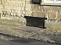
 Damaged benchmark on Headington Post Office - geograph.org.uk - 3684110.jpg 755 × 1,024; 238 KB
-
 Demop on London Road - geograph.org.uk - 6534727.jpg 3,600 × 2,700; 801 KB
-
 Dene Road, Headington - geograph.org.uk - 6273909.jpg 800 × 600; 111 KB
-
 Douglas Veale House on Trafford Road - geograph.org.uk - 6534738.jpg 3,600 × 2,700; 546 KB
-
 Dunstan Park, Headington - geograph.org.uk - 6273831.jpg 800 × 600; 134 KB
-
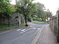
 Dunstan Road - geograph.org.uk - 2434591.jpg 1,024 × 768; 257 KB
-
 Dunstan Road - geograph.org.uk - 2442285.jpg 1,024 × 768; 207 KB
-
 Dunstan road from the cemetery - geograph.org.uk - 2460580.jpg 1,024 × 768; 231 KB
-
 Easter Monday Egg Roll - geograph.org.uk - 7643.jpg 640 × 479; 153 KB
-
 Edward Brooks (41764485160).jpg 1,763 × 1,763; 1.84 MB
-
 Electricity substation, Headley Way, Oxford - geograph.org.uk - 3672573.jpg 2,560 × 1,911; 2.32 MB
-
 Elizabeth Bowen blue plaque 1.jpg 4,032 × 3,024; 3.54 MB
-
 Elizabeth Bowen blue plaque 2.jpg 4,032 × 3,024; 4.74 MB
-
 Elizabeth II postbox on Old Road, New Headington - geograph.org.uk - 6275007.jpg 2,276 × 4,496; 3.34 MB
-
 ENG Oxford Finch Close 01.jpg 4,032 × 3,024; 2.72 MB
-
 ENG Oxford Gipsy Lane 01.jpg 4,016 × 3,012; 3.2 MB
-
 ENG Oxford Gipsy Lane 02.jpg 4,032 × 3,024; 1.79 MB
-
 ENG Oxford Girdlestone Road 01.jpg 3,970 × 2,978; 1.84 MB
-
 ENG Oxford Headington Road 01.jpg 3,024 × 4,032; 3.39 MB
-
 ENG Oxford Lime Walk 01.jpg 4,032 × 3,024; 1.02 MB
-
 ENG Oxford London Road 01.jpg 3,841 × 2,880; 1.94 MB
-
 ENG Oxford New High Street 01.jpg 4,032 × 3,024; 1.18 MB
-
 ENG Oxford Old High Street 01.jpg 4,032 × 3,024; 1.45 MB
-
 ENG Oxford Old High Street 02.jpg 4,032 × 3,024; 1.55 MB
-
 ENG Oxford Old High Street 03.jpg 3,883 × 2,912; 2.58 MB
-
 ENG Oxford Old High Street 04.jpg 4,032 × 3,024; 1.3 MB
-
 ENG Oxford Old High Street 05.jpg 4,032 × 3,024; 1.83 MB
-
 ENG Oxford Old High Street 06.jpg 4,032 × 3,024; 2.68 MB
-
 ENG Oxford Old Road 01.jpg 3,747 × 2,810; 2.2 MB
-
 ENG Oxford Roosevelt Drive 002.jpg 4,032 × 3,024; 1.81 MB
-
 ENG Oxford Roosevelt Drive 003.jpg 4,032 × 3,024; 1.44 MB
-
 ENG Oxford Sandfield Road 01.jpg 4,032 × 3,024; 1.78 MB
-
 ENG Oxford St Andrews Road 05.jpg 4,032 × 3,024; 2.04 MB
-
 ENG Oxford Windmill Road 001.jpg 2,896 × 3,862; 1.02 MB
-
 ENG Oxford Woodlands Road 02.jpg 4,032 × 3,024; 3.83 MB
-
 ENG Oxford Woodlands Road 03.jpg 4,032 × 3,024; 4.62 MB
-

-
 Entrance to Rushley Hall - geograph.org.uk - 2434617.jpg 1,024 × 768; 307 KB
-
 Entrance to the Hall - geograph.org.uk - 2434600.jpg 1,024 × 768; 341 KB
-
 Flats near recreation ground - geograph.org.uk - 6273815.jpg 800 × 600; 107 KB
-
 Flats on Eastern Bypass, Headington - geograph.org.uk - 2483305.jpg 1,600 × 1,200; 628 KB
-
 Footbridge to Warneford Meadow - geograph.org.uk - 5986364.jpg 2,025 × 2,700; 836 KB
-
 Footpath from Warneford Meadow - geograph.org.uk - 6124111.jpg 2,700 × 2,025; 677 KB
-
 Footpath near Boundary Brook - geograph.org.uk - 5986348.jpg 2,700 × 2,025; 810 KB
-
 Footpath near Boundary Brook - geograph.org.uk - 5986350.jpg 2,700 × 2,025; 785 KB
-
 Footpath near Boundary Brook - geograph.org.uk - 5986360.jpg 2,700 × 2,025; 952 KB
-
 Footpath to Barracks Lane - geograph.org.uk - 5413638.jpg 1,125 × 1,500; 331 KB
-
 Footpath to Barracks Lane - geograph.org.uk - 5413639.jpg 1,125 × 1,500; 405 KB
-
 Footpath to Warneford Meadow - geograph.org.uk - 5986362.jpg 2,700 × 2,025; 878 KB
-

-
 Foxwell Drive - geograph.org.uk - 1087377.jpg 640 × 480; 64 KB
-
 Foxwell Drive - geograph.org.uk - 6273829.jpg 800 × 600; 118 KB
-
 Foxwell Drive, Headington - geograph.org.uk - 338755.jpg 640 × 480; 70 KB
-
 Gates to the Farm - geograph.org.uk - 2442278.jpg 1,024 × 768; 216 KB
-
 George V postbox on St Andrew's Road, Headington - geograph.org.uk - 6274983.jpg 1,858 × 3,481; 1.67 MB
-
 Getting lost in ivy - geograph.org.uk - 2439177.jpg 600 × 800; 184 KB
-
 Gipsy Lane - geograph.org.uk - 5202136.jpg 1,024 × 683; 176 KB
-
 Girdlestone Road - geograph.org.uk - 2800196.jpg 3,648 × 2,736; 1.5 MB
-
 Going Nowhere (245504429).jpeg 1,000 × 473; 204 KB
-
 Green corridor between houses and A40 - geograph.org.uk - 337558.jpg 640 × 480; 219 KB
-
 Grunsell Close, Headington - geograph.org.uk - 338758.jpg 640 × 390; 59 KB
-
 Gurdwara Sri Guru Nanak Dev Ji Oxford on London Road - geograph.org.uk - 6534732.jpg 3,600 × 2,700; 1.13 MB
-
 Halliday Hill - geograph.org.uk - 2465014.jpg 1,024 × 768; 251 KB
-
 Hatch to the Beer cellar - geograph.org.uk - 2439129.jpg 1,024 × 768; 296 KB
-

-
 Guest house on London Road, Headington - geograph.org.uk - 1399502.jpg 589 × 640; 131 KB
-
 St Andrew's Church - geograph.org.uk - 1087392.jpg 640 × 480; 68 KB
-
 Headington Baptist Church - geograph.org.uk - 2438690.jpg 1,024 × 768; 135 KB
-
 Headington Baptist Church.jpg 640 × 480; 67 KB
-
 Headington Bowls Club - geograph.org.uk - 6124619.jpg 2,700 × 2,025; 288 KB
-
 Headington ClockCorner.jpg 2,940 × 1,960; 1.67 MB
-
 Headington Conservative Club - geograph.org.uk - 6273902.jpg 800 × 542; 79 KB
-
 Headington Hill Park.jpg 3,264 × 2,448; 1.83 MB
-
 Headington Hill, Oxford - geograph.org.uk - 3584670.jpg 3,859 × 2,922; 2.74 MB
-
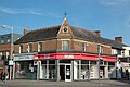
 Headington Post Office and shops, London Road - geograph.org.uk - 3684128.jpg 1,024 × 683; 200 KB
-
 Headington Road - geograph.org.uk - 4836879.jpg 2,304 × 1,728; 1.09 MB
-
 Headington Road - geograph.org.uk - 5192848.jpg 1,024 × 768; 192 KB
-
 Headington Road by Brookes University - geograph.org.uk - 5202124.jpg 1,024 × 683; 147 KB
-
 Headington Road, Oxford - geograph.org.uk - 5577261.jpg 1,280 × 851; 540 KB
-
 Headington Roundabout - geograph.org.uk - 1172620.jpg 640 × 480; 87 KB
-
 Headington roundabout - geograph.org.uk - 2367557.jpg 640 × 480; 61 KB
-
 Headington Telephone Exchange, Oxon - geograph.org.uk - 5661582.jpg 2,592 × 1,944; 1.44 MB
-
 Headington TXE4 building.JPG 2,048 × 1,536; 747 KB
-
 Headington Village Hall - geograph.org.uk - 2434608.jpg 1,024 × 768; 198 KB
-
 Headington WarnefordLa HighwayStone.jpg 2,000 × 3,000; 2.97 MB
-
 Headington, Oxford - geograph.org.uk - 3582132.jpg 3,988 × 2,748; 2.42 MB
-
 Headington, Oxford - geograph.org.uk - 3582173.jpg 3,577 × 3,005; 2.1 MB
-
 Headington, Oxford - geograph.org.uk - 3584612.jpg 2,832 × 2,263; 1.19 MB
-
 Headington, Oxford - geograph.org.uk - 3584624.jpg 3,557 × 2,405; 1.77 MB
-
 HeadingtonHill wallbox GeorgeVI closeup.jpg 1,770 × 2,950; 2.03 MB
-
 HeadingtonHill wallbox GeorgeVI.jpg 1,880 × 2,820; 2.53 MB
-
 Headley House on Eden Drive - geograph.org.uk - 2148251.jpg 1,500 × 977; 150 KB
-
 Headley Way at junction of Woodlands Road - geograph.org.uk - 2483146.jpg 1,600 × 1,200; 600 KB
-
 Headley Way at the junction of Jack Straw's Lane - geograph.org.uk - 4362982.jpg 1,536 × 980; 680 KB
-
 Headley Way in Headington - geograph.org.uk - 2148257.jpg 1,500 × 994; 157 KB
-
 Headley Way in Headington - geograph.org.uk - 2148258.jpg 1,500 × 993; 152 KB
-
 Headley Way, Headington - geograph.org.uk - 2483216.jpg 1,600 × 1,200; 653 KB
-
 Headley Way, Headington - geograph.org.uk - 2483253.jpg 1,600 × 1,200; 586 KB
-
 Hedge on Wood Farm Road - geograph.org.uk - 6701258.jpg 6,000 × 4,000; 3.64 MB
-
 Helen House - geograph.org.uk - 723951.jpg 640 × 478; 78 KB
-
 Hill Top Road - geograph.org.uk - 6700420.jpg 6,000 × 4,000; 4.45 MB
-
 Hill Top Road in Oxford - geograph.org.uk - 5986377.jpg 2,700 × 2,025; 401 KB
-
 Houses on Dene Road, Headington - geograph.org.uk - 6273906.jpg 800 × 497; 69 KB
-
 Houses on Headington Road - geograph.org.uk - 4836881.jpg 2,180 × 1,548; 1.02 MB
-
 Houses on Headington Road - geograph.org.uk - 4867494.jpg 2,048 × 1,536; 1.28 MB
-
 Houses on Headley Way (B4495) - geograph.org.uk - 6273688.jpg 640 × 397; 54 KB
-
 Houses on Old Road, Headington - geograph.org.uk - 6273921.jpg 800 × 600; 87 KB
-
 Houses on Windmill Road, Headington - geograph.org.uk - 6273903.jpg 800 × 511; 93 KB
-
 Hut in the corner - geograph.org.uk - 2464967.jpg 1,024 × 768; 260 KB
-
 Inott Furze, Headington - geograph.org.uk - 325469.jpg 640 × 480; 76 KB
-
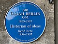 Isaiah Berlin blue plaque 1.jpg 4,032 × 3,024; 3.99 MB
-
 Isaiah Berlin blue plaque 2.jpg 4,032 × 3,024; 5.5 MB
-
 Ivy-covered houses on St Andrew's Road - geograph.org.uk - 3969375.jpg 3,872 × 2,592; 4.37 MB
-
 Joy Davidman plaque 1.jpg 4,032 × 3,024; 2.66 MB
-
 Joy Davidman plaque 2.jpg 4,032 × 3,024; 3.12 MB
-
 Junction of New High Street and Bateman Street - geograph.org.uk - 3687281.jpg 1,024 × 683; 160 KB
-
 Junction of Old Road and Lime Walk - geograph.org.uk - 3684862.jpg 1,024 × 683; 243 KB
-
 Junction of St Andrew's Road and Osler Road - geograph.org.uk - 3680141.jpg 1,024 × 683; 244 KB
-
 Junction with St Andrew road - geograph.org.uk - 2438659.jpg 1,024 × 768; 163 KB
-
 Kwik Fit and Mirabal Indian Restaurant on London Road - geograph.org.uk - 4863799.jpg 2,048 × 1,536; 1.48 MB
-
 Lane between the cottages - geograph.org.uk - 2439119.jpg 1,024 × 768; 143 KB
-
 Larkins Lane - geograph.org.uk - 2438675.jpg 1,024 × 768; 180 KB
-
 Layby on Eastern Bypass - geograph.org.uk - 2483340.jpg 1,600 × 1,200; 572 KB
-
 Leads to the Grange - geograph.org.uk - 2438666.jpg 600 × 800; 132 KB
-
 Light industry and offices, Cowley - geograph.org.uk - 325460.jpg 640 × 480; 64 KB
-
 Lime Walk in Headington - geograph.org.uk - 6124706.jpg 2,700 × 1,997; 321 KB
-
 Lime Walk in Headington - geograph.org.uk - 6124720.jpg 2,700 × 1,992; 412 KB
-
 Lime Walk Methodist Church - geograph.org.uk - 6299505.jpg 960 × 720; 148 KB
-
 Lloyds Bank in Headington - geograph.org.uk - 6124507.jpg 2,700 × 2,009; 490 KB
-
 Local shops on Westlands Drive - geograph.org.uk - 5074451.jpg 1,500 × 1,125; 210 KB
-
 Local shops on Westlands Drive - geograph.org.uk - 5074455.jpg 1,500 × 1,108; 247 KB
-
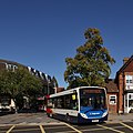 AlexanderDennis Dart Enviro200 SN63 VVT Oxford Headington.jpg 1,280 × 1,280; 507 KB
-
 Mercedes-Benz SprinterCity BU18 YRT Headington.jpg 1,180 × 1,280; 647 KB
-
 Oxford Bus Company 606 on Route U1, Headington (15400120428).jpg 3,888 × 2,592; 3.56 MB
-
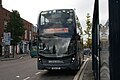
 Oxford Bus Company 610 (PK64 OXF) on Route U1, Headington Shops (15400638840).jpg 3,888 × 2,592; 3.83 MB
-
 Volvo B11R PlaxtonElite X90 LON Headington.jpg 1,280 × 713; 350 KB
-
 Wright StreetDeck OX68 OBU Headington.jpg 1,280 × 640; 645 KB
-
 Wright StreetDeck SK17 HHR Headington RightQuarter.jpg 1,280 × 853; 582 KB
-
 Wright StreetDeck SK17 HHR Headington RightSide.jpg 1,261 × 1,280; 713 KB
-
 London Road Headington - geograph.org.uk - 2483237.jpg 1,600 × 1,200; 538 KB
-
 London Road Headington - geograph.org.uk - 2483242.jpg 1,600 × 1,200; 547 KB
-
 London Road Headington - geograph.org.uk - 4836877.jpg 2,304 × 1,728; 824 KB
-

-
 London Road, Oxford - geograph.org.uk - 2807876.jpg 800 × 600; 108 KB

.jpg)


.jpg)


.jpg)


.jpeg)


_-_geograph.org.uk_-_6273688.jpg)


.jpg)
_on_Route_U1,_Headington_Shops_(15400638840).jpg)


