Category:Headland Way
Media in category "Headland Way"
The following 79 files are in this category, out of 79 total.
-
 Approach to Hartendale Gutter - geograph.org.uk - 1387762.jpg 640 × 480; 116 KB
-
 Beacon Hill - geograph.org.uk - 1387744.jpg 640 × 480; 80 KB
-
 Beacon Hill - geograph.org.uk - 295462.jpg 640 × 480; 90 KB
-
 Beacon Hill, Flamborough - geograph.org.uk - 538264.jpg 478 × 640; 107 KB
-
 Bempton Cliffs - geograph.org.uk - 1207537.jpg 640 × 480; 87 KB
-
 Cliff Steps at Flamborough South Landing - geograph.org.uk - 391704.jpg 520 × 640; 138 KB
-

-
 Cliff Top Paths at Sewerby. - geograph.org.uk - 529731.jpg 640 × 480; 58 KB
-
 Cliff Top Walk - geograph.org.uk - 1226819.jpg 640 × 480; 89 KB
-
 Cliff top walk Sewerby - geograph.org.uk - 1330356.jpg 640 × 480; 90 KB
-
 Cliff top, Flamborough Head. - geograph.org.uk - 247753.jpg 640 × 416; 121 KB
-
 Clifftop green - geograph.org.uk - 883409.jpg 640 × 469; 224 KB
-
 Clifftop Path (Headland Way) - geograph.org.uk - 1210837.jpg 640 × 480; 100 KB
-
 Clifftop Walk - geograph.org.uk - 1209140.jpg 640 × 480; 88 KB
-

-
 Clifftop Walk, Bempton Cliffs - geograph.org.uk - 1207546.jpg 640 × 480; 77 KB
-
 Coastal panorama - geograph.org.uk - 1358871.jpg 640 × 480; 82 KB
-
 Coastal Path - geograph.org.uk - 1227566.jpg 640 × 427; 75 KB
-

-
 Coastal Path Heading West - geograph.org.uk - 1227586.jpg 640 × 480; 51 KB
-

-
 Coastal scenery at Flamborough - geograph.org.uk - 1387755.jpg 480 × 640; 113 KB
-
 Down The Steps For Danes Dyke - geograph.org.uk - 1211616.jpg 640 × 480; 133 KB
-
 Dykes End - geograph.org.uk - 1204982.jpg 640 × 427; 342 KB
-
 Dykes End - geograph.org.uk - 551020.jpg 640 × 480; 76 KB
-
 Dykes End, Bempton - geograph.org.uk - 834788.jpg 640 × 401; 87 KB
-
 Flamborough Head Golf Course - geograph.org.uk - 1404950.jpg 640 × 480; 77 KB
-
 Footpath Along North Cliff - geograph.org.uk - 1226706.jpg 640 × 484; 77 KB
-
 Footpath junction - geograph.org.uk - 1405096.jpg 480 × 640; 61 KB
-
 Footpath junction along the Headland Way - geograph.org.uk - 1405086.jpg 640 × 480; 102 KB
-
 Footpath to Flamborough - geograph.org.uk - 1204996.jpg 640 × 427; 334 KB
-

-

-
 Footpath to Thornwick Bay - geograph.org.uk - 1419631.jpg 480 × 640; 73 KB
-
 Gull Nook, Flamborough - geograph.org.uk - 834814.jpg 465 × 640; 102 KB
-
 Hartendale Gutter - geograph.org.uk - 1387768.jpg 480 × 640; 127 KB
-
 Headland Way - geograph.org.uk - 1210858.jpg 640 × 480; 74 KB
-
 Headland Way Marker at Dyke's End - geograph.org.uk - 1226754.jpg 478 × 640; 83 KB
-
 Headland Way near Bempton - geograph.org.uk - 604595.jpg 640 × 480; 78 KB
-
 Headland Way Over Buckton Cliffs - geograph.org.uk - 1210989.jpg 640 × 480; 85 KB
-
 Headland Way Signpost - geograph.org.uk - 473729.jpg 480 × 640; 101 KB
-
 Holmes Gut, North Landing - geograph.org.uk - 763445.jpg 640 × 480; 234 KB
-
 Just Down from Bempton Cliffs - geograph.org.uk - 1207589.jpg 640 × 480; 74 KB
-
 Landslip - don't go near the edge - geograph.org.uk - 1115288.jpg 640 × 480; 91 KB
-
 Landslip On The Cliff Top Path - geograph.org.uk - 557887.jpg 640 × 480; 151 KB
-
-
 Looking north - geograph.org.uk - 505632.jpg 640 × 480; 85 KB
-
 Meeting of the ways on Beacon Hill - geograph.org.uk - 1387748.jpg 640 × 480; 76 KB
-

-
 North Cliff Footpath - geograph.org.uk - 412197.jpg 640 × 470; 72 KB
-
 North Cliff, Flamborough - geograph.org.uk - 834887.jpg 640 × 480; 66 KB
-
 Path Above South Landing - geograph.org.uk - 412226.jpg 640 × 480; 113 KB
-
 Path Marker, Headland Way - geograph.org.uk - 1211613.jpg 640 × 480; 88 KB
-
 Path Over Buckton Cliffs - geograph.org.uk - 1210912.jpg 640 × 480; 76 KB
-
 Pillbox near Beacon Hill - geograph.org.uk - 506425.jpg 640 × 480; 135 KB
-
 Rotten Row - above Buckton Cliffs - geograph.org.uk - 768676.jpg 640 × 315; 151 KB
-
 Sewerby Cliff Front - geograph.org.uk - 47028.jpg 640 × 480; 83 KB
-
 The approach to Thornwick Bay - geograph.org.uk - 1419599.jpg 640 × 480; 93 KB
-

-
 The Headland Way - geograph.org.uk - 1411975.jpg 640 × 480; 79 KB
-
 The Headland Way - geograph.org.uk - 1456072.jpg 640 × 427; 217 KB
-
 The Headland Way - geograph.org.uk - 1456087.jpg 640 × 427; 229 KB
-
 The Headland Way - geograph.org.uk - 835190.jpg 538 × 640; 234 KB
-
 The Headland Way - geograph.org.uk - 835250.jpg 640 × 416; 207 KB
-
 The Headland Way - geograph.org.uk - 835273.jpg 640 × 298; 167 KB
-
 The Headland Way - geograph.org.uk - 965985.jpg 640 × 427; 192 KB
-
 The Headland Way above East Nook cliffs - geograph.org.uk - 2600394.jpg 1,306 × 979; 366 KB
-
 The Headland Way at Flamborough Head - geograph.org.uk - 1404419.jpg 640 × 480; 81 KB
-
 The Headland Way Footpath - geograph.org.uk - 1509423.jpg 640 × 480; 117 KB
-
 The Headland Way on the north coast - geograph.org.uk - 2646261.jpg 1,142 × 857; 323 KB
-

-
 The Headland Way to Thornwick Bay - geograph.org.uk - 1419913.jpg 640 × 480; 96 KB
-
 The Headland way towards Bempton Cliffs - geograph.org.uk - 835291.jpg 640 × 480; 235 KB
-
 The Headland Way towards New Fall - geograph.org.uk - 1456133.jpg 640 × 422; 176 KB
-
 The Headland Way towards Thornwick Bay - geograph.org.uk - 1419594.jpg 640 × 480; 111 KB
-
 The Headland Way, South Cliff - geograph.org.uk - 2600401.jpg 857 × 1,142; 413 KB
-
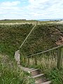
 The path climbs steeply^ - geograph.org.uk - 1419903.jpg 480 × 640; 109 KB
-
 To The Lighthouse - geograph.org.uk - 1229014.jpg 640 × 427; 90 KB
-
 Vanishing Footpath - geograph.org.uk - 1229042.jpg 640 × 427; 69 KB


_-_geograph.org.uk_-_1210837.jpg)


