Category:Hedges in Horkstow
Media in category "Hedges in Horkstow"
The following 53 files are in this category, out of 53 total.
-
 Anemometer Mast on Horkstow Wold - geograph.org.uk - 1356520.jpg 600 × 459; 273 KB
-
 Bank of the Ancholme - geograph.org.uk - 51263.jpg 640 × 425; 143 KB
-
 Bank of the New River Ancholme - geograph.org.uk - 1758328.jpg 640 × 622; 428 KB
-
 Beet Harvesting on Horkstow Wolds - geograph.org.uk - 1680285.jpg 640 × 480; 381 KB
-
 Beet Harvesting on Horkstow Wolds - geograph.org.uk - 1681066.jpg 640 × 480; 295 KB
-
 Bridge Lane in January - geograph.org.uk - 671525.jpg 640 × 480; 89 KB
-
 Bridge Lane, Horkstow - geograph.org.uk - 1137453.jpg 640 × 480; 76 KB
-

-
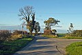
 Entering Horkstow - geograph.org.uk - 1739655.jpg 1,000 × 642; 646 KB
-
 Farm Track near Horkstow - geograph.org.uk - 1393829.jpg 480 × 640; 139 KB
-
 Farm Track on Horkstow Wolds - geograph.org.uk - 1353019.jpg 640 × 480; 118 KB
-
 Field Edge - geograph.org.uk - 536551.jpg 640 × 480; 130 KB
-
 Five Bar Gate - geograph.org.uk - 52028.jpg 640 × 480; 195 KB
-
 Fly Tipping near Spot Height 98m - geograph.org.uk - 553655.jpg 640 × 480; 147 KB
-
 Green Lane on Horkstow Wolds - geograph.org.uk - 1320232.jpg 640 × 480; 123 KB
-
 Green Lane on Horkstow Wolds - geograph.org.uk - 1332197.jpg 640 × 480; 147 KB
-
 Hall Farm, Horkstow - geograph.org.uk - 658396.jpg 640 × 480; 80 KB
-
 Hedge Cutting on Middlegate - geograph.org.uk - 2024710.jpg 1,000 × 883; 817 KB
-
 Horkstow Carrs - geograph.org.uk - 178936.jpg 640 × 480; 114 KB
-
 Horkstow Church - geograph.org.uk - 43901.jpg 480 × 640; 162 KB
-
 Horkstow Lane End - geograph.org.uk - 536571.jpg 640 × 480; 128 KB
-
 Horkstow Wolds - geograph.org.uk - 658481.jpg 640 × 480; 80 KB
-
 Junction near Spot Height 98m - geograph.org.uk - 599578.jpg 640 × 433; 88 KB
-
 Lane down to Horkstow - geograph.org.uk - 1526212.jpg 640 × 480; 88 KB
-
 Middlegate near Horkstow - geograph.org.uk - 1059167.jpg 640 × 480; 141 KB
-
 Middlegate near Horkstow - geograph.org.uk - 1064934.jpg 640 × 425; 74 KB
-
 Middlegate near Saxby All Saints - geograph.org.uk - 1320251.jpg 500 × 565; 383 KB
-
 Near Horkstow - geograph.org.uk - 1595464.jpg 640 × 480; 343 KB
-
 Near Horkstow - geograph.org.uk - 2082685.jpg 1,280 × 863; 1.09 MB
-
 Near North Wold Farm - geograph.org.uk - 965653.jpg 640 × 425; 81 KB
-
 Near Turton's Covert - geograph.org.uk - 519909.jpg 640 × 426; 101 KB
-
 On the Viking Way - geograph.org.uk - 1353048.jpg 640 × 480; 80 KB
-
 On the Viking Way - geograph.org.uk - 166793.jpg 640 × 426; 151 KB
-
 Ploughing near Manor Wold Farm - geograph.org.uk - 1592877.jpg 640 × 480; 251 KB
-
 Power Lines crossing Horkstow Wolds - geograph.org.uk - 994258.jpg 640 × 425; 87 KB
-
 Pylon on Horkstow Road - geograph.org.uk - 1137404.jpg 640 × 427; 42 KB
-
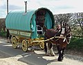 Romany Caravan on Horkstow Road - geograph.org.uk - 1240068.jpg 640 × 499; 324 KB
-
 Rural Prospect near Horkstow - geograph.org.uk - 1332169.jpg 640 × 377; 81 KB
-
 Seed Drilling near Manor Wold Farm - geograph.org.uk - 2122249.jpg 1,280 × 851; 1.01 MB
-
 The Approach to Horkstow Bridge - geograph.org.uk - 290815.jpg 640 × 480; 100 KB
-

-
 The road down to Horkstow - geograph.org.uk - 668004.jpg 480 × 640; 90 KB
-
 The Road to Horkstow - geograph.org.uk - 194438.jpg 640 × 480; 118 KB
-
 The Road towards Barton Upon Humber - geograph.org.uk - 1557916.jpg 640 × 481; 319 KB
-
 The Track down to the Old Quarry - geograph.org.uk - 1068646.jpg 640 × 480; 82 KB
-
 The Track to Hall Top - geograph.org.uk - 393277.jpg 640 × 426; 123 KB
-
 The Track to Hall Top Farm - geograph.org.uk - 536695.jpg 640 × 480; 97 KB
-
 The Viking Way - geograph.org.uk - 303239.jpg 640 × 427; 117 KB
-
 The Viking Way - geograph.org.uk - 667342.jpg 640 × 480; 98 KB
-
 The Viking Way at Spot Height 62m - geograph.org.uk - 410384.jpg 640 × 426; 116 KB
-
 The Viking Way near Horkstow - geograph.org.uk - 1594320.jpg 640 × 533; 387 KB
-
 To the North of Horkstow Road - geograph.org.uk - 290790.jpg 640 × 480; 121 KB
-
 Track South of Horkstow Bridge - geograph.org.uk - 668380.jpg 478 × 640; 92 KB


