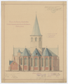
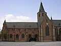
Category:Heilig Kruiskerk, Stekene
| Object location | | View all coordinates using: OpenStreetMap |
|---|
|
This is a category about Beschermd erfgoed number 9637
|
|
This is a category about onroerend erfgoed number 15459
|
church building in Stekene, Belgium  | |||||
| Upload media | |||||
| Instance of |
| ||||
|---|---|---|---|---|---|
| Made from material |
| ||||
| Location | Stekene, Arrondissement of Sint-Niklaas, East Flanders, Flemish Region, Belgium | ||||
| Street address |
| ||||
| Architectural style | |||||
| Diocese | |||||
| Heritage designation |
| ||||
| Inception |
| ||||
| Religion or worldview | |||||
 | |||||
Media in category "Heilig Kruiskerk, Stekene"
The following 5 files are in this category, out of 5 total.
-
 Stekene koor O1193.png 5,837 × 7,188; 82.22 MB
-
 Stekene, de Heilige Kruiskerk oeg15459 foto4 2013-05-06 15.18.jpg 4,416 × 3,312; 8.3 MB
-
 StekeneKerk.JPG 2,798 × 2,133; 2.21 MB
-
 Wikipedia Stekene H.Kruiskerk.JPG 3,264 × 2,448; 1.49 MB
-
 Wikipedia Stekene schandpaal.jpg 1,230 × 1,874; 148 KB


