Category:Heinersreuth
municipality in Landkreis Bayreuth in Germany     | |||||
| Upload media | |||||
| Instance of |
| ||||
|---|---|---|---|---|---|
| Part of |
| ||||
| Location | Bayreuth, Upper Franconia, Bavaria, Germany | ||||
| Head of government |
| ||||
| Population |
| ||||
| Area |
| ||||
| Elevation above sea level |
| ||||
| Different from | |||||
| official website | |||||
 | |||||
Subcategories
This category has the following 11 subcategories, out of 11 total.
B
C
- Cottenbach (Heinersreuth) (3 F)
D
- Dühlbach (1 F)
L
M
- Maps of Heinersreuth (2 F)
U
- Unterwaiz (4 F)
V
- Verschiedenes (Heinersreuth) (1 F)
- Views of Heinersreuth (3 F)
Media in category "Heinersreuth"
The following 11 files are in this category, out of 11 total.
-
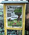
 Aue Wandern.jpg 2,529 × 4,373; 3.25 MB
-
 Auenwiesen (2).jpg 3,032 × 4,065; 3.11 MB
-
 Auenwiesen.jpg 2,994 × 3,563; 3.09 MB
-
 Bioenergie.jpg 2,579 × 4,392; 2.82 MB
-
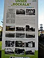 Bockala.jpg 3,456 × 4,608; 4.35 MB
-
 Digitales Orthofoto von Heinersreuth (Bayerische Vermessungsverwaltung).tif 15,000 × 17,500; 472.38 MB
-
 Dorfrand.jpg 3,270 × 4,517; 3.48 MB
-
 Feld, Rain, Hecke.jpg 3,456 × 4,608; 3.55 MB
-
 Heinersreuth Kulmbacher Straße.jpg 3,744 × 2,808; 3.24 MB
-
 Infotafel Altenplos IMG 2910.jpg 2,592 × 3,888; 3.22 MB
-
 Tannenbach.jpg 3,260 × 1,503; 3.19 MB

.jpg)


