Category:Hejce
| Object location | | View all coordinates using: OpenStreetMap |
|---|
village in Hungary  Roman Catholic church with 15th-century fortification walls   | |||||
| Upload media | |||||
| Instance of |
| ||||
|---|---|---|---|---|---|
| Location | Gönc District, Borsod-Abaúj-Zemplén County, Hungary | ||||
| Population |
| ||||
| Area |
| ||||
| official website | |||||
 | |||||
Subcategories
This category has the following 2 subcategories, out of 2 total.
2
- 2006 KFOR crash, Hejce (4 F)
C
Media in category "Hejce"
The following 8 files are in this category, out of 8 total.
-
 Flag of Hejce.svg 1,200 × 600; 24 KB
-
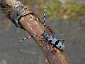 Havasi cincér.JPG 2,400 × 1,800; 1.14 MB
-
 Hejce rovastabla.png 81 × 40; 6 KB
-
 Hejce village (cropped).jpg 967 × 711; 206 KB
-
 Hejce village.jpg 1,024 × 768; 249 KB
-
 Hejce-Vilmány vasúti megállóhely.jpg 4,032 × 3,024; 5.15 MB
-
 HUN Hejce COA.jpg 2,000 × 3,009; 439 KB
-
 HUN Hejce Címer.svg 599 × 901; 779 KB


.jpg)


