Category:Hejtmánkovice
village in Náchod District of Hradec Králové region  Hejtmánkovice - čp. 88   | |||||
| Upload media | |||||
| Instance of | |||||
|---|---|---|---|---|---|
| Location |
| ||||
| Population |
| ||||
| Area |
| ||||
| Elevation above sea level |
| ||||
| official website | |||||
 | |||||
Subcategories
This category has the following 3 subcategories, out of 3 total.
Media in category "Hejtmánkovice"
The following 4 files are in this category, out of 4 total.
-
 Broumovský meteorit, kresba.png 1,772 × 2,914; 5.3 MB
-
 Hejtmánkovice vlajka.jpg 600 × 400; 44 KB
-
 Hejtmánkovice znak.jpg 1,893 × 1,894; 952 KB
-
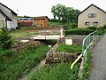 Liščí potok (02).jpg 3,264 × 2,448; 1.84 MB

.jpg)