Category:Helfensteine
| Object location | | View all coordinates using: OpenStreetMap |
|---|
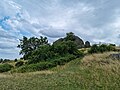
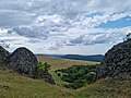
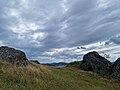
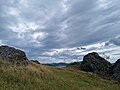
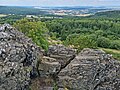
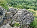
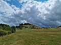
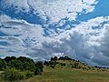
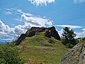
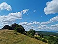
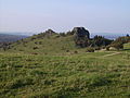
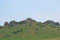
Deutsch: Helfenstein(e) – Felsformation (Basaltfelsen mit Basaltblockhalden) am Dörnberg in Zierenberg, Hessen, Deutschland – geschützt als flächenhaftes Naturdenkmal 6.33.918 und gelegen im FFH-Gebiet DE-4622-303 „Dörnberg, Immelburg und Helfenstein“
|
Helfensteine has an entry on OpenStreetMap (show). |
Subcategories
This category has the following 3 subcategories, out of 3 total.
F
V
Media in category "Helfensteine"
The following 69 files are in this category, out of 69 total.
-
 013 Blick auf die Helfensteine von dem Weg von der Zufahrtsstraße zu den Helfensteinen.jpg 9,248 × 6,936; 10.41 MB
-
 025 Blick von den Helfensteinen zum Hangarstein.jpg 9,248 × 6,936; 17.4 MB
-
 030 Helfensteine.jpg 9,248 × 6,936; 13.5 MB
-

-
-
 034 Helfensteine.jpg 9,248 × 6,936; 10.58 MB
-
 035 Helfensteine.jpg 9,248 × 6,936; 10.48 MB
-
 038 Blick von den Helfensteinen auf Bärenberg, Gudenberg, Zierenberger Kuppe, Schreckenberg.jpg 9,248 × 6,936; 10.93 MB
-
 040 Helfensteine.jpg 6,936 × 9,248; 13.82 MB
-
 048 Helfensteine.jpg 9,248 × 6,936; 9.48 MB
-
 055 Helfensteinen.jpg 9,248 × 6,936; 19.57 MB
-
 056 Helfensteinen.jpg 9,248 × 6,936; 18.46 MB
-
 057 Helfensteinen.jpg 9,248 × 6,936; 18.71 MB
-
 070 Blick auf die Helfensteine von dem Weg von der Zufahrtsstraße zu den Helfensteinen.jpg 9,248 × 6,936; 11.47 MB
-
 071 Blick auf die Helfensteine von dem Weg von der Zufahrtsstraße zu den Helfensteinen.jpg 9,248 × 6,936; 12.03 MB
-
 072 Blick auf die Helfensteine von dem Weg von der Zufahrtsstraße zu den Helfensteinen.jpg 9,248 × 6,936; 8.96 MB
-
 073 Helfensteine, dahinter Kassel.jpg 9,248 × 6,936; 12.08 MB
-
 074 Blick auf die Helfensteine von dem Weg von der Zufahrtsstraße zu den Helfensteinen.jpg 9,248 × 6,936; 11.94 MB
-
 075 Blick auf die Helfensteine von dem Weg von der Zufahrtsstraße zu den Helfensteinen.jpg 9,248 × 6,936; 18.08 MB
-
 082 Blick auf die Helfensteine von dem Weg von der Zufahrtsstraße zu den Helfensteinen.jpg 9,248 × 6,936; 9.22 MB
-
 090 Helfensteine.jpg 9,248 × 6,936; 11.4 MB
-
 091 Helfensteine.jpg 9,248 × 6,936; 14.1 MB
-
 092 Helfensteine.jpg 9,248 × 6,936; 11.53 MB
-
 093 Helfensteine.jpg 9,248 × 6,936; 10.78 MB
-
 094 Helfensteine.jpg 9,248 × 6,936; 13.47 MB
-
 108 Helfensteine.jpg 9,248 × 6,936; 14.54 MB
-
 109 Helfensteine.jpg 9,248 × 6,936; 13.39 MB
-
 109 Labyrinth an den Helfensteinen.jpg 9,248 × 6,936; 18.49 MB
-
 110 Helfensteine.jpg 9,248 × 6,936; 13.98 MB
-
 110 Labyrinth an den Helfensteinen.jpg 9,248 × 6,936; 18.3 MB
-
 126 Helfensteine, rechts dahinter kleiner Schreckenberg.jpg 9,248 × 6,936; 10.82 MB
-
 127 Helfensteine, rechts dahinter kleiner Schreckenberg.jpg 9,248 × 6,936; 10.89 MB
-
 136 Helfensteine.jpg 9,248 × 6,936; 20.59 MB
-
 Blick vom Hohen Dörnberg über die Helfensteine.JPG 3,264 × 2,448; 3.04 MB
-
 Die Helfensteine im Rauhreif, Dörnberg.jpg 7,952 × 5,304; 23.24 MB
-
 Dörnberg bei Zierenberg Kassel - Helfensteine 02.JPG 2,304 × 1,536; 969 KB
-
 Dörnberg bei Zierenberg Kassel - Helfensteine 03.JPG 2,304 × 1,536; 985 KB
-
 Dörnberg bei Zierenberg Kassel - Helfensteine 04.JPG 2,304 × 1,536; 969 KB
-
 Dörnberg bei Zierenberg Kassel - Helfensteine 05.JPG 2,304 × 1,536; 1,012 KB
-
 Dörnberg bei Zierenberg Kassel - Helfensteine 06.JPG 2,304 × 1,536; 956 KB
-
 Dörnberg bei Zierenberg Kassel - Helfensteine 07.JPG 2,304 × 1,536; 958 KB
-
 Dörnberg bei Zierenberg Kassel - Helfensteine 08.JPG 1,536 × 2,304; 967 KB
-
 Dörnberg bei Zierenberg Kassel - Helfensteine 11.JPG 2,304 × 1,536; 973 KB
-
 Dörnberg.jpg 6,016 × 4,016; 4.07 MB
-
 Helfenstein 1 Sep 2011.jpg 2,816 × 2,112; 2.97 MB
-
 Helfenstein 2 Sep 2011.jpg 2,816 × 2,112; 2.59 MB
-
 Helfenstein 3 Sep 2011.jpg 2,816 × 2,112; 2.6 MB
-
 Helfenstein2.jpg 4,176 × 2,784; 3.99 MB
-
 Helfensteine am Dörnberg in Zierenberg.jpg 2,500 × 1,604; 3.32 MB
-
 Helfensteine Dörnberg 01.jpg 2,500 × 1,669; 3.58 MB
-
 Helfensteine Dörnberg 02.jpg 2,500 × 1,674; 4.3 MB
-
 Helfensteine Dörnberg 03.jpg 2,500 × 1,649; 4.08 MB
-
 Helfensteine Dörnberg 04.jpg 2,500 × 1,674; 2.97 MB
-
 Helfensteine im Frühjahr.jpg 3,000 × 2,000; 1.73 MB
-
 Helfensteine, Dörnberg bei Zierenberg.JPG 2,304 × 1,536; 969 KB
-
 Helfensteine.JPG 1,600 × 1,200; 137 KB
-
 Naturdenkmal Landkreis Kassel 6.33.918 2017-09-16 a.JPG 3,264 × 2,448; 3.39 MB
-
 Naturdenkmal Landkreis Kassel 6.33.918 2017-09-16 b.JPG 3,264 × 2,448; 3.32 MB
-
 Naturdenkmal Landkreis Kassel 6.33.918 2017-09-16 c.JPG 3,264 × 2,448; 3.17 MB
-
 Naturdenkmal Landkreis Kassel 6.33.918 2017-09-16 d.JPG 2,448 × 3,264; 3.28 MB
-
 Naturdenkmal Landkreis Kassel 6.33.918 2017-09-16 e.JPG 3,264 × 2,448; 3.2 MB
-
 Naturdenkmal Landkreis Kassel 6.33.918 2017-09-16 f.JPG 3,264 × 2,448; 3.16 MB
-
 Naturdenkmal Landkreis Kassel 6.33.918 2017-09-16 g.JPG 3,264 × 2,448; 3.05 MB
-
 Naturdenkmal Landkreis Kassel 6.33.918 2017-09-16 h.JPG 3,264 × 2,448; 3.32 MB
-
 Naturdenkmal Landkreis Kassel 6.33.918 2017-09-16 j.JPG 3,264 × 2,448; 3.43 MB
-
 Naturdenkmal Landkreis Kassel 6.33.918 2017-09-16 k.JPG 3,264 × 2,448; 3.09 MB
-
 Naturdenkmal Landkreis Kassel 6.33.918 2019-01-20.JPG 3,264 × 2,448; 3.07 MB
-
 Naturdenkmal Landkreis Kassel 6.33.918 2021-08-22.JPG 3,648 × 2,736; 4.33 MB
-
 Raureif glitzert in der Morgensonne, Helfensteine, Dörnberg.jpg 7,952 × 5,088; 20.18 MB


