Category:Helhoughton
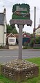
English: Helhoughton is a village and civil parish in Norfolk, England. It is north-northeast of London. The nearest railway station is at Sheringham for the Bittern Line which runs between Sheringham, Cromer and Norwich. The nearest airport is Norwich International Airport. The parish had, in the 2001 census, a population of 197. For the purposes of local government, the parish falls within the district of North Norfolk.
village in the United Kingdom  .jpg) | |||||
| Upload media | |||||
| Instance of | |||||
|---|---|---|---|---|---|
| Location | North Norfolk, Norfolk, East of England, England | ||||
| Area |
| ||||
| Said to be the same as | Helhoughton (Wikimedia duplicated page, civil parish) | ||||
 | |||||
Subcategories
This category has the following 2 subcategories, out of 2 total.
A
R
- Raynham Park railway station (5 F)
Media in category "Helhoughton"
The following 100 files are in this category, out of 100 total.
-
 A converted Nissen hut - geograph.org.uk - 4256930.jpg 640 × 638; 314 KB
-

-
 Abandoned boiler house at RAF West Raynham, Norfolk - geograph.org.uk - 4268107.jpg 4,320 × 3,240; 5.9 MB
-
 Abandoned building at RAF West Raynham, Norfolk - geograph.org.uk - 4268103.jpg 4,320 × 3,240; 5.91 MB
-

-
 Acres and acres of solar panels on the old airfield - geograph.org.uk - 4562266.jpg 3,456 × 2,592; 3.86 MB
-
 Air Ministry pillbox - geograph.org.uk - 4263434.jpg 640 × 480; 300 KB
-
 Airmen's Married Quarters - geograph.org.uk - 4228794.jpg 640 × 480; 164 KB
-
 All Saints' church in Helhoughton - geograph.org.uk - 1938735.jpg 640 × 480; 160 KB
-
 All Saints, Helhoughton - geograph.org.uk - 5586940.jpg 640 × 480; 91 KB
-

-
 Block 35 and Barracks store - geograph.org.uk - 4228744.jpg 640 × 480; 165 KB
-

-
 Blocks 100 and 101 - geograph.org.uk - 4228778.jpg 640 × 480; 161 KB
-
 Bridleway skirting Gravelpit Wood - geograph.org.uk - 4263419.jpg 640 × 480; 259 KB
-
 Buildings at Painswhin Farm, Helhoughton, Norfolk - geograph.org.uk - 4268113.jpg 4,320 × 3,240; 5.66 MB
-
 Byway past Rudham Common - geograph.org.uk - 4263425.jpg 640 × 480; 301 KB
-
 Children's playground at The Kiptons - geograph.org.uk - 4228755.jpg 640 × 480; 264 KB
-
 Coniferous woodland - geograph.org.uk - 4263074.jpg 640 × 480; 204 KB
-
 Crop field by RAF West Raynham - geograph.org.uk - 4228716.jpg 640 × 480; 232 KB
-
 Dismantled railway bridge near Helhoughton, Norfolk - geograph.org.uk - 4268363.jpg 4,320 × 3,240; 5.5 MB
-

-

-
 Entrance to solar farm construction site - geograph.org.uk - 4235563.jpg 640 × 480; 182 KB
-
 Entrance to the Airmen's Restaurant - geograph.org.uk - 4228807.jpg 640 × 516; 181 KB
-
 Entrance to The Orchard - geograph.org.uk - 4263333.jpg 640 × 464; 200 KB
-

-

-
 Former officers' housing - geograph.org.uk - 4256923.jpg 640 × 480; 178 KB
-

-
 Gravelpit Wood near West Raynham Airfield - geograph.org.uk - 4267908.jpg 4,320 × 3,240; 6.04 MB
-
 Helhoughton All Saints' church - geograph.org.uk - 2279099.jpg 760 × 570; 293 KB
-
 Helhoughton, Norfolk - Houses near church - geograph.org.uk - 4268117.jpg 4,320 × 3,240; 5.29 MB
-
 Helhoughton, Norfolk - The communications centre - geograph.org.uk - 4268118.jpg 4,320 × 3,240; 5.44 MB
-
 Helhoughton, Norfolk - The village centre - geograph.org.uk - 4268115.jpg 4,320 × 3,240; 5.72 MB
-

-

-
 Memorial at RAF West Raynham, Norfolk - geograph.org.uk - 4268101.jpg 4,320 × 3,240; 5.93 MB
-
 Minor road skirting RAF West Raynham - geograph.org.uk - 4263316.jpg 640 × 480; 165 KB
-
 New solar farm at West Raynham - geograph.org.uk - 4235556.jpg 640 × 434; 176 KB
-
 New solar farm at West Raynham - geograph.org.uk - 4235566.jpg 640 × 480; 184 KB
-
 November sunshine in Kipton Heath - geograph.org.uk - 4228713.jpg 480 × 640; 277 KB
-
 Officers' housing - geograph.org.uk - 4256920.jpg 640 × 480; 264 KB
-
 Overgrown pillbox near Gravelpit Wood, West Raynham - geograph.org.uk - 4267935.jpg 4,320 × 3,240; 6.06 MB
-
 Path next to Gravelpit Wood, West Raynham - geograph.org.uk - 4267943.jpg 4,320 × 3,240; 6.09 MB
-
 Path past Block 100 - geograph.org.uk - 4228784.jpg 640 × 480; 213 KB
-
 Pillbox embrasure with gun mounting - geograph.org.uk - 4263436.jpg 640 × 581; 211 KB
-
 Private land next to Helhoughton Common, Norfolk - geograph.org.uk - 4268375.jpg 4,320 × 3,240; 5.95 MB
-
 Pub and shop at the Kiptons - geograph.org.uk - 4228760.jpg 640 × 480; 248 KB
-
 RAF West Raynham airfield memorial - geograph.org.uk - 6345100.jpg 2,879 × 3,025; 2.43 MB
-

-
 RAF West Raynham memorial - geograph.org.uk - 4228734.jpg 640 × 470; 124 KB
-
 RAF West Raynham memorial - geograph.org.uk - 4228735.jpg 640 × 580; 259 KB
-
 Raynham Hall, aerial 2015 - geograph.org.uk - 4667665.jpg 640 × 427; 57 KB
-
 Raynham Park and Hall, aerial 2018 - geograph.org.uk - 5835694.jpg 1,024 × 683; 134 KB
-
 Raynham Park signal box in dappled sunlight - geograph.org.uk - 4562023.jpg 3,456 × 2,592; 3.63 MB
-

-
 Rural road through Kipton Heath - geograph.org.uk - 4228703.jpg 640 × 480; 278 KB
-
 Sheep grazing at RAF West Raynham - geograph.org.uk - 4228769.jpg 640 × 480; 188 KB
-
 Signs on gate - geograph.org.uk - 4256748.jpg 640 × 480; 163 KB
-
 Solar farm construction at West Raynham - geograph.org.uk - 4235558.jpg 640 × 621; 220 KB
-
 Solar farm construction at West Raynham - geograph.org.uk - 4235562.jpg 640 × 480; 155 KB
-
 Solar farm under construction at West Raynham - geograph.org.uk - 4271193.jpg 4,320 × 3,240; 5.87 MB
-
 Solar panels at former RAF West Raynham, Norfolk - geograph.org.uk - 4271199.jpg 4,320 × 3,240; 5.99 MB
-
 Solar panels at RAF West Raynham - geograph.org.uk - 4235561.jpg 640 × 480; 170 KB
-
 Stacks of logs in Kipton Heath - geograph.org.uk - 4228707.jpg 640 × 480; 258 KB
-
 Tall conifers - geograph.org.uk - 4263080.jpg 480 × 640; 219 KB
-

-
 The Airmen's Restaurant - geograph.org.uk - 4228803.jpg 640 × 480; 150 KB
-
 The Airmen's Restaurant - geograph.org.uk - 4228806.jpg 640 × 480; 174 KB
-

-
 The entrance to Block 100 - geograph.org.uk - 4228781.jpg 640 × 537; 257 KB
-

-
 The former NAAFI at RAF West Raynham - geograph.org.uk - 4228748.jpg 640 × 480; 150 KB
-
 The former Officers' Mess (east wing) - geograph.org.uk - 4263390.jpg 640 × 480; 204 KB
-
 The former Officers' Mess - geograph.org.uk - 4256927.jpg 640 × 480; 227 KB
-
 The former Officers' Mess at RAF West Raynham, Norfolk - geograph.org.uk - 4267995.jpg 4,320 × 3,240; 5.45 MB
-
 The Kiptons hub and The Pub - geograph.org.uk - 4228763.jpg 640 × 480; 254 KB
-
 The Officers' Mess (entrance) - geograph.org.uk - 4263403.jpg 640 × 599; 260 KB
-
 The Officers' Mess (west wing) - geograph.org.uk - 4263386.jpg 640 × 480; 181 KB
-
 The Officers' Mess - geograph.org.uk - 4263394.jpg 640 × 480; 176 KB
-

-

-

-
 The War Memorials at Helhoughton - geograph.org.uk - 4562647.jpg 2,592 × 3,456; 3.26 MB
-
 Timber next to Gravelpit Wood, West Raynham - geograph.org.uk - 4267983.jpg 4,320 × 3,240; 5.98 MB
-
 Track along the edge of Kipton Heath - geograph.org.uk - 4228710.jpg 640 × 480; 311 KB
-
 UK Helhoughton (SideA).jpg 806 × 1,587; 227 KB
-
 UK Helhoughton (SideB).jpg 833 × 1,715; 277 KB
-
 Unusual RAF type polygonal pillbox - geograph.org.uk - 4263094.jpg 640 × 480; 214 KB
-
 West Raynham airfield, Norfolk - geograph.org.uk - 123715.jpg 640 × 472; 285 KB
-

-
 West Rudham, aerial 2017 - geograph.org.uk - 5523691.jpg 800 × 533; 83 KB
-
 Farmland, west of West Raynham, Norfolk - geograph.org.uk - 123714.jpg 640 × 433; 290 KB
-
 Gallond Plantation, Helhoughton, Norfolk - geograph.org.uk - 123713.jpg 640 × 480; 306 KB
-
 Helhoughton village, Norfolk - geograph.org.uk - 123711.jpg 640 × 480; 265 KB
-
 North towards Painswhin Farm - geograph.org.uk - 529978.jpg 640 × 480; 129 KB
-

-

-
 Wooded former marlpit, Raynham, Norfolk - geograph.org.uk - 123707.jpg 640 × 480; 317 KB


_-_geograph.org.uk_-_4228738.jpg)


_-_geograph.org.uk_-_4263390.jpg)


_-_geograph.org.uk_-_4263403.jpg)
_-_geograph.org.uk_-_4263386.jpg)


.jpg)


