Category:Hempton, Norfolk
English: Hempton is a village and a civil parish in the English county of Norfolk. The village is north east of London. The village straddles the A1065 between Fakenham and Swaffham. The nearest railway station is at Sheringham for the Bittern Line which runs between Sheringham, Cromer and Norwich. The nearest airport is Norwich International Airport.
village and civil parish in Norfolk, United Kingdom  | |||||
| Upload media | |||||
| Instance of | |||||
|---|---|---|---|---|---|
| Location | North Norfolk, Norfolk, East of England, England | ||||
| Area |
| ||||
 | |||||
Subcategories
This category has the following 2 subcategories, out of 2 total.
H
S
Media in category "Hempton, Norfolk"
The following 75 files are in this category, out of 75 total.
-
 A four and a half bar gate - geograph.org.uk - 1761573.jpg 2,848 × 2,136; 3.06 MB
-
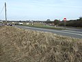
 A1065 at Hempton - geograph.org.uk - 3835009.jpg 640 × 430; 49 KB
-
 A1065 at Hempton - geograph.org.uk - 4638123.jpg 640 × 427; 330 KB
-
 A1065 at Hempton Road junction - geograph.org.uk - 3630141.jpg 640 × 481; 47 KB
-
 A1065 at Hempton village boundary - geograph.org.uk - 3630139.jpg 640 × 481; 46 KB
-
 A1065 heading north - geograph.org.uk - 3835007.jpg 640 × 430; 46 KB
-
 A1065 Leaving Hempton - geograph.org.uk - 4638140.jpg 640 × 480; 427 KB
-
 A1065 Pudding Norton - geograph.org.uk - 4638110.jpg 640 × 480; 358 KB
-

-
 B1146 near Hempton - geograph.org.uk - 5019815.jpg 1,916 × 1,217; 1.36 MB
-
 Both roads lead to Hempton - geograph.org.uk - 1761583.jpg 2,848 × 2,136; 3.07 MB
-
 Bungalows on Raynham Road, Hempton - geograph.org.uk - 5557815.jpg 640 × 453; 61 KB
-
 Close up, Elizabeth II postbox on Raynham Road, Hempton - geograph.org.uk - 5579791.jpg 1,507 × 2,232; 707 KB
-

-
 Cottages off Raynham Road, Hempton - geograph.org.uk - 5557816.jpg 640 × 480; 49 KB
-
 Cottages on Raynham Road, Hempton - geograph.org.uk - 5557819.jpg 640 × 480; 80 KB
-
 Dereham Road as it passes through Hempton Green - geograph.org.uk - 5950703.jpg 2,592 × 1,944; 2.93 MB
-
 Distance terrace - geograph.org.uk - 1761477.jpg 2,848 × 2,136; 3.07 MB
-
 Disused pit, Hempton - geograph.org.uk - 441156.jpg 640 × 480; 153 KB
-

-
 Elizabeth II postbox on Raynham Road, Hempton - geograph.org.uk - 5579795.jpg 2,848 × 2,136; 1.49 MB
-
 End of Hempton Marsh - geograph.org.uk - 5807129.jpg 1,600 × 1,200; 491 KB
-
 End of the boardwalk, Hempton Marsh - geograph.org.uk - 5807126.jpg 1,600 × 1,200; 806 KB
-
 Entrance to Hempton Marsh - geograph.org.uk - 5807118.jpg 1,600 × 1,200; 640 KB
-
 Fakenham church from Hempton church - geograph.org.uk - 2031279.jpg 640 × 480; 84 KB
-
 Fakenham West Station M^GN - geograph.org.uk - 1895749.jpg 800 × 531; 153 KB
-
 Footbridge Foundations - geograph.org.uk - 1895744.jpg 800 × 531; 203 KB
-
 Footpath off Raynham Road, Hempton - geograph.org.uk - 5557813.jpg 640 × 437; 59 KB
-
 Footpath, Hempton - geograph.org.uk - 441102.jpg 640 × 480; 99 KB
-
 Grazing land, Hempton, Fakenham - geograph.org.uk - 1761579.jpg 2,848 × 2,136; 3.07 MB
-
 Green Lane, Pudding Norton - geograph.org.uk - 377918.jpg 640 × 480; 65 KB
-
 Hand operated water pump on Hempton Green - geograph.org.uk - 5934888.jpg 3,456 × 2,592; 4.01 MB
-
 Heading north east from Hempton - geograph.org.uk - 5557821.jpg 640 × 480; 71 KB
-
 Hempton (Hamatuna) Village Sign - geograph.org.uk - 4704945.jpg 640 × 480; 74 KB
-
 Hempton Green with Fakenham beyond - geograph.org.uk - 377891.jpg 640 × 480; 76 KB
-
 Hempton Green, near Fakenham - geograph.org.uk - 377888.jpg 640 × 480; 99 KB
-
 Hempton Holy Trinity church - geograph.org.uk - 4353844.jpg 1,024 × 768; 468 KB
-
 Hempton Memorial Hall - geograph.org.uk - 2031283.jpg 640 × 480; 77 KB
-
 Hempton near Fakenham - geograph.org.uk - 1761593.jpg 2,848 × 2,136; 2.96 MB
-
 Hempton WW1 Memorial - geograph.org.uk - 4885606.jpg 3,456 × 2,592; 4.89 MB
-
 Hempton WW2 War Memorial - geograph.org.uk - 5934881.jpg 2,592 × 3,456; 2.89 MB
-
 Hempton, A1065 - geograph.org.uk - 4638114.jpg 640 × 480; 382 KB
-
 Junction A1065, Hempton - geograph.org.uk - 441158.jpg 640 × 480; 134 KB
-
 Northbound A1065 at Hempton - geograph.org.uk - 4638125.jpg 640 × 427; 374 KB
-
 Northbound A1065 near Hempton - geograph.org.uk - 4638134.jpg 640 × 427; 355 KB
-
 Old Gas Holder Base - geograph.org.uk - 1900238.jpg 800 × 531; 168 KB
-
 Poultry Sheds, Hempton - geograph.org.uk - 441103.jpg 640 × 480; 98 KB
-
 Raynam Road Hempton - geograph.org.uk - 6391667.jpg 800 × 533; 102 KB
-
 Raynham Road (A1065), Hempton - geograph.org.uk - 5579792.jpg 2,848 × 2,136; 1.22 MB
-
 Raynham Road (A1065), Hempton - geograph.org.uk - 5579796.jpg 2,848 × 2,136; 1.16 MB
-
 Raynham Road, Hempton - geograph.org.uk - 5557814.jpg 640 × 457; 58 KB
-
 Road into Fakenham - geograph.org.uk - 1895723.jpg 800 × 531; 116 KB
-
 Roadside houses at Hempton - geograph.org.uk - 6196308.jpg 1,024 × 762; 169 KB
-
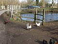 Rooster and hens by the river in Fakenham - geograph.org.uk - 2289662.jpg 2,848 × 2,136; 3.05 MB
-
 Shereford Road, Hempton, Fakenham - geograph.org.uk - 1761488.jpg 2,848 × 2,136; 3.11 MB
-
 Southbound A1065 Approaching Hempton - geograph.org.uk - 4638146.jpg 640 × 427; 323 KB
-
 Southbound A1065 at Hempton - geograph.org.uk - 4638129.jpg 640 × 427; 304 KB
-
 Terraced cottages on Goggs Mill Road - geograph.org.uk - 2031715.jpg 640 × 544; 204 KB
-
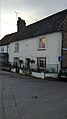
 The Bell at Hempton, Norfolk - geograph.org.uk - 2031285.jpg 640 × 480; 74 KB
-
 The Bell Inn.jpg 4,032 × 2,268; 1.78 MB
-
 The Bell public house, Hempton - geograph.org.uk - 2031700.jpg 640 × 448; 157 KB
-
 The Green 2.jpg 4,032 × 2,268; 1.85 MB
-
 The Green, Hempton - geograph.org.uk - 1761502.jpg 2,848 × 2,136; 2.92 MB
-
 Transformer on the green in Hempton - geograph.org.uk - 2031705.jpg 480 × 640; 162 KB
-
 View across Hempton Green - geograph.org.uk - 2031694.jpg 640 × 480; 184 KB
-
 View across Hempton Green - geograph.org.uk - 2031712.jpg 640 × 480; 220 KB
-
 View from Kingfisher Bridge - geograph.org.uk - 556715.jpg 640 × 427; 104 KB
-
 Village pond, Hempton, Fakenham - geograph.org.uk - 1761568.jpg 2,848 × 2,136; 3.03 MB
-
 Village Pump - geograph.org.uk - 3766079.jpg 402 × 600; 161 KB
-
 Village Sign - geograph.org.uk - 1269222.jpg 480 × 640; 61 KB
-
 Waiting for bread^ - geograph.org.uk - 504493.jpg 640 × 480; 119 KB
-
 Welcome to Fakenham - geograph.org.uk - 5557823.jpg 640 × 480; 105 KB
-
 Wensum House.jpg 2,268 × 4,032; 1.71 MB
-

-
 Sugar beet field - geograph.org.uk - 441044.jpg 640 × 480; 120 KB


_Village_Sign_-_geograph.org.uk_-_4704945.jpg)


,_Hempton_-_geograph.org.uk_-_5579792.jpg)
,_Hempton_-_geograph.org.uk_-_5579796.jpg)


