Category:Hemsworth
town in the City of Wakefield, West Yorkshire, England  | |||||
| Upload media | |||||
| Instance of | |||||
|---|---|---|---|---|---|
| Location | Wakefield, West Yorkshire, Yorkshire and the Humber, England | ||||
| Said to be the same as | Hemsworth (Wikimedia duplicated page, civil parish) | ||||
 | |||||
Cymraeg: Tref yn Swydd Gorllewin Efrog yw Hemsworth. Yn ôl Cyfrifiad y Deyrnas Unedig 2001 roedd gan y dref boblogaeth o 9,145.
English: Hemsworth is a town and civil parish on the edge of West Yorkshire, England. It forms part of the City of Wakefield, and has a population of 13,311.
Nederlands: Hemsworth is een stad (town) en civil parish in het bestuurlijke gebied City of Wakefield, in het Engelse graafschap West Yorkshire. De civil parish telt
Română: Hemsworth este un oraş în comitatul West Yorkshire, regiunea Yorkshire and the Humber, Anglia. Oraşul se află în districtul metropolitan Wakefield.
Svenska: Hemsworth är en liten stad i West Yorkshire i distriktet City of Wakefield i England i Storbritannien. Platsen är känd för att röster på Labour vägdes, inte räknades under 1960- och 1970-talen. En gång i tiden var Hemsworth en industristad där kolbrytning sysselsatte den större delen av befolkningen.
Subcategories
This category has the following 10 subcategories, out of 10 total.
- Buses in Hemsworth (5 F)
- Signs in Hemsworth (1 F)
K
- Kinsley, West Yorkshire (106 F)
P
R
- Hemsworth railway station (2 F)
W
- Watersons (bus company) (3 F)
Media in category "Hemsworth"
The following 200 files are in this category, out of 578 total.
(previous page) (next page)-
 3 and 4 Roslin Villas, Hemsworth - geograph.org.uk - 3063828.jpg 1,024 × 768; 142 KB
-
 58 metre spot height, Lowfield Road, Hemsworth - geograph.org.uk - 3063854.jpg 1,024 × 768; 103 KB
-
 A bridleway heading towards South Kirkby - geograph.org.uk - 2528875.jpg 800 × 600; 243 KB
-
 A low bike barrier on a Kinsley bridleway - geograph.org.uk - 3218479.jpg 1,024 × 768; 217 KB
-
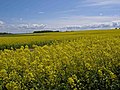 A sea of yellow - geograph.org.uk - 1283756.jpg 640 × 480; 108 KB
-
 A628 approaching Royd Moor Lane - geograph.org.uk - 3034106.jpg 640 × 480; 43 KB
-
 A628 at Barnsley boundary - geograph.org.uk - 3034149.jpg 640 × 480; 64 KB
-
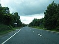
 A628 heading south - geograph.org.uk - 2617226.jpg 1,600 × 1,200; 410 KB
-
 A628 Hemsworth bypass - geograph.org.uk - 2617222.jpg 1,600 × 1,200; 491 KB
-
 A628 looking south - geograph.org.uk - 3034120.jpg 640 × 480; 52 KB
-
 A628 towards Barnsley - geograph.org.uk - 2637003.jpg 1,600 × 1,200; 623 KB
-
 A628 towards Hemsworth - geograph.org.uk - 2617213.jpg 1,600 × 1,200; 378 KB
-
 A628 west of Lanes Farm - geograph.org.uk - 3034087.jpg 640 × 480; 57 KB
-

-
 Alley and Cycleway in Hemsworth - geograph.org.uk - 5204497.jpg 4,544 × 3,394; 3.35 MB
-
 Allotments - Cemetery Road - geograph.org.uk - 4488371.jpg 640 × 480; 81 KB
-
 Allotments - Cemetery Road - geograph.org.uk - 5208540.jpg 640 × 480; 121 KB
-
 An overgrown Pond - geograph.org.uk - 3385842.jpg 4,000 × 3,000; 3.72 MB
-
 Another 90 degree bend coming up - geograph.org.uk - 1283793.jpg 640 × 480; 105 KB
-

-
 Ashfield Road - Southmoor Road - geograph.org.uk - 4500683.jpg 640 × 480; 70 KB
-
 Aston Chase - Longworth Road - geograph.org.uk - 4501189.jpg 640 × 480; 81 KB
-
 Autumn colour at the issues, South Moor - geograph.org.uk - 3219384.jpg 1,024 × 768; 182 KB
-
 B6273 towards Fitzwilliam - geograph.org.uk - 2637042.jpg 1,600 × 1,200; 368 KB
-
 Barn, Newstead Grange - geograph.org.uk - 2637245.jpg 1,600 × 1,200; 413 KB
-
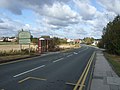
 Barnsley Road Hemsworth - geograph.org.uk - 1283881.jpg 640 × 480; 58 KB
-
 Barnsley Road, Hemsworth - geograph.org.uk - 2637022.jpg 1,600 × 1,200; 395 KB
-

-
 Baylee Street - Kirkby Road - geograph.org.uk - 4501212.jpg 640 × 480; 73 KB
-
 Beck - near Tesco carpark - geograph.org.uk - 4501883.jpg 480 × 640; 115 KB
-
-

-

-
 Beechwood Mount - Moorfield Crescent - geograph.org.uk - 4499913.jpg 640 × 480; 76 KB
-
 Bellmont Crescent - Elm Road - geograph.org.uk - 5285746.jpg 640 × 480; 74 KB
-
 Beware, obstruction^ - geograph.org.uk - 1748972.jpg 518 × 389; 136 KB
-
 Boundary between field and Newstead Lane - geograph.org.uk - 1748995.jpg 518 × 389; 141 KB
-
 Braithwaite Court - Conisborough Way - geograph.org.uk - 4489444.jpg 640 × 480; 72 KB
-
 Bredon Close - Ringwood Way - geograph.org.uk - 5285702.jpg 640 × 466; 57 KB
-
 Brettegate - Holgate Gardens - geograph.org.uk - 5208678.jpg 640 × 480; 58 KB
-
 Brettegate - Wortley Place - geograph.org.uk - 4488339.jpg 640 × 480; 57 KB
-
 Briar Bank - Common Road - geograph.org.uk - 5117153.jpg 640 × 480; 49 KB
-
 Bridge DOL 1-36 - Butcher Hill - geograph.org.uk - 4489439.jpg 640 × 480; 66 KB
-

-

-
 Bridleway and farm track, heading to Kinsley - geograph.org.uk - 3218697.jpg 1,024 × 768; 170 KB
-
 Bridleway and Fields - geograph.org.uk - 5204521.jpg 4,608 × 3,456; 3.44 MB
-
 Bridleway and Path Junction at Royd Moor - geograph.org.uk - 5204516.jpg 4,608 × 3,456; 3.52 MB
-
 Bridleway and power lines at dawn - geograph.org.uk - 601926.jpg 640 × 480; 55 KB
-
 Bridleway bridge - geograph.org.uk - 1283785.jpg 640 × 480; 123 KB
-
 Bridleway bridge over the railway near Royd Moor - geograph.org.uk - 3665072.jpg 1,600 × 1,200; 996 KB
-
 Bridleway curving to meet the Pontefract Road - geograph.org.uk - 2501971.jpg 1,024 × 768; 196 KB
-
 Bridleway from Kinsley - geograph.org.uk - 1283812.jpg 480 × 640; 130 KB
-
 Bridleway parallel to the Hemsworth bypass - geograph.org.uk - 2501961.jpg 1,024 × 768; 199 KB
-
 Bridleway parallel to Tombridge Crescent - geograph.org.uk - 3218714.jpg 1,024 × 768; 182 KB
-
 Bridleway towards Kinsley - geograph.org.uk - 5746925.jpg 1,600 × 1,200; 619 KB
-
 Brookside - Cottam Croft - geograph.org.uk - 4489903.jpg 640 × 480; 56 KB
-
 Brookside - viewed from Elm Road - geograph.org.uk - 5285752.jpg 640 × 480; 68 KB
-
 Brown, not green, south-west of Kinsley - geograph.org.uk - 3218680.jpg 1,024 × 768; 233 KB
-
 Building at Robincroft Farm - geograph.org.uk - 3218728.jpg 1,024 × 768; 176 KB
-
 Buildings at Newstead Grange - geograph.org.uk - 3041169.jpg 800 × 600; 113 KB
-
 Bullenshaw Road - Market Street - geograph.org.uk - 4499897.jpg 640 × 480; 67 KB
-
 Bullinger Wood - geograph.org.uk - 5204513.jpg 4,608 × 3,456; 3.87 MB
-
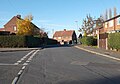
 Bungalows in Bronte Grove, Hemsworth - geograph.org.uk - 3063814.jpg 1,024 × 768; 111 KB
-
 Burntwood Bank - Nor Wood Road - geograph.org.uk - 4500677.jpg 640 × 480; 62 KB
-
 Bus stop by an extended house, Hemsworth - geograph.org.uk - 3063832.jpg 1,024 × 768; 105 KB
-
 Bush Street - Kirkby Road - geograph.org.uk - 4501218.jpg 640 × 480; 80 KB
-

-

-

-
 Car Park - viewed from Gorton Street - geograph.org.uk - 5117230.jpg 640 × 480; 61 KB
-
 Carlton Close - Ashfield Road - geograph.org.uk - 4500179.jpg 640 × 480; 82 KB
-
 Carr Lane off Newstead Lane - geograph.org.uk - 3041165.jpg 800 × 600; 135 KB
-
 Carr Lane towards Carr Farm - geograph.org.uk - 6075803.jpg 1,600 × 1,065; 843 KB
-

-
 Cemetery Road - Sandygate Lane - geograph.org.uk - 4488368.jpg 640 × 480; 64 KB
-
 Cemetery Road - Wakefield Road - geograph.org.uk - 4489387.jpg 640 × 480; 57 KB
-

-
 Centre Street - Wakefield Road - geograph.org.uk - 4489372.jpg 640 × 458; 70 KB
-
 Chantry Gardens - Wakefield Road - geograph.org.uk - 5117270.jpg 640 × 480; 92 KB
-
 Cherry Garth - Moorfield Crescent - geograph.org.uk - 4499918.jpg 640 × 480; 84 KB
-
 Cheviot Close - Ringwood Way - geograph.org.uk - 4489875.jpg 640 × 480; 64 KB
-
 Chiltern Court - Pennine Way - geograph.org.uk - 4489857.jpg 640 × 480; 87 KB
-
 Church of St Helen, Hemsworth - geograph.org.uk - 4794697.jpg 1,024 × 768; 166 KB
-
 Church of the Sacred Heart, Hemsworth - geograph.org.uk - 2310908.jpg 1,152 × 864; 1.08 MB
-

-

-

-
 Conisborough Way - Butcher Hill - geograph.org.uk - 4489441.jpg 640 × 480; 70 KB
-
 Conisborough Way - Station Road - geograph.org.uk - 4489457.jpg 640 × 480; 65 KB
-
 Cotswold Close - Pennine Way - geograph.org.uk - 4489861.jpg 640 × 440; 59 KB
-
 Cottam Croft - Lowfield Road - geograph.org.uk - 5285667.jpg 640 × 480; 54 KB
-
 Cottam Croft - viewed from Brookside - geograph.org.uk - 5285754.jpg 640 × 480; 70 KB
-
 Craven Road - Rosehill Avenue - geograph.org.uk - 4500165.jpg 640 × 480; 77 KB
-
 Craven Road - Rosehill Avenue - geograph.org.uk - 4500170.jpg 640 × 480; 73 KB
-
 Crop Field near Royd Moor Farm - geograph.org.uk - 5204514.jpg 4,608 × 3,456; 3.97 MB
-

-
 Ditch between road and field - geograph.org.uk - 1748979.jpg 518 × 389; 153 KB
-
 Dorset Close - Springvale Rise - geograph.org.uk - 4489402.jpg 640 × 480; 57 KB
-
 East Dale Close - Wood Moor Road - geograph.org.uk - 5285669.jpg 640 × 480; 76 KB
-
 Eastgate - Hague Terrace - geograph.org.uk - 4501826.jpg 640 × 480; 61 KB
-
 Ebberton Close - Conisborough Way - geograph.org.uk - 4489447.jpg 640 × 480; 74 KB
-

-

-

-

-

-

-

-

-

-

-

-

-

-

-

-

-
 Elsham Fold - Lotherton Road - geograph.org.uk - 5285645.jpg 640 × 480; 58 KB
-
 Emerging crop, south-west of Kinsley - geograph.org.uk - 3218687.jpg 1,024 × 768; 209 KB
-
 Entering Havercroft - geograph.org.uk - 3041182.jpg 800 × 600; 186 KB
-
 Everdale Mount - Barnsley Road - geograph.org.uk - 4488149.jpg 640 × 480; 54 KB
-

-
 Farm Lane, Fitzwilliam - geograph.org.uk - 6075609.jpg 1,600 × 1,065; 583 KB
-
 Farm track heading towards Kinsley - geograph.org.uk - 1748956.jpg 518 × 389; 158 KB
-
 Farm track to Newstead Grange - geograph.org.uk - 1748954.jpg 518 × 389; 141 KB
-

-
 Farming on South Moor - geograph.org.uk - 3219402.jpg 1,024 × 768; 152 KB
-
 Farmland near Fitzwilliam - geograph.org.uk - 2637235.jpg 1,600 × 1,200; 463 KB
-
 Farmland north of the bridleway to Kinsley - geograph.org.uk - 3218551.jpg 1,024 × 768; 219 KB
-
 Farmland off Robin Lane - geograph.org.uk - 2637010.jpg 1,600 × 1,200; 387 KB
-
 Farmland off the A628 - geograph.org.uk - 2617207.jpg 1,600 × 1,200; 539 KB
-
 Farmland off the A628 - geograph.org.uk - 2637001.jpg 1,600 × 1,200; 700 KB
-
 Farmland, Hemsworth - geograph.org.uk - 2637028.jpg 1,600 × 1,200; 668 KB
-
 Farringdon Close - Longworth Road - geograph.org.uk - 4501198.jpg 640 × 480; 79 KB
-
 Ferndale Place - Rosehill Avenue - geograph.org.uk - 4500158.jpg 640 × 480; 67 KB
-
 Fishing Lake at Hoyle Mill Dam - geograph.org.uk - 5746943.jpg 1,600 × 1,200; 481 KB
-
 Fitzwilliam Country Park, Fitzwilliam - geograph.org.uk - 4099466.jpg 1,600 × 1,064; 845 KB
-
 Fitzwilliam Primary Walking Bus - geograph.org.uk - 4099388.jpg 1,600 × 1,064; 720 KB
-
 Fitzwilliam Railway Station - geograph.org.uk - 6092312.jpg 1,024 × 683; 231 KB
-
 Fitzwilliam Railway Station from Footbridge - geograph.org.uk - 3385782.jpg 4,000 × 3,000; 3.28 MB
-
 Fitzwilliam railway station, Yorkshire - geograph.org.uk - 3471765.jpg 1,024 × 768; 201 KB
-

-

-
 Football Ground - Sandygate Lane - geograph.org.uk - 5208675.jpg 640 × 405; 37 KB
-
 Footbridge - Fitzwilliam Station - geograph.org.uk - 5117279.jpg 640 × 480; 84 KB
-
 Footbridge at Fitzwilliam station - geograph.org.uk - 3224997.jpg 2,048 × 1,536; 569 KB
-
 Footbridge near Taylor Wood - geograph.org.uk - 5721506.jpg 1,600 × 1,200; 1 MB
-
 Footpath - Butcher Hill - geograph.org.uk - 5285662.jpg 640 × 480; 100 KB
-
 Footpath - Conisborough Way - geograph.org.uk - 4489449.jpg 480 × 640; 80 KB
-
 Footpath - Conisborough Way - geograph.org.uk - 4489452.jpg 480 × 640; 99 KB
-
 Footpath - Conisborough Way - geograph.org.uk - 5285660.jpg 640 × 480; 88 KB
-
 Footpath - Cottam Croft - geograph.org.uk - 4489907.jpg 480 × 640; 104 KB
-
 Footpath - end of Highfield Road - geograph.org.uk - 4500136.jpg 640 × 480; 88 KB
-
 Footpath - Everdale Mount - geograph.org.uk - 4488152.jpg 453 × 640; 63 KB
-
 Footpath - Gargrave Crescent - geograph.org.uk - 5208790.jpg 480 × 640; 114 KB
-

-
 Footpath - Lotherton Road - geograph.org.uk - 5285649.jpg 640 × 480; 85 KB
-
 Footpath - Mill View - geograph.org.uk - 5208787.jpg 640 × 480; 94 KB
-
 Footpath - off Brownhill Crescent - geograph.org.uk - 5117156.jpg 640 × 480; 107 KB
-
 Footpath - off Lothertoh Road - geograph.org.uk - 5285653.jpg 640 × 480; 95 KB
-
 Footpath - Springvale Rise - geograph.org.uk - 4489398.jpg 640 × 480; 79 KB
-
 Footpath - Station Road - geograph.org.uk - 5285542.jpg 640 × 483; 99 KB
-
 Footpath - Sunnyfield Drive - geograph.org.uk - 5116966.jpg 640 × 480; 77 KB
-
 Footpath - Wakefield Road - geograph.org.uk - 5116955.jpg 480 × 640; 78 KB
-
 Footpath - Wakefield Road - geograph.org.uk - 5117274.jpg 480 × 640; 112 KB
-
 Footpath between Fitzwilliam and Brackenhill - geograph.org.uk - 3225003.jpg 2,048 × 1,536; 565 KB
-
 Footpath joining Lowfield Road - geograph.org.uk - 3063946.jpg 1,024 × 768; 170 KB
-
 Footpath near Carr Farm - geograph.org.uk - 6076118.jpg 1,600 × 1,065; 770 KB
-
 Footpath sign, Robin Lane - geograph.org.uk - 3063294.jpg 1,024 × 768; 172 KB
-
 Footpath towards Kinsley - geograph.org.uk - 5746921.jpg 1,600 × 1,200; 593 KB
-
 Footpath ^ Cycle Way - Grove Terrace - geograph.org.uk - 4501857.jpg 640 × 480; 82 KB
-
 Ford Street, Kinsley - geograph.org.uk - 2637050.jpg 1,600 × 1,200; 382 KB
-
 Forester Close - Farm Lane - geograph.org.uk - 5116972.jpg 640 × 480; 63 KB
-

-
 Former railway line at Kinsley Common - geograph.org.uk - 6075539.jpg 1,600 × 1,065; 842 KB
-
 Former railway line at Kinsley Common - geograph.org.uk - 6075556.jpg 1,600 × 1,065; 1.14 MB
-

-

-

-

-
 Gargrave Place - Gargrave Crescent - geograph.org.uk - 4499931.jpg 640 × 480; 73 KB
-
 Gargrave Place - Gargrave Crescent - geograph.org.uk - 4499941.jpg 640 × 480; 77 KB
-
 Garmil Head Lane, Fitzwilliam - geograph.org.uk - 3041133.jpg 800 × 600; 103 KB
-
 Gold 'N' Glow Tanning Salon - geograph.org.uk - 4099451.jpg 1,600 × 1,064; 720 KB
-

-
 Grangeway - Meadow Rise - geograph.org.uk - 4488125.jpg 640 × 434; 86 KB
-
 Greenfield Road - Nor Wood Road - geograph.org.uk - 4500676.jpg 640 × 480; 59 KB
-
 Grove Avenue - Elm Road - geograph.org.uk - 5285747.jpg 640 × 480; 72 KB
-
 Grove Avenue - Grove Lane - geograph.org.uk - 4501836.jpg 640 × 480; 73 KB
-
-

-

-

-
 Grove Place - Grove Lane - geograph.org.uk - 4501846.jpg 640 × 480; 60 KB
-
 Grove Terrace - Grove Lane - geograph.org.uk - 4501855.jpg 640 × 480; 66 KB
-

-
 Hague Crescent - Kirkby Road - geograph.org.uk - 4501783.jpg 640 × 480; 95 KB
-
 Hague Lane, the B 6422 - geograph.org.uk - 286578.jpg 640 × 480; 88 KB
-
 Hague Terrace - Kirkby Road - geograph.org.uk - 4501240.jpg 640 × 480; 90 KB


