Category:Hengrave
English: Hengrave is a small settlement in Suffolk, England. It is near the town of Bury St Edmunds.
village in the United Kingdom  | |||||
| Upload media | |||||
| Instance of | |||||
|---|---|---|---|---|---|
| Location | St Edmundsbury, Suffolk, East of England, England | ||||
 | |||||
Subcategories
This category has the following 3 subcategories, out of 3 total.
Media in category "Hengrave"
The following 26 files are in this category, out of 26 total.
-
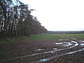
 Crop field off Hyde Road - geograph.org.uk - 4856359.jpg 640 × 480; 55 KB
-
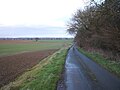
 Down Mill Lane - geograph.org.uk - 1433452.jpg 640 × 480; 69 KB
-
 East on track to Lynford Water - geograph.org.uk - 6171646.jpg 1,024 × 768; 381 KB
-
 Fence and footpath - geograph.org.uk - 639714.jpg 427 × 640; 112 KB
-

-
 Grass strip marks midline of Hyde Road - geograph.org.uk - 2865047.jpg 3,264 × 2,448; 1.34 MB
-
 Hengrave Lock, River Lark - geograph.org.uk - 639710.jpg 427 × 640; 98 KB
-
 Hengrave Lock, River Lark, 1973 (geograph 2613115).jpg 640 × 428; 131 KB
-
 Hyde Road - geograph.org.uk - 4856362.jpg 640 × 480; 66 KB
-
 Mill Road - geograph.org.uk - 5221338.jpg 1,024 × 768; 165 KB
-
 River Lark at Ducksluice Farm - geograph.org.uk - 20733.jpg 640 × 427; 121 KB
-
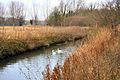 River Lark near Hengrave - geograph.org.uk - 639706.jpg 640 × 427; 106 KB
-
 Round Bus Shelter - geograph.org.uk - 5221344.jpg 768 × 1,024; 215 KB
-
 Shades of green in the crops beside Hyde Road - geograph.org.uk - 5821782.jpg 3,456 × 2,592; 3.75 MB
-
 Sugar beet crop beside Hyde Road - geograph.org.uk - 5821774.jpg 3,456 × 2,592; 3.98 MB
-
 Thatched cottages along the A1101 in Hengrave (geograph 2296237).jpg 3,648 × 2,736; 1.21 MB
-
 The Thatched Cottage, Hengrave (geograph 6693418).jpg 1,024 × 684; 173 KB
-
 Where Mill Lane Ends - geograph.org.uk - 1433472.jpg 640 × 480; 138 KB
-
 Young crop field beside woodland - geograph.org.uk - 4856357.jpg 640 × 480; 81 KB
-
 A1101 Entering Hengrave - geograph.org.uk - 299928.jpg 640 × 480; 136 KB
-
 Footbridge Over The Lark - geograph.org.uk - 1433479.jpg 640 × 480; 152 KB
-
 Fornham Park - geograph.org.uk - 24655.jpg 640 × 427; 92 KB
-
 Hyde Wood and Queen Elizabeth's Walk - geograph.org.uk - 20728.jpg 640 × 427; 77 KB
-
 Stanchil's Farm - geograph.org.uk - 31222.jpg 640 × 427; 71 KB
-
 Trees at South Wood - geograph.org.uk - 639712.jpg 640 × 429; 92 KB
-
 View towards Heath Barn, Risby - geograph.org.uk - 20724.jpg 640 × 427; 77 KB


.jpg)


.jpg)
.jpg)


