Category:Hepworth, Suffolk
village and civil parish in Suffolk, UK | |||||
| Upload media | |||||
| Instance of | |||||
|---|---|---|---|---|---|
| Location |
| ||||
 | |||||
Subcategories
This category has the following 2 subcategories, out of 2 total.
H
P
Media in category "Hepworth, Suffolk"
The following 164 files are in this category, out of 164 total.
-
 A143 Bury Road, Hepworth - geograph.org.uk - 5067466.jpg 3,072 × 2,304; 2.68 MB
-
 A143 Bury Road, Hepworth - geograph.org.uk - 5067885.jpg 3,072 × 2,304; 1.89 MB
-
 A143 Bury Road, Hepworth - geograph.org.uk - 5067888.jpg 3,072 × 2,304; 1.86 MB
-
 A143 Bury Road, Hepworth - geograph.org.uk - 5069689.jpg 3,072 × 2,304; 3.76 MB
-
 A143 Bury Road, Hepworth - geograph.org.uk - 5069706.jpg 3,072 × 2,304; 3.55 MB
-
 A143 Bury Road, Hepworth - geograph.org.uk - 5074668.jpg 3,072 × 2,304; 1.83 MB
-
 A143 Bury Road, Hepworth - geograph.org.uk - 5083210.jpg 3,072 × 2,304; 1.8 MB
-
 Barningham Road sign - geograph.org.uk - 5087206.jpg 3,072 × 2,304; 2.01 MB
-
 Barningham Road, Barningham - geograph.org.uk - 5087235.jpg 3,072 × 2,231; 2.59 MB
-
 Barningham Road, Hepton - geograph.org.uk - 5087215.jpg 3,072 × 2,304; 2.06 MB
-
 Barningham Road, Hepworth - geograph.org.uk - 5087231.jpg 2,304 × 3,072; 3.35 MB
-
 Barningham Road, Hepworth - geograph.org.uk - 5087233.jpg 3,072 × 2,304; 1.91 MB
-
 Barningham Road, Hepworth - geograph.org.uk - 5087617.jpg 3,072 × 2,304; 1.79 MB
-
 Blue Bells Plantation - geograph.org.uk - 212261.jpg 640 × 427; 60 KB
-
 Broken Sign - geograph.org.uk - 2327866.jpg 1,600 × 1,200; 635 KB
-
 Bus Stop ^ Shelter off The Street - geograph.org.uk - 5087702.jpg 3,072 × 2,304; 1.89 MB
-
 Byway to Wood Lane - geograph.org.uk - 5087059.jpg 3,072 × 2,304; 1.94 MB
-
 Church House - geograph.org.uk - 2327816.jpg 1,600 × 1,200; 366 KB
-
 Church Lane sign - geograph.org.uk - 5067950.jpg 3,072 × 2,304; 1.92 MB
-
 Church Lane, Hepworth - geograph.org.uk - 5067931.jpg 3,072 × 2,304; 1.76 MB
-
 Church Lane, Hepworth - geograph.org.uk - 5068159.jpg 3,072 × 2,304; 1.81 MB
-
 Church Lane, Hepworth - geograph.org.uk - 5068162.jpg 3,072 × 2,304; 1.87 MB
-
 Church Lane, Hepworth - geograph.org.uk - 5068215.jpg 2,790 × 2,098; 2.52 MB
-
 Church Lane, Hepworth - geograph.org.uk - 5087068.jpg 3,072 × 2,276; 2.79 MB
-
 Clay Lane on Hepworth South Common - geograph.org.uk - 5087033.jpg 3,072 × 2,304; 2.97 MB
-
 Clay Lane ^ footpath - geograph.org.uk - 5087050.jpg 3,072 × 2,304; 1.9 MB
-
 Country Road - geograph.org.uk - 2327868.jpg 1,200 × 1,600; 547 KB
-
 Dunhill Lane - geograph.org.uk - 221430.jpg 640 × 427; 126 KB
-
 Dunhill Lane, Hepworth - geograph.org.uk - 221427.jpg 640 × 427; 89 KB
-
 Dunhill Lane, Hepworth - geograph.org.uk - 6224421.jpg 3,488 × 2,616; 2.93 MB
-
 Entering Hepworth - geograph.org.uk - 2327339.jpg 1,600 × 1,200; 576 KB
-
 Entering Hepworth on Barningham Road - geograph.org.uk - 5087228.jpg 3,072 × 2,304; 2.01 MB
-
 Entering Hepworth on the A143 Bury Road - geograph.org.uk - 5067430.jpg 2,953 × 2,215; 2.74 MB
-
 Entering Hepworth on the A143 Bury Road - geograph.org.uk - 5069673.jpg 3,072 × 2,304; 1.71 MB
-
 Entering Hepworth on the A143 Bury Road - geograph.org.uk - 5074669.jpg 2,970 × 2,131; 3.28 MB
-
 Entering Hepworth on the Street - geograph.org.uk - 5067896.jpg 3,072 × 2,304; 1.81 MB
-
 Entrance Drive - geograph.org.uk - 2327346.jpg 1,600 × 1,200; 468 KB
-

-
 Field entrance off The Street - geograph.org.uk - 5087828.jpg 3,072 × 2,304; 1.87 MB
-
 Footbridge - geograph.org.uk - 2327375.jpg 1,600 × 1,200; 527 KB
-
 Footpath And Gate - geograph.org.uk - 2327820.jpg 1,600 × 1,200; 877 KB
-
 Footpath off Church Lane - geograph.org.uk - 5068172.jpg 2,304 × 3,072; 3.05 MB
-
 Footpath Sign ^ Roadsign off Church Lane - geograph.org.uk - 5087070.jpg 2,304 × 3,072; 2.83 MB
-
 Footpath To Brockley Wood - geograph.org.uk - 2327739.jpg 1,600 × 1,200; 423 KB
-
 Footpath to Clay Lane - geograph.org.uk - 5067918.jpg 3,072 × 2,304; 1.95 MB
-
 Footpath to Dunhill Lane - geograph.org.uk - 5087061.jpg 3,072 × 2,304; 1.83 MB
-
 Footpath to Hepworth - geograph.org.uk - 212325.jpg 640 × 427; 113 KB
-
 Footpath to The Street - geograph.org.uk - 5087052.jpg 3,072 × 2,304; 1.97 MB
-
 Footpath to Wood Lane - geograph.org.uk - 5087074.jpg 3,072 × 2,304; 1.94 MB
-
 Footpath to Wood Lane - geograph.org.uk - 5087077.jpg 2,304 × 3,072; 3.5 MB
-
 Footpath to Wood Lane ^ entrance to the Recreation Ground - geograph.org.uk - 5087072.jpg 3,072 × 2,304; 1.91 MB
-
 Hepworth Recreation Ground - geograph.org.uk - 5087076.jpg 3,072 × 2,304; 1.89 MB
-
 Hepworth Recreation Ground - geograph.org.uk - 5087085.jpg 3,072 × 2,304; 1.87 MB
-
 Hepworth Recreation Ground car park - geograph.org.uk - 5087087.jpg 3,072 × 2,304; 1.96 MB
-
 Hepworth Recreation Ground car park - geograph.org.uk - 5087092.jpg 3,072 × 2,304; 1.86 MB
-
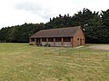
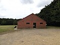
 Hepworth Recreation Ground Pavilion - geograph.org.uk - 5087078.jpg 3,072 × 2,304; 1.87 MB
-
 Hepworth Recreation Ground Pavilion - geograph.org.uk - 5087084.jpg 3,072 × 2,304; 1.93 MB
-
 Hepworth Recreation Ground Pavilion - geograph.org.uk - 5087089.jpg 3,072 × 2,304; 1.9 MB
-
 Hepworth Village Map - geograph.org.uk - 5087108.jpg 2,304 × 3,072; 2.89 MB
-
 Hepworth Village Map - geograph.org.uk - 5087111.jpg 2,304 × 3,072; 2.68 MB
-
 Hepworth Village Map - geograph.org.uk - 5087112.jpg 3,072 × 2,304; 1.84 MB
-
 Hepworth Village Map ^ Notice Board - geograph.org.uk - 5087105.jpg 2,304 × 3,072; 3.84 MB
-
 Hepworth Village Name sign on Barningham Road - geograph.org.uk - 5087230.jpg 2,291 × 3,046; 5.55 MB
-
 Hepworth Village Name sign on the A143 Bury Road - geograph.org.uk - 5069675.jpg 3,072 × 2,304; 1.9 MB
-
 Hepworth Village Name sign on the A143 Bury Road - geograph.org.uk - 5074672.jpg 2,951 × 2,214; 3.4 MB
-
 Hepworth Village Name sign on The Street - geograph.org.uk - 5067903.jpg 3,072 × 2,304; 1.91 MB
-
 Hepworth Village Name sign ^ Barningham Road - geograph.org.uk - 5087992.jpg 3,072 × 2,304; 2.05 MB
-
 Hepworth Village Name sign ^ Roadsign - geograph.org.uk - 5067433.jpg 3,072 × 2,304; 1.76 MB
-
 Hepworth Village Notice Board - geograph.org.uk - 5087109.jpg 3,072 × 2,304; 1.91 MB
-
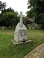 Hepworth War Memorial - geograph.org.uk - 5068174.jpg 2,291 × 3,046; 4.27 MB
-
 Industrial Estate Entrance off Sumner Road - geograph.org.uk - 5730382.jpg 1,600 × 1,185; 802 KB
-
 Lay-by off the A143 Bury Road - geograph.org.uk - 5074665.jpg 3,072 × 2,304; 1.93 MB
-
 Lollipop Diner sign - geograph.org.uk - 5068291.jpg 2,074 × 2,753; 1.59 MB
-
 Lollipop Diner, Hepworth - geograph.org.uk - 5068275.jpg 3,023 × 2,191; 3.36 MB
-
 Looking North East - geograph.org.uk - 2305918.jpg 1,600 × 1,200; 427 KB
-
 Market Weston Road sign - geograph.org.uk - 5087166.jpg 3,004 × 2,253; 5.25 MB
-
 Market Weston Road, Hepworth - geograph.org.uk - 5087165.jpg 3,072 × 2,304; 1.84 MB
-
 Market Weston Road, Hepworth - geograph.org.uk - 5087209.jpg 2,967 × 2,136; 4.35 MB
-
 Milk Churns - geograph.org.uk - 2327376.jpg 1,600 × 1,200; 697 KB
-
 North Common sign - geograph.org.uk - 5087188.jpg 2,845 × 2,133; 4.28 MB
-
 North Common, Hepworth - geograph.org.uk - 5087176.jpg 3,072 × 2,304; 1.92 MB
-
 North Common, Hepworth - geograph.org.uk - 5087211.jpg 3,072 × 2,304; 1.82 MB
-
 North Hall Farm Entrance - geograph.org.uk - 2327362.jpg 640 × 480; 61 KB
-
 Old Bridge - geograph.org.uk - 2327379.jpg 1,600 × 1,200; 668 KB
-
 Ordnance Survey Flush Bracket S8201 - geograph.org.uk - 4293088.jpg 4,000 × 3,000; 2.33 MB
-
 Paddock Fencing - geograph.org.uk - 2327744.jpg 1,600 × 1,200; 474 KB
-
 Part of Goswell Farm on Clay Lane - geograph.org.uk - 2135325.jpg 3,573 × 2,573; 1.26 MB
-
 Play Area at Hepworth Recreation Ground - geograph.org.uk - 5087082.jpg 3,072 × 2,304; 2.09 MB
-
 Post Office The Street Postbox - geograph.org.uk - 5068147.jpg 3,072 × 2,304; 1.77 MB
-
 Post Office The Street Postbox - geograph.org.uk - 5068148.jpg 3,072 × 2,304; 1.84 MB
-
 Post Office The Street Postbox - geograph.org.uk - 5068152.jpg 3,072 × 2,304; 1.93 MB
-
 Post Office The Street Postbox - geograph.org.uk - 5068153.jpg 2,265 × 3,011; 4.33 MB
-
 Post Office The Street Postbox - geograph.org.uk - 5068163.jpg 2,291 × 3,046; 3.67 MB
-
 Post Office The Street Postbox - geograph.org.uk - 5068385.jpg 2,253 × 2,995; 4.47 MB
-
 Post Office The Street Postbox - geograph.org.uk - 5068389.jpg 2,228 × 2,962; 4.36 MB
-
 Road Junction - geograph.org.uk - 2327366.jpg 1,600 × 1,200; 645 KB
-
 Road junction where Church Lane meets The Street - geograph.org.uk - 2135243.jpg 3,648 × 2,736; 950 KB
-
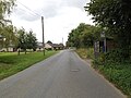
 Road through Hepworth - geograph.org.uk - 4254675.jpg 4,000 × 3,000; 2.35 MB
-
 Roadsign on Market Weston Road - geograph.org.uk - 5087203.jpg 2,283 × 3,044; 6.18 MB
-
 Roadsign on the A143 Bury Road - geograph.org.uk - 5067437.jpg 3,072 × 2,304; 1.83 MB
-
 Roadsign on The Street - geograph.org.uk - 5067778.jpg 2,291 × 3,046; 4.75 MB
-
 Roadsign ^ Grit Bin on The Street - geograph.org.uk - 5067943.jpg 2,265 × 3,011; 4.21 MB
-
 Roadsigns on the A143 Bury Road - geograph.org.uk - 5067882.jpg 3,072 × 2,304; 1.9 MB
-
 Roadsigns on the A143 Bury Road - geograph.org.uk - 5083208.jpg 3,072 × 2,304; 1.88 MB
-
 Scaseshole Farm Industrial Estate (2) - geograph.org.uk - 6218221.jpg 3,196 × 2,397; 1.34 MB
-
 Scaseshole Farm Industrial Estate - geograph.org.uk - 6218207.jpg 3,264 × 2,448; 1.65 MB
-
 Seat off The Street - geograph.org.uk - 5087116.jpg 3,072 × 2,304; 1.81 MB
-
 Shepherds Grove Industrial Estate - geograph.org.uk - 212328.jpg 640 × 427; 66 KB
-
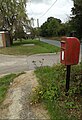
 South Common Postbox - geograph.org.uk - 5067740.jpg 3,072 × 2,304; 1.86 MB
-
 South Common Postbox - geograph.org.uk - 5067746.jpg 3,072 × 2,304; 1.86 MB
-
 South Common Postbox - geograph.org.uk - 5067755.jpg 2,291 × 3,046; 6.32 MB
-
 South Common Postbox - geograph.org.uk - 5067763.jpg 2,253 × 2,995; 3.76 MB
-
 South Common Postbox - geograph.org.uk - 5068366.jpg 3,072 × 2,304; 1.88 MB
-
 South Common Postbox - geograph.org.uk - 5068370.jpg 2,253 × 2,995; 4.97 MB
-
 St Peter, Hepworth - East end - geograph.org.uk - 6070650.jpg 1,000 × 750; 307 KB
-
 St Peter, Hepworth - Font and font cover - geograph.org.uk - 6070652.jpg 508 × 1,000; 168 KB
-
 St Peter, Hepworth - geograph.org.uk - 6070645.jpg 1,000 × 751; 452 KB
-
 St Peter, Hepworth - geograph.org.uk - 6070647.jpg 1,000 × 780; 338 KB
-
 St Peter, Hepworth - Organ - geograph.org.uk - 6070654.jpg 699 × 1,000; 301 KB
-
 St Peter, Hepworth - Roof - geograph.org.uk - 6070668.jpg 640 × 480; 105 KB
-

-
 St Peter, Hepworth - War Memorial WWI - geograph.org.uk - 6070658.jpg 711 × 1,000; 479 KB
-
 St.Peter's Church Notice Board - geograph.org.uk - 5068166.jpg 2,265 × 3,011; 4.71 MB
-
 St.Peter's Church, Hepworth - geograph.org.uk - 5068156.jpg 3,072 × 2,304; 2.17 MB
-
 St.Peter's Church, Hepworth - geograph.org.uk - 5068167.jpg 2,265 × 3,011; 3.63 MB
-
 St.Peter's Church, Hepworth - geograph.org.uk - 5068169.jpg 3,072 × 2,304; 1.81 MB
-
 St.Peter's Church, Hepworth - geograph.org.uk - 5068170.jpg 3,072 × 2,304; 1.76 MB
-
 St.Peter's Church, Hepworth - geograph.org.uk - 5068199.jpg 3,072 × 2,304; 1.78 MB
-
 Stanton Road Farm - geograph.org.uk - 2327905.jpg 1,600 × 1,200; 444 KB
-
 Summer Road, Hepworth - geograph.org.uk - 5083203.jpg 3,072 × 2,304; 1.79 MB
-
 Summer Road, Hepworth - geograph.org.uk - 5083206.jpg 3,072 × 2,304; 1.82 MB
-
 Summer Road, Hepworth - geograph.org.uk - 6217175.jpg 3,195 × 2,313; 1.75 MB
-
 The Duke of Marlborough Public House sign - geograph.org.uk - 5087833.jpg 2,240 × 2,978; 2.74 MB
-
 The Old School, Hepworth - geograph.org.uk - 5087831.jpg 3,031 × 2,273; 2.94 MB
-
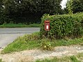
 The Street Postbox - geograph.org.uk - 5087655.jpg 3,072 × 2,304; 1.87 MB
-
 The Street Postbox - geograph.org.uk - 5087661.jpg 3,072 × 2,304; 2.02 MB
-
 The Street Postbox - geograph.org.uk - 5087679.jpg 2,265 × 3,011; 6.29 MB
-
 The Street Postbox - geograph.org.uk - 5087681.jpg 2,304 × 3,072; 4.4 MB
-
 The Street Postbox - geograph.org.uk - 5087834.jpg 2,085 × 3,044; 3.96 MB
-
 The Street Postbox - geograph.org.uk - 5087835.jpg 3,072 × 2,304; 1.88 MB
-
 The Street sign - geograph.org.uk - 5067770.jpg 3,072 × 2,304; 1.95 MB
-
 The Street sign - geograph.org.uk - 5087169.jpg 3,010 × 2,257; 4.66 MB
-
 The Street ^ South Common Postbox - geograph.org.uk - 5067712.jpg 3,072 × 2,304; 1.89 MB
-
 The Street ^ The Old School - geograph.org.uk - 5087830.jpg 3,072 × 2,304; 1.91 MB
-
 The Street ^ The Street Postbox - geograph.org.uk - 5087648.jpg 3,072 × 2,304; 1.8 MB
-
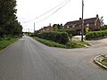
 The Street, Hepworth - geograph.org.uk - 5067701.jpg 3,072 × 2,304; 1.94 MB
-
 The Street, Hepworth - geograph.org.uk - 5067749.jpg 3,072 × 2,304; 1.9 MB
-
 The Street, Hepworth - geograph.org.uk - 5067910.jpg 3,072 × 2,304; 1.86 MB
-
 The Street, Hepworth - geograph.org.uk - 5067925.jpg 3,072 × 2,304; 1.88 MB
-
 The Street, Hepworth - geograph.org.uk - 5067928.jpg 3,072 × 2,304; 1.83 MB
-
 The Street, Hepworth - geograph.org.uk - 5067958.jpg 3,072 × 2,304; 1.85 MB
-
 The Street, Hepworth - geograph.org.uk - 5087639.jpg 3,072 × 2,304; 1.72 MB
-
 The Street, Hepworth - geograph.org.uk - 5087832.jpg 3,072 × 2,304; 1.83 MB
-
 The Street, Hepwoth - geograph.org.uk - 5087093.jpg 3,072 × 2,304; 1.85 MB
-
 The Street, Hepwoth - geograph.org.uk - 5087118.jpg 3,072 × 2,304; 1.91 MB
-
 The Street, Hepwoth - geograph.org.uk - 5087127.jpg 3,072 × 2,304; 1.89 MB
-
 The Street, Hepwoth - geograph.org.uk - 5087128.jpg 3,072 × 2,304; 1.87 MB
-
 The Street, Hepwoth - geograph.org.uk - 5087134.jpg 3,072 × 2,304; 1.94 MB
-
 The Street, Hepwoth - geograph.org.uk - 5087208.jpg 3,072 × 2,304; 1.9 MB
-
 Weston Bury Lane - geograph.org.uk - 2305916.jpg 1,600 × 1,200; 402 KB
-
 Wood Lane Byway to Dunhill Lane - geograph.org.uk - 5087103.jpg 2,304 × 3,072; 3.28 MB
-
 Wood Lane Byway to Dunhill Lane - geograph.org.uk - 5087121.jpg 2,304 × 3,072; 3.89 MB
-
 Wood Lane sign - geograph.org.uk - 5087113.jpg 3,072 × 2,304; 2 MB
-
 Wood Lane, Hepworth - geograph.org.uk - 212263.jpg 640 × 427; 128 KB


_-_geograph.org.uk_-_6218221.jpg)


