Category:Hertford Heath
English: Hertford Heath is a small village near the county town of Hertford in Hertfordshire, England.
Português: Hertford Heath é um pequeno vilarejo perto de Hertford, a "capital" do condado de Hertfordshire, Inglaterra.
village in Hertfordshire, England, UK | |||||
| Upload media | |||||
| Instance of | |||||
|---|---|---|---|---|---|
| Location | East Hertfordshire, Hertfordshire, East of England, England | ||||
 | |||||
Subcategories
This category has the following 3 subcategories, out of 3 total.
H
- Hertford Heath nature reserve (16 F)
L
Media in category "Hertford Heath"
The following 55 files are in this category, out of 55 total.
-
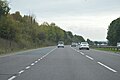
 A10 from Hoe Lane bridge, Ware - geograph.org.uk - 1980795.jpg 1,280 × 960; 461 KB
-
 A10, southbound - geograph.org.uk - 4793440.jpg 640 × 426; 45 KB
-
 A10, southbound - geograph.org.uk - 4793444.jpg 640 × 426; 36 KB
-
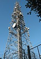 BT mast at Hertford Heath - geograph.org.uk - 2444325.jpg 455 × 640; 152 KB
-
 BT Radio mast on Ermine Street - geograph.org.uk - 787148.jpg 480 × 640; 51 KB
-
 Clearing on Hertford Heath - geograph.org.uk - 2444926.jpg 1,024 × 768; 258 KB
-
 Diverted footpath - geograph.org.uk - 2444349.jpg 1,024 × 768; 485 KB
-
 Downfield Road, Hertford Heath - geograph.org.uk - 3205920.jpg 2,048 × 1,536; 1.78 MB
-
 Elbow Lane Farm - geograph.org.uk - 4063280.jpg 1,024 × 764; 203 KB
-
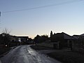
 Entering Hertford Heath on Downfield Road - geograph.org.uk - 3205933.jpg 2,048 × 1,536; 1.87 MB
-
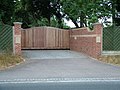 Entrance to Rush Green Hall - geograph.org.uk - 1980806.jpg 1,280 × 960; 467 KB
-
 Ermine Street - geograph.org.uk - 136182.jpg 480 × 640; 133 KB
-
 Ermine Street at Elbow Lane Farm - geograph.org.uk - 787166.jpg 640 × 480; 104 KB
-
 Ermine Street north of Elbow Lane Farm - geograph.org.uk - 4063300.jpg 1,024 × 768; 341 KB
-
 Ermine Street sign - geograph.org.uk - 2444896.jpg 640 × 480; 181 KB
-
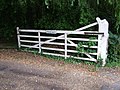 Five barred gate - geograph.org.uk - 1980835.jpg 1,280 × 960; 481 KB
-
 Hertford Heath (20692410214).jpg 3,886 × 2,926; 3.12 MB
-
 Hertford Heath Nature Reserve - geograph.org.uk - 4824759.jpg 4,608 × 3,456; 5.42 MB
-
 Hertford Heath village green 1.JPG 744 × 992; 183 KB
-
 Hertford Heath village green 2.JPG 992 × 540; 90 KB
-
 Hertford Heath war memorial - geograph.org.uk - 2444990.jpg 1,024 × 768; 495 KB
-
 Hoe Lane - geograph.org.uk - 1980825.jpg 1,280 × 960; 482 KB
-
 Hoe Lane from the junction of Stanstead Road - geograph.org.uk - 3205743.jpg 2,048 × 1,536; 1.52 MB
-
 Hogsdell Lane, Hertford Heath - geograph.org.uk - 3205893.jpg 2,048 × 1,536; 1.68 MB
-
 Junction of Downfield Road and Rush Green Lane - geograph.org.uk - 1980819.jpg 1,280 × 960; 477 KB
-
 Junction of Rush Green Lane and Downfield Road - geograph.org.uk - 1980831.jpg 1,280 × 960; 460 KB
-
 Log piles on Elbow Lane - geograph.org.uk - 2444905.jpg 1,024 × 768; 582 KB
-
 London Road, B1197 - geograph.org.uk - 5029249.jpg 640 × 480; 92 KB
-
 London Road, Hertford Heath - geograph.org.uk - 3205911.jpg 2,048 × 1,536; 1.45 MB
-
 Northbound A10 - geograph.org.uk - 5677862.jpg 640 × 428; 96 KB
-
 Northbound A10 - geograph.org.uk - 5677876.jpg 640 × 428; 85 KB
-
 Northbound A10 - geograph.org.uk - 5677888.jpg 640 × 428; 87 KB
-
 Northbound A10 - geograph.org.uk - 5677894.jpg 640 × 428; 83 KB
-
 Parking area on the A10, Great Amwell - geograph.org.uk - 2992169.jpg 1,600 × 1,200; 562 KB
-
 Pondcroft, Rush Green Lane - geograph.org.uk - 1980783.jpg 1,280 × 960; 475 KB
-
 Public footpath near Rush Green Roundabout - geograph.org.uk - 1980815.jpg 1,280 × 960; 487 KB
-
 Radio mast - geograph.org.uk - 1980789.jpg 1,280 × 960; 442 KB
-
 Radio mast by Elbow Lane - geograph.org.uk - 4063310.jpg 768 × 1,024; 178 KB
-
-
 Road sign on the B1502 - geograph.org.uk - 1980802.jpg 1,280 × 960; 460 KB
-
 Roundabout under the A10 bridge - geograph.org.uk - 273632.jpg 640 × 428; 145 KB
-
 Rush Green Hall - geograph.org.uk - 1980836.jpg 1,280 × 960; 472 KB
-
 Rush Green House - geograph.org.uk - 1980780.jpg 1,280 × 960; 471 KB
-
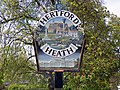
 Sign for Hertford Heath village - geograph.org.uk - 2444974.jpg 1,024 × 768; 327 KB
-
 Sign of the Silver Fox - geograph.org.uk - 2444967.jpg 480 × 640; 127 KB
-
 The A10 - geograph.org.uk - 4793442.jpg 640 × 426; 51 KB
-
 The A10 from Hoe Lane, Rush Green - geograph.org.uk - 3205768.jpg 2,048 × 1,536; 1.48 MB
-
 The entrance to Perennials garden centre, Stanstead Road - geograph.org.uk - 3205941.jpg 2,048 × 1,536; 1.53 MB
-
 The Goat, Hertford Heath.jpg 3,072 × 2,304; 1.34 MB
-
 The Silver Fox at Hertford Heath - geograph.org.uk - 2444956.jpg 1,024 × 768; 253 KB
-
 The Townshend Arms, Hertford Heath - geograph.org.uk - 135392.jpg 640 × 480; 88 KB
-
 The Townshend Arms, Hertford Heath - geograph.org.uk - 2444978.jpg 1,024 × 768; 239 KB
-
 Townsend Arms demolished, Hertford Heath.jpg 3,072 × 2,304; 1.34 MB
-
 Vicarage Causeway, Hertford Heath - geograph.org.uk - 3205785.jpg 2,048 × 1,536; 1.45 MB
-
 View across the A10 - geograph.org.uk - 3908809.jpg 1,600 × 1,064; 280 KB


.jpg)


