Category:Hervormde Kerk, Wamel
| Object location | | View all coordinates using: OpenStreetMap |
|---|
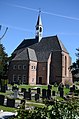
church building in West Maas en Waal, Netherlands  | |||||
| Upload media | |||||
| Instance of | |||||
|---|---|---|---|---|---|
| Location | Wamel, Gelderland, Netherlands | ||||
| Street address |
| ||||
| Located on street |
| ||||
| Heritage designation |
| ||||
 | |||||
|
This is a category about rijksmonument number 38240
|
| Address |
|
Media in category "Hervormde Kerk, Wamel"
The following 46 files are in this category, out of 46 total.
-
 An ancient church at Wamel, just behind the Waal river dike - panoramio.jpg 3,264 × 4,928; 7.21 MB
-
 Avondmaalsbeker, 1790 - Wamel - 20249141 - RCE.jpg 951 × 1,200; 83 KB
-
 Avondmaalsbeker, 1790 - Wamel - 20249142 - RCE.jpg 946 × 1,200; 122 KB
-
 Avondmaalsschotel, 1828 - Wamel - 20249140 - RCE.jpg 1,200 × 962; 132 KB
-
 Detail zuid-oostelijke gevel - Wamel - 20249127 - RCE.jpg 1,200 × 1,197; 443 KB
-
 Doopvont, 1857 - Wamel - 20249135 - RCE.jpg 956 × 1,200; 176 KB
-
 Doorgang noordertransept - Wamel - 20249148 - RCE.jpg 1,190 × 1,200; 506 KB
-
 Doorgang noordertransept - Wamel - 20249149 - RCE.jpg 1,197 × 1,200; 518 KB
-
 Ingang noordgevel - Wamel - 20249124 - RCE.jpg 1,197 × 1,200; 451 KB
-
 Ingang noordgevel - Wamel - 20249125 - RCE.jpg 1,190 × 1,200; 486 KB
-
 Interieur koor naar het oosten - Wamel - 20249109 - RCE.jpg 954 × 1,200; 159 KB
-
 Interieur naar het oosten - Wamel - 20249113 - RCE.jpg 947 × 1,200; 180 KB
-
 Interieur naar het westen - Wamel - 20249116 - RCE.jpg 955 × 1,200; 181 KB
-
 Interieur zuid zijkapel - Wamel - 20249117 - RCE.jpg 956 × 1,200; 161 KB
-
 Interieur, aanzicht orgel, orgelnummer 1600 - Wamel - 20369434 - RCE.jpg 829 × 1,200; 163 KB
-
 Interieur, preekstoel - Wamel - 20249114 - RCE.jpg 960 × 1,200; 191 KB
-
 Kapiteeltje zuid-oost zijde - Wamel - 20249128 - RCE.jpg 1,200 × 1,195; 379 KB
-
 Kerk naar het noord-oosten - Wamel - 20249106 - RCE.jpg 1,200 × 949; 203 KB
-
 Kerk naar het noord-oosten - Wamel - 20249111 - RCE.jpg 951 × 1,200; 294 KB
-
 Kerk naar het noord-westen - Wamel - 20249107 - RCE.jpg 1,200 × 948; 291 KB
-
 Kerk naar het zuid-westen - Wamel - 20249108 - RCE.jpg 1,200 × 951; 236 KB
-
 Kerk naar het zuid-westen - Wamel - 20249110 - RCE.jpg 959 × 1,200; 274 KB
-
 Kerk zuid-oost zijde - Wamel - 20249112 - RCE.jpg 940 × 1,200; 316 KB
-
 Koperen zandloper houder van preekstoel - Wamel - 20249132 - RCE.jpg 953 × 1,200; 159 KB
-
 Lezenaar van preekstoel, koper 1722 - Wamel - 20249131 - RCE.jpg 1,200 × 960; 262 KB
-
 Noord transept met orgel - Wamel - 20249115 - RCE.jpg 945 × 1,200; 187 KB
-
 Noord-oost gevel - Wamel - 20249123 - RCE.jpg 962 × 1,200; 273 KB
-
 Noordgevel - Wamel - 20249147 - RCE.jpg 1,200 × 946; 227 KB
-
 Orgel (1807) - Wamel - 20249133 - RCE.jpg 958 × 1,200; 165 KB
-
 Orgel - Wamel - 20249134 - RCE.jpg 958 × 1,200; 162 KB
-
 Overzicht Hervormde Pastorie - Wamel - 20249176 - RCE.jpg 1,200 × 953; 302 KB
-
 Preekstoel (kuip 1687) - Wamel - 20249129 - RCE.jpg 950 × 1,200; 196 KB
-
 Preekstoel - Wamel - 20249130 - RCE.jpg 953 × 1,200; 190 KB
-
 T.T Hervormde Kerk Wamel (1).JPG 1,984 × 1,488; 563 KB
-
 T.T Hervormde Kerk Wamel (2).JPG 1,488 × 1,984; 209 KB
-
 Voorzangerslezenaar (in de pastorie aanwezig) - Wamel - 20249136 - RCE.jpg 1,200 × 956; 173 KB
-
 WAMEL HERVORMDE KERK 01.jpg 4,608 × 3,456; 3.96 MB
-
 WAMEL HERVORMDE KERK 02.jpg 3,456 × 4,608; 1.74 MB
-
 Wamel Rijksmonument 38240 NH kerk.JPG 3,648 × 2,736; 3.65 MB
-
 Wamel, de Hervormde kerk RM38240 IMG 8528 2021-03-24 13.13.jpg 4,968 × 3,464; 9.78 MB
-
 Zilveren avondmaalsschotels - Wamel - 20249137 - RCE.jpg 1,200 × 939; 133 KB
-
 Zilveren schenkkan, 1874 - Wamel - 20249138 - RCE.jpg 960 × 1,200; 108 KB
-
 Zilveren schenkkan, 1874 - Wamel - 20249139 - RCE.jpg 953 × 1,200; 132 KB
-
 Zonnewijzer zuidgevel - Wamel - 20249126 - RCE.jpg 959 × 1,200; 446 KB
-
 Zuid-oostelijke gevel - Wamel - 20249121 - RCE.jpg 953 × 1,200; 335 KB
-
 Zuid-oostelijke gevel - Wamel - 20249122 - RCE.jpg 957 × 1,200; 390 KB


_-_Wamel_-_20249133_-_RCE.jpg)


_-_Wamel_-_20249129_-_RCE.jpg)

.JPG)
.JPG)
_-_Wamel_-_20249136_-_RCE.jpg)


