Category:Hervormde Kerk, Westzaan
| Object location | | View all coordinates using: OpenStreetMap |
|---|
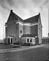
church building in Zaanstad, Netherlands  | |||||
| Upload media | |||||
| Instance of | |||||
|---|---|---|---|---|---|
| Location | Westzaan, Westzaan | ||||
| Street address |
| ||||
| Located on street |
| ||||
| Heritage designation |
| ||||
| Inception |
| ||||
 | |||||
Nederlands: Nederlands Hervormde Kerk
|
This is a category about rijksmonument number 40006
|
| Address |
|
Media in category "Hervormde Kerk, Westzaan"
The following 37 files are in this category, out of 37 total.
-
 Detail preekstoel - Westzaan - 20255066 - RCE.jpg 960 × 1,200; 199 KB
-
 Exterieur vanuit 't noorden - Westzaan - 20255050 - RCE.jpg 960 × 1,200; 214 KB
-
 Exterieur vanuit 't noorden - Westzaan - 20255051 - RCE.jpg 960 × 1,200; 354 KB
-
 Exterieur vanuit het noord-oosten - Westzaan - 20255058 - RCE.jpg 1,200 × 960; 191 KB
-
 Exterieur vanuit het noord-westen - Westzaan - 20255052 - RCE.jpg 960 × 1,200; 226 KB
-
 Exterieur vanuit het noord-westen - Westzaan - 20255053 - RCE.jpg 960 × 1,200; 246 KB
-
 Exterieur vanuit het noord-westen - Westzaan - 20255056 - RCE.jpg 960 × 1,200; 211 KB
-
 Exterieur vanuit het noord-westen - Westzaan - 20255057 - RCE.jpg 960 × 1,200; 300 KB
-
 Exterieur vanuit het noorden - Westzaan - 20255055 - RCE.jpg 960 × 1,200; 277 KB
-
 Exterieur vanuit het oosten - Westzaan - 20255054 - RCE.jpg 960 × 1,200; 270 KB
-
 Exterieur vanuit het zuid-westen - Westzaan - 20255059 - RCE.jpg 1,200 × 952; 247 KB
-
 Gewelf van het interieur - Westzaan - 20255067 - RCE.jpg 960 × 1,200; 147 KB
-
 Hervormde-kerk.JPG 2,304 × 3,072; 1.7 MB
-
 Interieur - Westzaan - 20255060 - RCE.jpg 1,200 × 960; 181 KB
-
 Interieur gewelf - Westzaan - 20255068 - RCE.jpg 1,200 × 957; 131 KB
-
 Interieur naar de preekstoel - Westzaan - 20255062 - RCE.jpg 1,200 × 960; 205 KB
-
 Interieur naar de preekstoel - Westzaan - 20255063 - RCE.jpg 960 × 1,200; 189 KB
-
 Interieur naar het orgel - Westzaan - 20255061 - RCE.jpg 1,200 × 960; 185 KB
-
 Interieur, aanzicht orgel, orgelnummer 1652 - Westzaan - 20374904 - RCE.jpg 695 × 1,200; 147 KB
-
 Interieur, kaarsenkroon - Westzaan - 20255044 - RCE.jpg 951 × 1,200; 150 KB
-
 Kerk vanuit het noord-oosten - Westzaan - 20255042 - RCE.jpg 1,200 × 952; 253 KB
-
 Orgel - Westzaan - 20255064 - RCE.jpg 960 × 1,200; 214 KB
-
 Overzicht - Westzaan - 20255069 - RCE.jpg 1,200 × 960; 229 KB
-

-
 Overzicht oostgevel met beeldhouwwerk - Westzaan - 20255045 - RCE.jpg 894 × 1,200; 220 KB
-
 Preekstoel - Westzaan - 20255043 - RCE.jpg 952 × 1,200; 154 KB
-
 Preekstoel - Westzaan - 20255065 - RCE.jpg 960 × 1,200; 159 KB
-

-

-

-

-
 Westzaan - Kerkbuurt - Torenstraat - View West on Protestant Church 1740.jpg 5,808 × 3,871; 16.57 MB
-

-

-
 Westzaan - Kerkstraat - Kerkbuurt - View SW on Protestant Church 1740.jpg 5,934 × 3,955; 17.57 MB
-

-
 Westzaan - Torenstraat - View NE on Protestant Church 1740.jpg 5,869 × 3,912; 20.77 MB


_1781-1783_by_Johan_Samuel_Creutz_01.jpg)
_1781-1783_by_Johan_Samuel_Creutz_03.jpg)

_1781-1783_by_Johan_Samuel_Creutz.jpg)
