Category:Hervormde kerk (Burum)
| Object location | | View all coordinates using: OpenStreetMap |
|---|
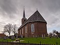
church building in Kollumerland en Nieuwkruisland, Netherlands  | |||||
| Upload media | |||||
| Instance of | |||||
|---|---|---|---|---|---|
| Location | Burum, Friesland, Noardeast-Fryslân, Friesland, Netherlands | ||||
| Street address |
| ||||
| Located on street |
| ||||
| Heritage designation |
| ||||
| Inception |
| ||||
| official website | |||||
 | |||||
Nederlands: Hervormde Kerk - Anno 1784
|
This is a category about rijksmonument number 23745
|
| Address |
|
Media in category "Hervormde kerk (Burum)"
The following 40 files are in this category, out of 40 total.
-
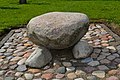
 Boerum, protestanske Terptsjerke, betinkingsstien.jpg 6,000 × 4,000; 12.56 MB
-
 Boerum, protestanske Terptsjerke, hearebank.jpg 3,673 × 5,505; 7.65 MB
-
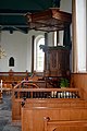 Boerum, protestanske Terptsjerke, preekstoel.jpg 3,589 × 5,384; 14.6 MB
-
 Boerum, protestanske Terptsjerke, rjochtersstien.jpg 6,000 × 4,000; 11.65 MB
-
 Boerum, protestanske Terptsjerke, Van Oeckelenoargel.jpg 3,194 × 4,798; 6.57 MB
-
 Boerum, protestanske Terptsjerke, ynterieur.jpg 6,000 × 4,000; 17.8 MB
-
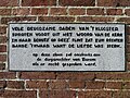 Burum - kerk - gevelsteen.jpg 4,000 × 3,000; 4.84 MB
-
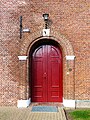 Burum - kerk - ingang.jpg 2,367 × 3,156; 2.61 MB
-
 Burum - NH kerk.jpg 3,699 × 2,775; 3.73 MB
-
 Burum, de Nederlands Hervormde kerk RM23745 foto1 2013-08-25 13.06.jpg 4,311 × 3,233; 9.92 MB
-
 Een van de 3 zerken in consistorie - Burum - 20046075 - RCE.jpg 946 × 1,200; 328 KB
-
 Een van de 3 zerken in de consistorie - Burum - 20046076 - RCE.jpg 961 × 1,200; 291 KB
-
 Een van de drie zerken in consistorie - Burum - 20046074 - RCE.jpg 956 × 1,200; 272 KB
-
 Herenbank - Burum - 20046063 - RCE.jpg 948 × 1,200; 218 KB
-
 Herenbank - Burum - 20046068 - RCE.jpg 951 × 1,200; 202 KB
-
 Herenbank - Burum - 20046069 - RCE.jpg 947 × 1,200; 204 KB
-
 Herenbanken - Burum - 20046064 - RCE.jpg 956 × 1,200; 224 KB
-
 Herenbanken - Burum - 20046065 - RCE.jpg 946 × 1,200; 215 KB
-
 Herenbanken - Burum - 20046066 - RCE.jpg 962 × 1,200; 203 KB
-
 Herenbanken - Burum - 20046067 - RCE.jpg 1,200 × 956; 219 KB
-
 Herenbanken - Burum - 20046070 - RCE.jpg 966 × 1,200; 221 KB
-
 Hervormde kerk Burum.jpg 4,150 × 3,109; 2.29 MB
-
 Hervormde kerk, Burum 1.jpg 2,309 × 1,732; 1.67 MB
-
 Hervormde kerk, Burum 2.jpg 2,309 × 1,732; 821 KB
-
 Intenieur, aanzicht orgel, orgelnummer 259 - Burum - 20417385 - RCE.jpg 668 × 1,200; 135 KB
-
 Interieur naar het oosten - Burum - 20046060 - RCE.jpg 1,200 × 954; 184 KB
-
 Interieur naar het westen - Burum - 20046061 - RCE.jpg 1,200 × 944; 202 KB
-
 INTERIEUR, AVONDMAALBEKERS - Burum - 20287347 - RCE.jpg 1,200 × 1,192; 174 KB
-

-
 INTERIEUR, PREEKSTOEL MET DOOPTUIN, OVERZICHT - Burum - 20260400 - RCE.jpg 797 × 1,200; 127 KB
-
 Kapstokbord voor collecte zakken - Burum - 20046078 - RCE.jpg 969 × 1,200; 105 KB
-
 Koperen kroon - Burum - 20046077 - RCE.jpg 963 × 1,200; 165 KB
-
 N.H.Kerk, aanzicht - Burum - 20046058 - RCE.jpg 1,200 × 805; 196 KB
-
 Overzicht achterzijde - Burum - 20046086 - RCE.jpg 1,188 × 1,200; 307 KB
-
 Overzicht herenbanken - Burum - 20046062 - RCE.jpg 1,200 × 960; 195 KB
-
 Paneel van preekstoel met doodshoofd en zandloper - Burum - 20046073 - RCE.jpg 946 × 1,200; 358 KB
-
 Preekstoel - Burum - 20046071 - RCE.jpg 937 × 1,200; 203 KB
-
 Preekstoel - Burum - 20046072 - RCE.jpg 937 × 1,200; 187 KB
-
 Preekstoel - Burum - 20046079 - RCE.jpg 954 × 1,200; 179 KB
-
 Zuid-oost zijde - Burum - 20046059 - RCE.jpg 1,200 × 946; 206 KB


_(1899)_-_Burum_-_20276976_-_RCE.jpg)


