Category:Hesket Newmarket
English: Hesket Newmarket is a small village in Cumbria, on the opposite side of Skiddaw to Keswick in the extreme North West of England.
village in Cumbria, United Kingdom  | |||||
| Upload media | |||||
| Instance of | |||||
|---|---|---|---|---|---|
| Location | Caldbeck, Allerdale, Cumbria, North West England, England | ||||
 | |||||
Media in category "Hesket Newmarket"
The following 54 files are in this category, out of 54 total.
-
-
 Football Pitch for Sheep - geograph.org.uk - 20966.jpg 640 × 426; 125 KB
-
 Hesket Newmarket - geograph.org.uk - 1520652.jpg 640 × 382; 47 KB
-
 Hesket Newmarket green - geograph.org.uk - 1275040.jpg 640 × 480; 133 KB
-
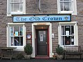
 Hesket Newmarket Post Office with fingerpost, Sept 1994 - Flickr - sludgegulper.jpg 1,671 × 1,042; 268 KB
-
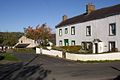
 Houses in Hesket Newmarket - geograph.org.uk - 949604.jpg 640 × 426; 68 KB
-
 Houses in Hesket Newmarket - geograph.org.uk - 951250.jpg 640 × 426; 60 KB
-
 Lane entering Hesket Newmarket - geograph.org.uk - 1275052.jpg 640 × 480; 108 KB
-
 Market Cross, Hesket Newmarket - geograph.org.uk - 951270.jpg 640 × 426; 77 KB
-
-
 Rear view of houses - geograph.org.uk - 1275023.jpg 640 × 295; 48 KB
-
 Road sign in Hesket Newmarket - geograph.org.uk - 951259.jpg 426 × 640; 71 KB
-
 Seat on the green, Hesket Newmarket - geograph.org.uk - 283068.jpg 640 × 480; 156 KB
-
-
 The Street, Hesket Newmarket - geograph.org.uk - 2345659.jpg 1,024 × 768; 140 KB
-
 Woodland next to the River Caldew - geograph.org.uk - 1582214.jpg 640 × 480; 152 KB
-
 Abandoned Mine Workings - geograph.org.uk - 97125.jpg 459 × 640; 104 KB
-
 Barn - geograph.org.uk - 1519898.jpg 640 × 354; 112 KB
-
 Beck above Potts Gill Farm - geograph.org.uk - 780112.jpg 640 × 480; 73 KB
-
-
 Dry Gulley - geograph.org.uk - 127401.jpg 640 × 480; 110 KB
-
 Farmland next to Pasture Lane - geograph.org.uk - 96919.jpg 597 × 400; 65 KB
-

-
 Haltcliff House - geograph.org.uk - 195860.jpg 640 × 478; 121 KB
-
 Hesket Bridge - geograph.org.uk - 20965.jpg 640 × 426; 142 KB
-
 Hesket Newmarket - geograph.org.uk - 20964.jpg 640 × 426; 116 KB
-
 Hesket Newmarket - geograph.org.uk - 549484.jpg 600 × 437; 76 KB
-
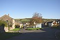
 Hill Top, Nether Row - geograph.org.uk - 639675.jpg 640 × 480; 140 KB
-
 Lane above Hesket Newmarket - geograph.org.uk - 639588.jpg 640 × 480; 127 KB
-
 Looking towards High Row - geograph.org.uk - 96920.jpg 597 × 400; 81 KB
-
 Matthew Rudding - geograph.org.uk - 341273.jpg 600 × 399; 77 KB
-

-
 Millhouse - geograph.org.uk - 20962.jpg 640 × 426; 112 KB
-
 Mine Track, Caldbeck Fells - geograph.org.uk - 97129.jpg 640 × 401; 63 KB
-

-
 Pastures above Caldbeck - geograph.org.uk - 639700.jpg 640 × 480; 134 KB
-
 Pastures above Caldbeck - geograph.org.uk - 639704.jpg 640 × 480; 151 KB
-
 Pastures and tree above Street Head - geograph.org.uk - 96615.jpg 400 × 597; 89 KB
-
 Pastures, Nether Row - geograph.org.uk - 639656.jpg 640 × 480; 156 KB
-
 Pastures, Nether Row - geograph.org.uk - 639659.jpg 640 × 480; 131 KB
-
 Pond and Wood Hall Farm - geograph.org.uk - 96918.jpg 597 × 400; 74 KB
-
 Potts Gill and Old Mine - geograph.org.uk - 97134.jpg 640 × 427; 98 KB
-
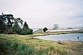
 River Caldew - geograph.org.uk - 196321.jpg 478 × 640; 213 KB
-

-
 Road entering Nether Row - geograph.org.uk - 639696.jpg 640 × 480; 151 KB
-
 Sheep grazing at an old quarry - geograph.org.uk - 96617.jpg 597 × 400; 77 KB
-

-
 Slippery road. - geograph.org.uk - 114512.jpg 640 × 431; 43 KB
-
 Sowerby Hall Farm, Castle Sowerby - geograph.org.uk - 274133.jpg 640 × 463; 113 KB
-
 Sunny Bank, West Fell - geograph.org.uk - 97122.jpg 640 × 427; 98 KB
-

-
 Top of the green, Hesket Newmarket - geograph.org.uk - 283036.jpg 640 × 433; 57 KB
-
 Track, Nether Row - geograph.org.uk - 639665.jpg 640 × 480; 157 KB
-
 Wind turbine above Newlands - geograph.org.uk - 96923.jpg 400 × 597; 76 KB


