Category:Hetton, Tyne and Wear
English: Hetton is a civil parish in the Sunderland district, in the county of Tyne and Wear, England.
civil parish in Sunderland, Tyne and Wear, England | |||||
| Upload media | |||||
| Instance of | |||||
|---|---|---|---|---|---|
| Location | Sunderland, Tyne and Wear, North East England, England | ||||
 | |||||
Subcategories
This category has the following 6 subcategories, out of 6 total.
Media in category "Hetton, Tyne and Wear"
The following 200 files are in this category, out of 267 total.
(previous page) (next page)-
 A690 slip road, East Rainton - geograph.org.uk - 2579551.jpg 640 × 480; 57 KB
-
 Allotments at Hetton-le-Hole - geograph.org.uk - 2907878.jpg 2,815 × 2,099; 1.27 MB
-
 Allotments off Downpit Lane - geograph.org.uk - 3333900.jpg 640 × 427; 300 KB
-
 B1284 Road - geograph.org.uk - 5553710.jpg 640 × 478; 58 KB
-
 Back lane, Hetton-le-Hole - geograph.org.uk - 3394395.jpg 640 × 480; 60 KB
-
 Barriers on public bridleway - geograph.org.uk - 3331186.jpg 3,648 × 2,736; 2.73 MB
-
 Bench at East Rainton - geograph.org.uk - 2579564.jpg 640 × 480; 85 KB
-
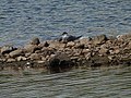
 Bird line up - geograph.org.uk - 5248439.jpg 1,001 × 727; 468 KB
-
 Black Boy Pub, Moorsley - geograph.org.uk - 3237384.jpg 1,920 × 1,080; 695 KB
-
 Blossom Street, Hetton-le-Hole - geograph.org.uk - 3193122.jpg 640 × 480; 66 KB
-
 Bonnie Pit Lad, Easington Lane - geograph.org.uk - 2927275.jpg 1,600 × 950; 290 KB
-
 Braken Hill - geograph.org.uk - 2908927.jpg 3,264 × 2,448; 1.37 MB
-
 Brewers Arms, Hetton-le-Hole - geograph.org.uk - 2442987.jpg 640 × 478; 121 KB
-
 Bridge over a stream near East Rainton - geograph.org.uk - 2580883.jpg 480 × 640; 136 KB
-

-

-

-
 Bridleway heading towards East Rainton - geograph.org.uk - 5299532.jpg 1,275 × 1,600; 704 KB
-
 Bridleway near Houghton-le-Spring - geograph.org.uk - 2584313.jpg 640 × 480; 92 KB
-
 Bridleway near Rainton Meadows - geograph.org.uk - 3502763.jpg 640 × 480; 100 KB
-
 Bridleway north-west from the A690 - geograph.org.uk - 3448308.jpg 1,500 × 1,125; 1.5 MB
-
 Bridleway through Carr House Plantation to Murton Bridge - geograph.org.uk - 3840795.jpg 3,264 × 2,448; 2.62 MB
-
 Bridleway to Great Eppleton from Salter's Lane - geograph.org.uk - 3840805.jpg 3,264 × 2,448; 3.59 MB
-
 Bridleway west of East Rainton - geograph.org.uk - 3529393.jpg 1,500 × 994; 1.26 MB
-
 Broomhill Terrace, Hetton-le-Hole - geograph.org.uk - 3573434.jpg 3,648 × 2,736; 3.11 MB
-

-

-
 Bus stop on the A690 - geograph.org.uk - 4513099.jpg 640 × 480; 73 KB
-
 Byer Street, Hetton-le-Hole - geograph.org.uk - 3394362.jpg 640 × 480; 73 KB
-
 Byer Street, Hetton-le-Hole - geograph.org.uk - 3394369.jpg 640 × 480; 55 KB
-
 Carr House Farm - geograph.org.uk - 2908969.jpg 3,264 × 2,448; 1.67 MB
-
 Clarence Court housing development - geograph.org.uk - 2505008.jpg 640 × 480; 75 KB
-
 Coal Bank Farm at Low Moorsley - geograph.org.uk - 2913951.jpg 4,608 × 3,456; 5.22 MB
-
 Colliery Inn, Hetton-le-Hole - geograph.org.uk - 2443007.jpg 640 × 480; 117 KB
-

-
 Common tern on nest - geograph.org.uk - 3497635.jpg 640 × 480; 101 KB
-

-
 Convenience store, Easington Lane - geograph.org.uk - 3219193.jpg 640 × 480; 78 KB
-
 Convenience store, East Rainton - geograph.org.uk - 4513114.jpg 640 × 480; 55 KB
-
 Cowley Crescent, East Rainton - geograph.org.uk - 4513106.jpg 640 × 426; 44 KB
-
 Crop field off Elemore Lane - geograph.org.uk - 4498839.jpg 640 × 480; 67 KB
-

-
 Demolished houses, Eppleton Estate - geograph.org.uk - 3193129.jpg 640 × 480; 52 KB
-
 Down Pit Lane - geograph.org.uk - 3333924.jpg 640 × 427; 278 KB
-
 Downs Pit Lane - geograph.org.uk - 2554677.jpg 3,276 × 2,131; 950 KB
-
 Downs Pit Lane, Hetton-le-Hole - geograph.org.uk - 3394447.jpg 640 × 480; 71 KB
-
 Downs Pit Lane, Hetton-le-Hole - geograph.org.uk - 3394451.jpg 640 × 480; 52 KB
-
 Durham Road, East Rainton - geograph.org.uk - 4513109.jpg 640 × 458; 57 KB
-
 Easington Lane Apostolic Church - geograph.org.uk - 2934936.jpg 640 × 404; 66 KB
-

-
 Easington Lane W.M.C. - geograph.org.uk - 4504276.jpg 640 × 480; 82 KB
-
 East Rainton Methodist Church - geograph.org.uk - 2661913.jpg 640 × 480; 142 KB
-
 East Rainton Methodist Church, Interior - geograph.org.uk - 2661917.jpg 640 × 480; 127 KB
-
 Empty road, Hetton-le-Hole - geograph.org.uk - 3394384.jpg 640 × 480; 67 KB
-
 Entering County Durham - geograph.org.uk - 3219228.jpg 800 × 627; 129 KB
-
 Entering County Durham - geograph.org.uk - 4513040.jpg 640 × 480; 89 KB
-

-
 Entering East Rainton - geograph.org.uk - 4513102.jpg 640 × 480; 47 KB
-
 Entering East Rainton - geograph.org.uk - 4522774.jpg 640 × 480; 78 KB
-
 Entering Houghton-le-Spring - geograph.org.uk - 5553691.jpg 640 × 478; 86 KB
-
 Entering The City of Sunderland - geograph.org.uk - 4513093.jpg 640 × 480; 59 KB
-

-
 Entrance off Park View to Hetton-Le-Hole bus interchange - geograph.org.uk - 3331317.jpg 3,648 × 2,736; 3.13 MB
-
 Entrance to Hetton Bogs Nature Reserve - geograph.org.uk - 3573478.jpg 3,648 × 2,736; 3.41 MB
-
 Entrance to Hetton Park - geograph.org.uk - 3573405.jpg 3,648 × 2,736; 3.05 MB
-
 Eppleton Quarry - geograph.org.uk - 3333918.jpg 640 × 427; 240 KB
-
 Eppleton Terrace, Hetton-le-Hole - geograph.org.uk - 3394403.jpg 640 × 480; 65 KB
-
 Fairy Street, Hetton-le-Hole - geograph.org.uk - 2827514.jpg 640 × 480; 76 KB
-
 Farm track and footpath, High Moorsley - geograph.org.uk - 4504380.jpg 640 × 480; 100 KB
-
 Farm track near High Moorsley Farm - geograph.org.uk - 2907474.jpg 4,608 × 3,456; 4.66 MB
-
 Farm track off Elemore Lane - geograph.org.uk - 4504029.jpg 640 × 480; 61 KB
-

-

-
 Field House Farm - geograph.org.uk - 3237458.jpg 3,968 × 2,232; 4.13 MB
-
 Field House Sand Hole, Houghton-Le-Spring - geograph.org.uk - 3245209.jpg 1,920 × 1,080; 596 KB
-
 Fields near Lyons - geograph.org.uk - 2030097.jpg 640 × 480; 69 KB
-
 Fields, Moorsley Banks - geograph.org.uk - 4504375.jpg 640 × 403; 63 KB
-
 Firtree Lane, Lyons - geograph.org.uk - 2030087.jpg 640 × 480; 75 KB
-
 Flower Meadow at Rainton Meadows Nature Reserve - geograph.org.uk - 2975585.jpg 3,648 × 2,736; 1.91 MB
-

-
 Footpath near East Rainton - geograph.org.uk - 2580846.jpg 640 × 480; 135 KB
-
 Footpath near East Rainton - geograph.org.uk - 2580855.jpg 640 × 480; 122 KB
-
 Footpath to Rainton Meadows - geograph.org.uk - 2584286.jpg 640 × 480; 94 KB
-
 Former Railway Building - geograph.org.uk - 3848348.jpg 640 × 427; 248 KB
-

-

-

-

-
 Four Lane Ends Roundabout - geograph.org.uk - 3749637.jpg 640 × 480; 57 KB
-
 Front Street, Hetton-le-Hole - geograph.org.uk - 2443018.jpg 640 × 480; 121 KB
-
 G Whitfield Pharmacy, Hetton-le-Hole - geograph.org.uk - 2442985.jpg 480 × 640; 67 KB
-
 Gateway at the edge of Rainton Meadows - geograph.org.uk - 3502762.jpg 640 × 480; 118 KB
-
 Gillas Lane West - geograph.org.uk - 3511993.jpg 640 × 480; 68 KB
-
 Grazing, Moorsley Banks - geograph.org.uk - 4498848.jpg 640 × 480; 79 KB
-
 Hetton - Hetton le Hill.jpg 640 × 480; 63 KB
-
 Hetton Bogs Nature Reserve Entrance - geograph.org.uk - 5547713.jpg 640 × 478; 130 KB
-
 Hetton Downs Estate, Hetton-le-Hole - geograph.org.uk - 3394457.jpg 640 × 480; 64 KB
-
 Hetton Downs Estate, Hetton-le-Hole - geograph.org.uk - 3394460.jpg 640 × 480; 78 KB
-
 Hetton le Hill from Elemore Lane - geograph.org.uk - 2913935.jpg 4,608 × 3,456; 4.4 MB
-
 Hetton Library, Blue plaque - geograph.org.uk - 2442975.jpg 640 × 480; 179 KB
-
 Hetton Lyon Industrial Estate - geograph.org.uk - 2455080.jpg 640 × 480; 102 KB
-
 Hetton Lyons BMX Track - geograph.org.uk - 2555505.jpg 3,648 × 2,736; 2.58 MB
-
 Hetton Lyons Country Park - geograph.org.uk - 3333911.jpg 640 × 427; 311 KB
-
 Hetton Lyons Country Park - geograph.org.uk - 3394429.jpg 640 × 480; 73 KB
-
 Hetton Lyons Country Park - geograph.org.uk - 3394435.jpg 640 × 480; 61 KB
-
 Hetton Lyons Country Park - geograph.org.uk - 3394441.jpg 640 × 480; 77 KB
-

-

-
 Hetton School - geograph.org.uk - 4498840.jpg 640 × 480; 76 KB
-

-
 Hetton-le-Hill Golf Club - geograph.org.uk - 4504033.jpg 640 × 480; 82 KB
-
 Hetton-Le-Hole Sign, Moorsley Road - geograph.org.uk - 3238382.jpg 1,272 × 1,080; 916 KB
-
 Hide at Rainton Meadows Nature Reserve - geograph.org.uk - 5317629.jpg 1,500 × 759; 778 KB
-
 Highfield Hotel - geograph.org.uk - 5110964.jpg 640 × 480; 84 KB
-
 Hillside below High Moorsley - geograph.org.uk - 2907485.jpg 4,608 × 3,456; 5.54 MB
-
 Houghton Road - geograph.org.uk - 5547700.jpg 640 × 478; 61 KB
-
 Houghton Road, Hetton-le-Hole - geograph.org.uk - 2442966.jpg 640 × 480; 111 KB
-
 House in Hetton-le-Hole - geograph.org.uk - 3219199.jpg 640 × 480; 64 KB
-
 Houses at Hetton le Hill - geograph.org.uk - 2913928.jpg 4,608 × 3,456; 5.35 MB
-

-
 Houses on Vale Street, Elmore Vale - geograph.org.uk - 4504267.jpg 640 × 480; 62 KB
-
 Housing in Hetton-le-Hole - geograph.org.uk - 3394455.jpg 640 × 480; 56 KB
-
 Housing, Hetton Downs - geograph.org.uk - 3333905.jpg 640 × 427; 244 KB
-
 Industrial unit off Mercantile Road - geograph.org.uk - 4499192.jpg 640 × 480; 70 KB
-
 Joe's Pond - geograph.org.uk - 3448295.jpg 1,500 × 1,125; 1.37 MB
-
 Joe's Pond - geograph.org.uk - 3502761.jpg 640 × 480; 113 KB
-
 Joe's Pond - geograph.org.uk - 5248435.jpg 4,608 × 3,456; 6.45 MB
-
 Joe's Pond in early spring - geograph.org.uk - 2916136.jpg 4,608 × 3,456; 5.61 MB
-
 Lane at south side of Rainton Meadows - geograph.org.uk - 3448693.jpg 1,500 × 985; 1.39 MB
-
 Lane heading into East Rainton - geograph.org.uk - 5300289.jpg 1,500 × 847; 1.9 MB
-
 Lane up to East Rainton - geograph.org.uk - 2914706.jpg 4,608 × 3,456; 5.28 MB
-
 Leamside Line - geograph.org.uk - 5554846.jpg 640 × 478; 76 KB
-
 Leaving County Durham - geograph.org.uk - 2927268.jpg 1,024 × 576; 209 KB
-
 Leaving County Durham on the B1285 - geograph.org.uk - 3171836.jpg 3,648 × 2,736; 2.32 MB
-
 Leaving High Moorsley - geograph.org.uk - 4513035.jpg 640 × 480; 89 KB
-
 Lindsay Street, Hetton-le-Hole - geograph.org.uk - 3394464.jpg 640 × 480; 62 KB
-
 Local shop, Hetton-le-Hole - geograph.org.uk - 3394390.jpg 640 × 480; 57 KB
-
 Looking along the footpath - geograph.org.uk - 2914669.jpg 4,608 × 3,456; 5.51 MB
-
 Looking down Market Street, Hetton-le-Hole - geograph.org.uk - 3573388.jpg 3,648 × 2,736; 2.79 MB
-
 Looking East along Hazard Lane - geograph.org.uk - 2914646.jpg 4,608 × 3,456; 5.63 MB
-
 Looking East from the Trail - geograph.org.uk - 2914689.jpg 4,608 × 3,456; 4.92 MB
-
 Looking South from Moorsley Road - geograph.org.uk - 2907349.jpg 4,608 × 3,456; 4.46 MB
-

-
 Looking up the track to Carr House Farm - geograph.org.uk - 2908977.jpg 2,970 × 2,098; 1.17 MB
-
 Lyons Cottages - geograph.org.uk - 3572225.jpg 3,648 × 2,736; 2.91 MB
-
 Lyons Gardens, Lyons - geograph.org.uk - 2030108.jpg 640 × 480; 83 KB
-
 Lyons Lake - geograph.org.uk - 3333907.jpg 640 × 427; 264 KB
-
 Marker Post, Hetton-Le-Hole - geograph.org.uk - 3237388.jpg 1,920 × 1,080; 922 KB
-
 Maxim Brewery, Hetton-le-Hole - geograph.org.uk - 2706652.jpg 640 × 480; 67 KB
-
 Meeting of bridleways near Low Moorsley - geograph.org.uk - 5299467.jpg 1,500 × 916; 1.68 MB
-
 Memorial Clock Tower, Easington Lane - geograph.org.uk - 2927288.jpg 1,600 × 1,045; 315 KB
-
 Mercantile Road - geograph.org.uk - 4523826.jpg 640 × 480; 69 KB
-
 Mercantile Road - geograph.org.uk - 5169422.jpg 640 × 478; 72 KB
-
 Methodist Church at East Rainton - geograph.org.uk - 2914731.jpg 4,608 × 3,456; 5.79 MB
-
 Moorsley Road - geograph.org.uk - 3237435.jpg 3,968 × 2,232; 4.18 MB
-
 Moorsley Road - geograph.org.uk - 3749627.jpg 640 × 480; 53 KB
-
 Moorsley Road - geograph.org.uk - 4504323.jpg 640 × 480; 76 KB
-
 Moorsley Road - geograph.org.uk - 4513036.jpg 640 × 480; 79 KB
-
 Moorsley Road. Low Moorsley - geograph.org.uk - 4504341.jpg 640 × 480; 67 KB
-

-

-
 Newcastle Bound Bus - geograph.org.uk - 3749609.jpg 640 × 480; 79 KB
-
 No Entry Sign, Eppleton Quarry - geograph.org.uk - 3333921.jpg 640 × 360; 220 KB
-
 North Road - geograph.org.uk - 3749604.jpg 640 × 480; 73 KB
-
 North Street, East Rainton - geograph.org.uk - 2661924.jpg 640 × 480; 128 KB
-

-

-
 Oilseed rape crop and woodland - geograph.org.uk - 4498892.jpg 640 × 480; 71 KB
-
 Oilseed rape crop, Low Moorsley - geograph.org.uk - 4504334.jpg 640 × 480; 93 KB
-
 Old Railway Walk - geograph.org.uk - 2908940.jpg 3,264 × 2,448; 1.12 MB
-
 Open fieldscape at Hetton le Hill - geograph.org.uk - 2913923.jpg 4,608 × 3,456; 5.07 MB
-
 Ordnance Survey Cut Mark - geograph.org.uk - 5913334.jpg 1,024 × 748; 263 KB
-
 Overgrown pond - geograph.org.uk - 3573500.jpg 3,648 × 2,736; 3.61 MB
-
 Park View - geograph.org.uk - 3749653.jpg 640 × 480; 65 KB
-
 Parkgate, Lyons - geograph.org.uk - 3219216.jpg 640 × 447; 42 KB
-
 Path down to Rainton Meadows - geograph.org.uk - 2914748.jpg 4,608 × 3,456; 5.54 MB
-
 Path to Hetton le Hill - geograph.org.uk - 2907497.jpg 4,608 × 3,456; 5.11 MB
-

-
 Path to Rainton Meadows - geograph.org.uk - 3573548.jpg 3,648 × 2,736; 3.39 MB
-
 Path, Rainton Meadows Nature Reserve - geograph.org.uk - 4523831.jpg 640 × 480; 100 KB
-
 Penshaw Monument - geograph.org.uk - 3245245.jpg 1,920 × 1,080; 425 KB
-
 Percy Street in Hetton-le-Hole - geograph.org.uk - 2554663.jpg 3,648 × 2,736; 1.87 MB
-
 Permissive path to enter Rainton Meadows Nature Reserve - geograph.org.uk - 3330709.jpg 2,432 × 1,883; 2.01 MB
-
 Picnic area at Hetton Lyons Country Park - geograph.org.uk - 2554693.jpg 3,648 × 2,736; 2.76 MB
-
 Ploughed field near Hetton-le-Hole - geograph.org.uk - 2580876.jpg 640 × 480; 93 KB
-
 Pond 4 at Rainton Meadows - geograph.org.uk - 2916237.jpg 4,608 × 3,456; 4.76 MB
-
 Pond at Rainton Meadows - geograph.org.uk - 5248445.jpg 4,608 × 3,456; 5.82 MB
-

-
 Public Footpath - geograph.org.uk - 3749617.jpg 640 × 480; 74 KB
-
 Public footpath near High Moorsley - geograph.org.uk - 2580902.jpg 480 × 640; 131 KB
-
 Public footpath near High Moorsley - geograph.org.uk - 2582180.jpg 640 × 480; 103 KB
-
 Public footpath near High Moorsley - geograph.org.uk - 2582189.jpg 480 × 640; 163 KB
-
 Quarry House Lane, East Rainton - geograph.org.uk - 2580835.jpg 640 × 480; 102 KB
-
 Quarry House Lane, East Rainton - geograph.org.uk - 2580839.jpg 640 × 480; 90 KB
-
 Rail Stockyard - geograph.org.uk - 3333890.jpg 640 × 427; 72 KB
-
 Rail Stockyard - geograph.org.uk - 3333894.jpg 640 × 427; 247 KB
-
 Railway bridge near Rainton Meadows - geograph.org.uk - 2584303.jpg 640 × 480; 104 KB
-
 Railway path near High Moorsley - geograph.org.uk - 2580891.jpg 640 × 480; 145 KB
-
 Railway path near High Moorsley - geograph.org.uk - 2580898.jpg 640 × 480; 133 KB
-
 Rainton Bridge - geograph.org.uk - 2579544.jpg 640 × 480; 87 KB


_-_geograph.org.uk_-_4504023.jpg)


_off_Moorsley_Road_-_geograph.org.uk_-_4498852.jpg)


,_Hetton-le-Hole_-_geograph.org.uk_-_3219201.jpg)


