Category:High Rigg, Cumbria
English: High Rigg is a hill in the civil parish of St John's Castlerigg and Wythburn, in the Cumberland district, in the ceremonial county of Cumbria, England.
mountain in United Kingdom  | |||||
| Upload media | |||||
| Instance of | |||||
|---|---|---|---|---|---|
| Location |
| ||||
| Mountain range | |||||
| Elevation above sea level |
| ||||
| Parent peak | |||||
 | |||||
Media in category "High Rigg, Cumbria"
The following 28 files are in this category, out of 28 total.
-
 Collects creating a boggy tarn on High Rigg - geograph.org.uk - 4488436.jpg 1,024 × 768; 174 KB
-
 High Rigg - geograph.org.uk - 1325497.jpg 640 × 480; 86 KB
-
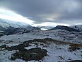
 High Rigg in the Lake District - geograph.org.uk - 5216115.jpg 640 × 427; 162 KB
-
 High Rigg Summit - geograph.org.uk - 2667395.jpg 2,560 × 1,920; 2.06 MB
-
 High Rigg summit area, looking south-east - geograph.org.uk - 4488470.jpg 1,024 × 768; 146 KB
-
 High Rigg Summit Cairn - geograph.org.uk - 4663894.jpg 4,000 × 3,000; 5.01 MB
-
 Moss Crag on High Rigg - geograph.org.uk - 2310254.jpg 2,272 × 1,704; 2.18 MB
-
 On High Rigg - geograph.org.uk - 1325500.jpg 640 × 480; 64 KB
-
 On High Rigg - geograph.org.uk - 3298657.jpg 2,560 × 1,920; 585 KB
-
 On High Rigg - geograph.org.uk - 3613779.jpg 2,560 × 1,920; 2.09 MB
-
 On High Rigg - geograph.org.uk - 861746.jpg 640 × 480; 65 KB
-
 On High Rigg, near Moss Crag - geograph.org.uk - 3346092.jpg 2,592 × 1,944; 1.04 MB
-

-
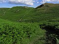 Paths through bracken, Moss Crag (High Rigg) - geograph.org.uk - 4280439.jpg 1,024 × 768; 221 KB
-
 Rock outcrops on High Rigg - geograph.org.uk - 5267825.jpg 1,499 × 907; 1.24 MB
-
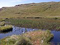 Small Tarn, High Rigg - geograph.org.uk - 3582562.jpg 640 × 480; 426 KB
-
 Small Tarn, High Rigg - geograph.org.uk - 3582567.jpg 640 × 480; 419 KB
-
 South along High Rigg - geograph.org.uk - 2136169.jpg 640 × 480; 97 KB
-
 South from High Rigg summit - geograph.org.uk - 9503.jpg 640 × 480; 39 KB
-
 Stone walls on High Rigg - geograph.org.uk - 4838743.jpg 1,600 × 1,064; 454 KB
-
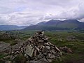 Summit Cairn, High Rigg - geograph.org.uk - 469749.jpg 640 × 480; 80 KB
-
 Summit Cairn, High Rigg - geograph.org.uk - 861748.jpg 640 × 480; 79 KB
-
 The lumpy and bumpy ridge that is High Rigg - geograph.org.uk - 4488443.jpg 1,024 × 768; 165 KB
-
 The summit of High Rigg - geograph.org.uk - 3346110.jpg 2,592 × 1,944; 1.72 MB
-

-
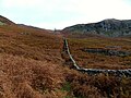
 Wall along the ridge - geograph.org.uk - 1825349.jpg 3,872 × 2,592; 3.96 MB
-
 Wall descending the east side of High Rigg - geograph.org.uk - 4488451.jpg 1,024 × 768; 149 KB
-
 Wall on High Rigg - geograph.org.uk - 5173890.jpg 640 × 480; 85 KB


_-_geograph.org.uk_-_4280439.jpg)


