Category:High Street, Lindfield

Subcategories
This category has the following 11 subcategories, out of 11 total.
B
- Bent Arms pub, Lindfield (6 F)
- The Bower House, Lindfield (2 F)
C
- Church House, Lindfield (17 F)
L
- Lindfield House, West Sussex (2 F)
- Lindfield Place (2 F)
- Lindfield United Reformed Church (12 F)
M
- Malling Priory (3 F)
- The Manor House, Lindfield (2 F)
O
- Old Place, Lindfield (10 F)
T
Media in category "High Street, Lindfield"
The following 38 files are in this category, out of 38 total.
-
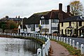
 95-97, High Street, Lindfield (geograph 4641071).jpg 640 × 480; 78 KB
-
 Bus to Haywards Heath, High Street, Lindfield - geograph.org.uk - 2417952.jpg 4,320 × 3,240; 4.06 MB
-
 High Street, Lindfield - geograph.org.uk - 2417914.jpg 4,320 × 3,240; 3.72 MB
-
 High Street, Lindfield - geograph.org.uk - 2417916.jpg 4,320 × 3,240; 4.79 MB
-
 High Street, Lindfield - geograph.org.uk - 2443019.jpg 1,600 × 1,200; 499 KB
-
 High Street, Lindfield - geograph.org.uk - 4578473.jpg 640 × 480; 69 KB
-
 High Street, Lindfield - geograph.org.uk - 4641339.jpg 640 × 480; 61 KB
-
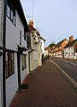
 High Street, Lindfield - geograph.org.uk - 668412.jpg 640 × 479; 88 KB
-
 High Street, Lindfield, Sussex - geograph.org.uk - 2680736.jpg 2,984 × 1,986; 7.56 MB
-
 High Street, Lindfield, Sussex - geograph.org.uk - 2680752.jpg 4,592 × 3,056; 6.78 MB
-
 High Street, Lindfield, Sussex - geograph.org.uk - 2684977.jpg 3,407 × 2,292; 7.71 MB
-
 High Street, Lindfield, Sussex - geograph.org.uk - 2684981.jpg 3,306 × 2,200; 7.69 MB
-
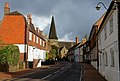
 Lindfield High Street near the church - geograph.org.uk - 19551.jpg 640 × 456; 92 KB
-
 Lindfield old fire station 1 - geograph.org.uk - 587725.jpg 640 × 427; 258 KB
-
 Lindfield old fire station 2 - geograph.org.uk - 587722.jpg 640 × 427; 201 KB
-
 LK51 JYN (Metrobus Driver Training Bus) at High Street, Lindfield (17138652225).jpg 4,608 × 3,456; 3.24 MB
-

-
 Metrobus bus 491 (YN53 RZD) 2004 Scania N94UD OmniDekka, Lindfield, 30 March 2011.jpg 2,072 × 1,336; 1.01 MB
-

-
 Red Lion pub, High Street, Lindfield (April 2015).JPG 4,200 × 3,200; 4.72 MB
-
 Stand Up Inn, High Street, Lindfield (April 2015).JPG 4,400 × 3,200; 2.3 MB
-
 The Red Lion public house, Lindfield - geograph.org.uk - 2417909.jpg 4,320 × 3,240; 4.2 MB
-
 The Toll House 56 High Street Lindfield RH16 2HL.jpg 2,988 × 5,312; 2.55 MB
-
 The Toll House, 56 High Street, Lindfield (NHLE Code 1025456) (April 2015).JPG 2,800 × 3,400; 1.93 MB
-
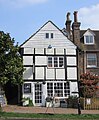
 The Well House 95 High Street Lindfield RH16 2HL.jpg 2,988 × 5,312; 6.85 MB
-

-
 View along High Street, Lindfield (April 2015) (1).JPG 3,400 × 4,600; 3.01 MB
-
 View along High Street, Lindfield (April 2015) (2).JPG 4,400 × 3,000; 1.95 MB
-
 View along High Street, Lindfield (April 2015) (3).JPG 4,600 × 3,400; 3.1 MB
-

-
-
 Viking, 121 High Street, Lindfield (NHLE Code 1354981) (April 2015).JPG 3,400 × 3,600; 1.86 MB
-
 Wincote, 65 High Street, Lindfield (NHLE Code 1192816) (April 2015).JPG 4,400 × 3,000; 1.88 MB
-
 YN08 OBP (Route 82) at High Street, Lindfield (1) (16518485433).jpg 3,456 × 4,608; 3.58 MB
-
 YN08 OBP (Route 82) at High Street, Lindfield (5) (17112715266).jpg 3,456 × 4,608; 2.71 MB
-
 YY15 GBZ (Route 270) at High Street, Lindfield (17112702076).jpg 4,608 × 3,456; 3.91 MB
-
 YY15 GCX (Route 270) at High Street, Lindfield (16516221824).jpg 4,608 × 3,456; 4.53 MB
-
 YY15 GDA (Route 270) at High Street, Lindfield (17138661015).jpg 4,608 × 3,456; 3.75 MB
.jpg)


_at_High_Street,_Lindfield_(17138652225).jpg)

_2004_Scania_N94UD_OmniDekka,_Lindfield,_30_March_2011.jpg)

.JPG)
.JPG)


_(April_2015).JPG)


_(1).JPG)
_(2).JPG)
_(3).JPG)
_and_Chantry_Cottage_(NHLE_Code_1025446),_High_Street,_Lindfield_(April_2015).JPG)

_(April_2015).JPG)
_(April_2015).JPG)
_at_High_Street,_Lindfield_(1)_(16518485433).jpg)
_at_High_Street,_Lindfield_(5)_(17112715266).jpg)
_at_High_Street,_Lindfield_(17112702076).jpg)
_at_High_Street,_Lindfield_(16516221824).jpg)
_at_High_Street,_Lindfield_(17138661015).jpg)