Category:Highburton
village in United Kingdom | |||||
| Upload media | |||||
| Instance of | |||||
|---|---|---|---|---|---|
| Location | Kirkburton, Kirklees, West Yorkshire, Yorkshire and the Humber, England | ||||
 | |||||
English: Highburton is part of the township of Kirkburton, a village in the county of West Yorkshire, England. It is located five miles southeast of Huddersfield. It occupies much of the high ground that can be found at the top of the steep inclines of Far Dene and Slant Gate and is a mixture of densely congregated housing estates and open pastoral farmland.
Subcategories
This category has the following 6 subcategories, out of 6 total.
4
C
- Highburton Cross (6 F)
F
- The Foxglove, Highburton (3 F)
H
K
- Kirkburton Hall (4 F)
S
- Smith's Arms, Highburton (3 F)
Media in category "Highburton"
The following 15 files are in this category, out of 15 total.
-
 118 Paddock Road, Highburton.jpg 4,752 × 3,168; 6.39 MB
-
 2, Town Gate, Highburton.jpg 3,168 × 4,752; 5.28 MB
-
 21, Far Dean, Highburton.jpg 4,752 × 3,168; 7.2 MB
-
 31 and 33 Far Dean, Highburton.jpg 4,752 × 3,168; 4.82 MB
-
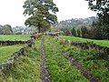
 Burton Acres lane - geograph.org.uk - 874142.jpg 640 × 480; 105 KB
-

-
 Darnley Cottage, Highburton.jpg 3,168 × 4,752; 6.43 MB
-
 Dean Fold - geograph.org.uk - 1465855.jpg 480 × 640; 82 KB
-
 Far Dene - geograph.org.uk - 1465835.jpg 640 × 480; 75 KB
-

-
 Lane near Woodsome Lees - geograph.org.uk - 70757.jpg 640 × 480; 155 KB
-

-
 View from Riley Lane, Kirkburton - geograph.org.uk - 395423.jpg 640 × 480; 104 KB
-

-
 Fields next to Carr Wood - geograph.org.uk - 144968.jpg 640 × 480; 121 KB


