Category:Higher Hurdsfield
English: Higher Hurdsfield is a village and civil parish in the unitary authority of Cheshire East and the ceremonial county of Cheshire, England. It has a population of around 300, and is situated on the eastern outskirts of Macclesfield around 7 miles from the border of Derbyshire and Cheshire. The nearest village is Rainow.
village and civil parish in Cheshire East, Cheshire, UK  | |||||
| Upload media | |||||
| Instance of | |||||
|---|---|---|---|---|---|
| Location | Cheshire East, Cheshire, North West England, England | ||||
 | |||||
Subcategories
This category has only the following subcategory.
M
Media in category "Higher Hurdsfield"
The following 35 files are in this category, out of 35 total.
-

-
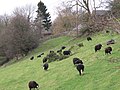 Black sheep below Kerridge - geograph.org.uk - 2754782.jpg 1,024 × 768; 367 KB
-
 Boundary Stone, Kerridge.jpg 1,800 × 1,350; 2.4 MB
-
 Doncasterhill Farm - geograph.org.uk - 4967146.jpg 800 × 600; 147 KB
-
 Field below Well Lane - geograph.org.uk - 2754500.jpg 1,024 × 768; 276 KB
-
 Former chapel - geograph.org.uk - 2754467.jpg 1,024 × 768; 252 KB
-
 Former Sunday School - geograph.org.uk - 2754462.jpg 1,024 × 768; 264 KB
-
 Former village well, Higher Hurdsfield - geograph.org.uk - 2754425.jpg 1,024 × 768; 473 KB
-
 From Higher Hurdsfield heights - geograph.org.uk - 2728376.jpg 2,272 × 1,704; 863 KB
-
 Gorsey hillside, Higher Fence, Macclesfield - geograph.org.uk - 2328659.jpg 2,272 × 1,704; 1.49 MB
-
 Higherfold winding hole - geograph.org.uk - 2754372.jpg 1,024 × 768; 314 KB
-
 Hurdsfield Industrial Estate - geograph.org.uk - 2754580.jpg 1,024 × 768; 124 KB
-
 In a field corner, near Jenny's Farm, Higher Hurdsfield - geograph.org.uk - 4972916.jpg 3,072 × 1,728; 4.61 MB
-
 Jenny's Farm, High Hurdsfield.jpg 1,024 × 768; 255 KB
-
 Kerridge Millennium Stone - geograph.org.uk - 2754787.jpg 1,024 × 768; 443 KB
-
 Looking towards Jenny's Farm, Higher Hurdsfield - geograph.org.uk - 4972909.jpg 3,060 × 1,704; 3.82 MB
-
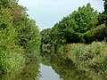
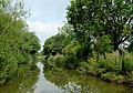
 Macclesfield Canal - geograph.org.uk - 4050365.jpg 4,912 × 3,264; 4.72 MB
-
-
-
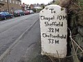
 Milestone to Macclesfield - geograph.org.uk - 2754435.jpg 1,023 × 768; 308 KB
-
 Milestone, High Hurdsfield.jpg 1,024 × 768; 314 KB
-
 Property boundary marker stone - geograph.org.uk - 6036063.jpg 768 × 1,024; 247 KB
-
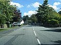 Rainow Road - geograph.org.uk - 2569578.jpg 640 × 481; 86 KB
-
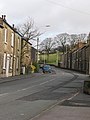 Rainow Road - geograph.org.uk - 2686494.jpg 1,704 × 2,272; 1.04 MB
-
 Sheep at Swanscoe - geograph.org.uk - 2754578.jpg 1,024 × 768; 146 KB
-
 Swanscoe Lane from Well Lane, Higher Hurdsfield - geograph.org.uk - 2691751.jpg 2,272 × 1,704; 1.16 MB
-
 The George and Dragon - geograph.org.uk - 2754474.jpg 1,024 × 768; 248 KB
-
 The Macclesfield Canal at Hurdsfield - geograph.org.uk - 4967147.jpg 800 × 600; 155 KB
-
 The Three Crowns, Higher Hurdsfield - geograph.org.uk - 2754411.jpg 1,024 × 768; 215 KB
-
 Two ponds at Swanscoe - geograph.org.uk - 2754574.jpg 1,024 × 768; 350 KB
-
 We're watching you ... - geograph.org.uk - 2328944.jpg 2,272 × 1,704; 1.05 MB
-
 Well Lane - geograph.org.uk - 2754506.jpg 1,024 × 768; 350 KB
-
 Winding hole on the Macclesfield Canal - geograph.org.uk - 4967142.jpg 800 × 600; 139 KB
-
 Working narrowboat near Macclesfield, Cheshire - geograph.org.uk - 4314426.jpg 768 × 1,024; 635 KB
-
 Flooded meadow - geograph.org.uk - 261506.jpg 640 × 480; 120 KB


