Category:Hiking and footpath fingerposts in the canton of Aargau

Cantons of Switzerland: Aargau (AG) · Appenzell Ausserrhoden (AR) · Appenzell Innerrhoden (AI) · Basel-Stadt (BS) · Basel-Landschaft (BL) · Bern (BE) · Fribourg (FR) · Geneva (GE) · Glarus (GL) · Graubünden (GR) · Jura (JU) · Luzern (LU) · Neuchâtel (NE) · Nidwalden (NW) · Obwalden (OW) · Schaffhausen (SH) · Schwyz (SZ) · Solothurn (SO) · St. Gallen (SG) · Thurgau (TG) · Ticino (TI) · Uri (UR) · Valais (VS) · Vaud (VD) · Zug (ZG) · Zürich (ZH)
Media in category "Hiking and footpath fingerposts in the canton of Aargau"
The following 50 files are in this category, out of 50 total.
-
 Baden IMG 6736.JPG 2,592 × 3,888; 3.23 MB
-
 Bahnhof Mumpf.JPG 2,816 × 1,584; 2.2 MB
-
 Brugg IMG 6744 ShiftN.jpg 2,360 × 3,147; 2.4 MB
-
 Chörnlisberg Aargauer Weg.jpg 2,592 × 1,944; 1.69 MB
-
 Gebenstorfer Horn Jura- Höhenweg.jpg 1,944 × 2,592; 2.6 MB
-
 Gebenstorfer Horn Wanderweg E4.jpg 2,048 × 1,536; 678 KB
-
 Gisliflue01.JPG 850 × 1,309; 366 KB
-
 Hägglingen - Maiengrüen - Wegweiser 2017.jpg 1,242 × 811; 205 KB
-
 Kaiserstuhl Brücke 339 m, fingerpost sign, 2010.jpg 449 × 497; 186 KB
-
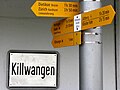 Limmat - Killwangen IMG 6688.JPG 3,188 × 2,390; 1.63 MB
-
 Limmat - Würenlos IMG 6685.JPG 3,264 × 2,448; 1.53 MB
-
 Lindhof Windisch Wegweiser.jpg 2,592 × 1,944; 2.29 MB
-
 Lägern - Jura-Höhenweg 20100524 16-08-30.JPG 4,288 × 2,848; 5.51 MB
-
 Lägern - Jura-Höhenweg 20100524 16-24-34.JPG 2,848 × 4,288; 6.74 MB
-
 Lägern - Jura-Höhenweg 20100524 16-24-42.jpg 2,522 × 3,800; 1.33 MB
-
 Rejnponto inter Kaiserstuhl kaj Hohentengen 208.jpg 3,872 × 2,592; 3.36 MB
-
 SBB Historic - F 122 00665 008 - Mellingen Stationsgebaeude und Gueterschuppen mit Postauto.jpg 6,366 × 4,405; 18.46 MB
-
 Wanderweg Hauptwegweiser.jpg 867 × 1,376; 247 KB
-
 Wanderweg Verzweigung.jpg 684 × 1,097; 156 KB
-
 Wanderwegweiser Bahnhof Koblenz.JPG 2,000 × 1,500; 1.8 MB
-
 Wanderwegweiser Beinwil am See 451.jpg 3,024 × 4,032; 1.97 MB
-
 Wanderwegweiser Beinwil am See 520.jpg 2,193 × 3,957; 982 KB
-
 Wanderwegweiser Birrwil am See 455.jpg 2,994 × 2,773; 1.35 MB
-
 Wanderwegweiser Boniswil 476.jpg 2,779 × 2,341; 634 KB
-
 Wanderwegweiser Boniswil Abzweigung Seeuferweg.jpg 2,199 × 2,700; 1.39 MB
-
 Wanderwegweiser Boniswil Schiffsteg 449.jpg 4,031 × 1,597; 513 KB
-
 Wanderwegweiser Delphin 457.jpg 3,592 × 1,825; 878 KB
-
 Wanderwegweiser Lägern Burghorn 859.jpg 1,512 × 2,016; 760 KB
-
 Wanderwegweiser Lägerngrat.jpg 2,016 × 1,512; 1 MB
-
 Wanderwegweiser Lägernsattel 785.jpg 2,016 × 1,512; 1.21 MB
-
 Wanderwegweiser Ober Flügelberg 769.jpg 4,032 × 3,024; 1.06 MB
-
 Wanderwegweiser Schartenfels 464.jpg 1,512 × 2,016; 642 KB
-
 Wanderwegweiser Schloss Hallwil 452.jpg 1,968 × 2,949; 1.22 MB
-
 Wanderwegweiser Seengen Schiff-Haltestelle 450.jpg 3,145 × 2,930; 1.32 MB
-
 Wanderwegweiser Seerose 450.jpg 3,498 × 994; 416 KB
-
 Wanderwegweiser Stauwehr Schinznach.jpg 1,740 × 931; 900 KB
-
 Wanderwegweiser Strandbad Tennwil 453.jpg 3,275 × 1,291; 704 KB
-
 Wegweiser am Freiämterweg in Wohlen - panoramio.jpg 1,936 × 2,592; 2.37 MB
-
 Wegweiser Forest Langholz (Rothrist) - panoramio.jpg 2,592 × 1,936; 2.18 MB
-
 Wegweiser Langholz 459 m - panoramio (1).jpg 2,592 × 1,936; 1.76 MB
-
 Wegweiser Langholz 459 m - panoramio.jpg 2,592 × 1,936; 2.12 MB
-
 Wegweiser Langholz Vordemwald - panoramio.jpg 2,592 × 1,936; 1.85 MB
-
 Wegweiser Murg, Stauwehr - panoramio.jpg 2,592 × 1,936; 2.09 MB
-
 Wegweiser Railway station Langenthal - panoramio.jpg 2,592 × 1,936; 1.78 MB
-
 Wegweiser Rothrist Station 407 m - panoramio.jpg 2,592 × 1,936; 1.56 MB
-
 Wegweiser Siebenzwingstein1.JPG 3,000 × 4,000; 1.93 MB
-
 Wegweiser Siebenzwingstein2.JPG 4,000 × 3,000; 2.02 MB
-
 Wegweiser Zofingen 432 m - panoramio (1).jpg 2,592 × 1,936; 1.58 MB
-
 Wegweiser Zofingen 432 m - panoramio.jpg 2,592 × 1,936; 1.23 MB
-
 Windisch IMG 6956 ShiftN.jpg 2,229 × 2,972; 2.39 MB


_-_panoramio.jpg)
.jpg)


.jpg)

