Category:Hiking and footpath signs in Andalusia
Autonomous communities of Spain: Andalusia · Aragon · Asturias · Balearic Islands · Basque Autonomous Community · Canary Islands · Cantabria · Castile and León · Castilla–La Mancha · Catalonia · Extremadura · Galicia · Community of Madrid · Region of Murcia · Navarre · La Rioja · Valencian Community · Autonomous cities:
Subcategories
This category has the following 2 subcategories, out of 2 total.
S
Media in category "Hiking and footpath signs in Andalusia"
The following 70 files are in this category, out of 70 total.
-
 043. Indicador en el carril Montes de Málaga (12857761074).jpg 1,024 × 768; 291 KB
-
 Alcaucín - Canillas de Aceituno, Abril 2013 (8625806064).jpg 3,264 × 2,448; 3.94 MB
-
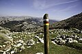
 Baliza gr-142 pr-a-297.JPG 1,024 × 768; 629 KB
-
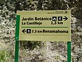 Cartebenamah.JPG 2,272 × 1,704; 867 KB
-
 Cartel indicando el camino de acceso.jpg 3,072 × 2,304; 1.72 MB
-
 Cartel Informativo en Sierra Tejeda.jpg 4,320 × 2,880; 5.14 MB
-
 Cartel punta umbria.jpg 2,272 × 1,704; 910 KB
-
 Carteles Sendero de La Sauceda.jpg 3,456 × 2,304; 2.34 MB
-
 Cartelmajaceite.JPG 2,272 × 1,704; 902 KB
-
 D00 094 Wanderwegweiser.jpg 1,944 × 2,592; 730 KB
-
 D00 163 Wegweiser Nava de Espino.jpg 1,944 × 2,592; 1.05 MB
-
 D00 167 Fin de Sendero.jpg 1,944 × 2,592; 1.96 MB
-
 D00 168 Atalaya del Infante Don Enrique.jpg 1,944 × 2,592; 1.21 MB
-
 Day 1 (51142220097).jpg 4,928 × 3,264; 3.78 MB
-
 Day 2 (51142784686).jpg 4,928 × 3,264; 3.39 MB
-
 Day 2 (51142799656).jpg 4,928 × 3,264; 4.31 MB
-
 Day 2 (51142994453).jpg 4,928 × 3,264; 3.75 MB
-
 Day 3 (51142097032).jpg 4,928 × 3,264; 3.21 MB
-
 Day 4 (51142052127).jpg 4,928 × 3,264; 4.76 MB
-
 Day 5 (51142636801).jpg 4,928 × 3,264; 3.92 MB
-
 Day 5 (51142679761).jpg 4,928 × 3,264; 3.98 MB
-
 Day 5 (51142693916).jpg 4,928 × 3,264; 3.24 MB
-
 Day 6 (51141927352).jpg 4,928 × 3,264; 4.02 MB
-
 Day 6 (51142593076).jpg 4,928 × 3,264; 4.46 MB
-
 Day 6 (51143718900).jpg 4,928 × 3,264; 4.13 MB
-
 Day 7 (51142565731).jpg 4,928 × 3,264; 4.27 MB
-
 Day 7 (51142579241).jpg 4,928 × 3,264; 4.88 MB
-
 Day 7 (51142786903).jpg 4,928 × 3,264; 3.37 MB
-
 DSC 3013 (51143642740).jpg 4,928 × 3,264; 4.74 MB
-
 El Acebuche 02.jpg 2,592 × 1,944; 2.26 MB
-
 El Chorro (17771223184).jpg 640 × 480; 166 KB
-
 ElTorcal0216.jpg 4,272 × 2,848; 5.2 MB
-
 Fuente Segura 09gm.jpg 2,560 × 1,920; 2.27 MB
-
 GR 242 (6786912192).jpg 2,448 × 3,264; 4.76 MB
-
 GR 249 Gran Senda de Málaga (51142257642).jpg 4,928 × 3,264; 4.56 MB
-
 GR-7 (8730629883).jpg 2,448 × 3,264; 3.62 MB
-
 Indicaciones de los PR-A 267 y 268 (3534812396).jpg 1,024 × 768; 116 KB
-
 Indicaciones del SL-A 22. Ruta de las Escaleruelas (4136738018).jpg 1,024 × 768; 341 KB
-
 Indicador (3409724923).jpg 1,024 × 768; 243 KB
-
 Indicador (3410553364).jpg 1,024 × 768; 218 KB
-
 Indicador de la ruta medieval PR-A 299 (9774999825).jpg 1,024 × 768; 566 KB
-
 Indicador de pequeño recorrido (3534822254).jpg 1,024 × 768; 251 KB
-
 Indicador del GR (12859394053).jpg 1,024 × 768; 576 KB
-
 Indicador del GR-142 (9774732881).jpg 1,024 × 768; 664 KB
-
 Indicador del PR-A 344 (6466806809).jpg 1,024 × 768; 248 KB
-
 Indicadores (16634873081).jpg 1,024 × 768; 618 KB
-
 Indicadores (3334562465).jpg 1,024 × 768; 277 KB
-
 Indicadores de senderos para el río Guazalamanco (44397481155).jpg 3,968 × 2,976; 2.58 MB
-
 Indicativo del GR-242 (9087576466).jpg 1,024 × 768; 377 KB
-
 Inidicador del sendero local Pitres-Ferreirola (9774654972).jpg 1,024 × 768; 579 KB
-
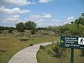
 Jardín Botánico del Albardinal 19-08-2011 19-12-13 3648x2056.JPG 3,648 × 2,056; 3.24 MB
-
 Panneau Acer monspessulanum Torcal.jpg 4,592 × 3,056; 1.44 MB
-
 Peñabón 01.JPG 2,544 × 1,696; 1.26 MB
-
 Poste sendero GR-7.JPG 2,048 × 1,536; 899 KB
-
 Ruta de la Plata Castilblanco 2.jpg 2,322 × 4,128; 2.86 MB
-
 Ruta de la Plata Castilblanco.jpg 2,322 × 4,128; 2.85 MB
-
 Ruta del Agua (12142551876).jpg 6,016 × 4,000; 2.19 MB
-
 Sendero (6976496641).jpg 2,448 × 3,264; 3.02 MB
-
 Señalización de sendero de La Sauceda.jpg 3,456 × 2,304; 2.54 MB
-
 Señalización rural Cuevas del Negro.jpg 1,600 × 1,200; 511 KB
-
 Sierra de las Nieves 07.jpg 1,280 × 960; 2.1 MB
-
 Sierra de los Tajos del Sabar (7232260174).jpg 1,024 × 768; 213 KB
-
 Sierra de Tejeda (6932859893).jpg 2,448 × 3,264; 4.27 MB
-
 Sierra Segura Yelmo 15gm.jpg 2,245 × 1,684; 2.02 MB
-
 Siles pena del olivar 04gm.jpg 2,560 × 1,920; 2.36 MB
-
 SL-A 68, de Moclinejo a Totalán (8480187124).jpg 2,448 × 3,264; 3.48 MB
-
 SL-A 68, de Moclinejo a Totalán (8480210874).jpg 3,264 × 2,448; 4.85 MB
-
 Tajo de los Bermejales (29568118302).jpg 1,920 × 1,440; 2.27 MB
-
 Uno de los accesos.jpg 2,274 × 2,274; 1.38 MB
-
 Villaluenga-P1050264.JPG 2,048 × 1,536; 1.52 MB
.jpg)
.jpg)


.jpg)
.jpg)
.jpg)
.jpg)
.jpg)
.jpg)
.jpg)
.jpg)
.jpg)
.jpg)
.jpg)
.jpg)
.jpg)
.jpg)
.jpg)
.jpg)

.jpg)


.jpg)
.jpg)
.jpg)
.jpg)
.jpg)
.jpg)
.jpg)
.jpg)
.jpg)
.jpg)
.jpg)
.jpg)
.jpg)
.jpg)
.jpg)
.jpg)
.jpg)


.jpg)
.jpg)


.jpg)
.jpg)


.jpg)
.jpg)
.jpg)

