Category:Hiking and footpath signs in Savoie
Subcategories
This category has only the following subcategory.
Media in category "Hiking and footpath signs in Savoie"
The following 47 files are in this category, out of 47 total.
-
 Bienvenue en Italie.jpg 2,816 × 2,112; 2.92 MB
-
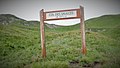
 Bienvenue à Corsuet.JPG 2,048 × 1,536; 1.26 MB
-
 Chemin du Mollard au bas de St-Piere-de-Soucy (octobre 2021).JPG 1,848 × 1,332; 2.22 MB
-
 Cirque du Grand Marchet (2209 m).jpg 1,920 × 1,080; 742 KB
-
 Cirque du Grand Marchet, 2209 m.jpg 1,920 × 1,080; 675 KB
-
 Col de la cochette.jpg 5,184 × 3,888; 5.51 MB
-
 Col des saulces, 2371 m.jpg 1,920 × 1,080; 759 KB
-
 Col du Bresson.jpg 4,608 × 3,456; 6.09 MB
-
 Col Leschaux, 2564 m.jpg 1,920 × 1,080; 475 KB
-
 Croix de Lognan.jpg 6,473 × 2,998; 3.83 MB
-
 Golet de Doucy panneau hiver.jpg 4,608 × 3,456; 5.05 MB
-
 Hameau Combe Noire à St-Jean-de-la-Porte (octobre 2021).JPG 3,264 × 2,448; 6.27 MB
-
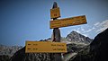
 Hiking sign Lac de Saint-Guerin.JPG 2,448 × 3,264; 1.69 MB
-
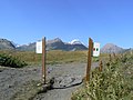
 Hiking sign.jpg 2,399 × 3,365; 3.09 MB
-
 Isère et Pont Morens côté Montmélian (mars 2022).JPG 1,948 × 1,436; 1.81 MB
-
 Le Chargeur.jpg 3,632 × 5,456; 7.97 MB
-
 Leisse04.jpg 972 × 1,296; 508 KB
-

-
 Mont-Cenis et chapelle St-Sébastien à La Chapelle-Blanche (2021).JPG 3,264 × 2,448; 3.46 MB
-
 Montée de l'église à Peisey (août 2022).JPG 2,048 × 1,536; 1.57 MB
-
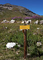
 Panneau Cirque du Grand Marchet(2209m).jpg 1,920 × 1,080; 658 KB
-
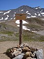
 Panneau col d'Aussois(2916m).jpg 1,920 × 1,080; 647 KB
-
 Panneau col de la Grande Pierre(2403m).jpg 1,920 × 1,080; 530 KB
-
 Panneau col de Leschaux(2564m).jpg 1,920 × 1,080; 324 KB
-
 Panneau col du Mône(2533m).jpg 1,920 × 1,080; 915 KB
-
 Panneau col du Soufre(2819m).jpg 1,920 × 1,080; 485 KB
-
 Panneau du Rocher d'escalade à Corentin sur Orelle..jpg 2,560 × 1,152; 1.11 MB
-
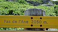 Panneau Pas de l'Ane(2050m).jpg 1,920 × 1,080; 571 KB
-
 Panneaux d'indication des refuges au Clapier Blanc (août 2022).JPG 1,995 × 1,497; 2.79 MB
-
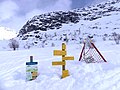 Panneaux de randonnée dans la neige à L'Écot à Bonneval (mars 2024).JPG 3,264 × 2,448; 5.17 MB
-
 Panneaux de randonnée dans la neige à Plan Bouchet à Orelle (2024).JPG 2,048 × 1,536; 1.42 MB
-
 Panneaux des refuges sur le GR 5 au Plan de la Grassaz (août 2023).JPG 3,108 × 2,296; 3.92 MB
-
 Parc Piot en neige (Monts, 2013).JPG 3,072 × 2,304; 4.65 MB
-
 Parking de l'Arcellin, direction Chapelle N D D A d'Orelle.jpg 1,152 × 2,560; 915 KB
-
 Pas de l'ane, 2050 m.jpg 1,920 × 1,080; 726 KB
-
 Passerelle piétonne à l'embouchure du Coisin (mars 2022).JPG 3,148 × 2,396; 4.56 MB
-
 Petit Mont-Blanc, 2680 m (1).jpg 4,896 × 2,752; 4.14 MB
-
 Petit Mont-Blanc, 2680 m (2).jpg 4,896 × 2,752; 4.36 MB
-
 Pistes dans les vignobles de Montmélian et Arbin (octobre 2021).JPG 3,264 × 2,448; 5.94 MB
-
 Pont Rouge d'Aix-les-Bains en soirée (août 2021).JPG 3,212 × 2,392; 5.66 MB
-
 Quechua tents in the Vanoise National Park in Arpont, 2309 m (1).jpg 4,896 × 2,752; 4.94 MB
-
 Sentier JJRousseau et Avenue de la Grande Chartreuse (été 2021).JPG 3,184 × 2,372; 5.94 MB
-
 Sentier raquettes en contrebas du Nivolet (décembre 2021).JPG 1,989 × 1,494; 2.69 MB
-
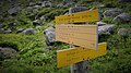
 Signalétique Randonnées Savoie.JPG 1,402 × 1,107; 1.47 MB
-

-
 Vignobles de Montmélian à la limite d'Arbin en automne (2021) 1.JPG 2,048 × 1,536; 1.54 MB
-
 Voie verte Marcel-Mailly à Aix-les-Bains (janvier 2022).JPG 2,001 × 1,512; 3.03 MB


.JPG)
.jpg)


.JPG)


.JPG)


.JPG)
.JPG)
.jpg)
.jpg)
.jpg)
.jpg)
.jpg)
.jpg)

.jpg)
.JPG)
.JPG)
.JPG)
.JPG)
.JPG)


.JPG)
.jpg)
.jpg)
.JPG)
.JPG)
.jpg)
.JPG)
.JPG)


_1.JPG)
.JPG)