Category:Hilderstone
village in United Kingdom  | |||||
| Upload media | |||||
| Instance of | |||||
|---|---|---|---|---|---|
| Location | Stafford, Staffordshire, West Midlands, England | ||||
| Said to be the same as | Hilderstone (Wikimedia duplicated page, civil parish) | ||||
 | |||||
Media in category "Hilderstone"
The following 38 files are in this category, out of 38 total.
-
 "The Meadows" at Hilderstone - geograph.org.uk - 199446.jpg 640 × 480; 73 KB
-
 A Stile near Wooliscroft - geograph.org.uk - 2701094.jpg 640 × 428; 126 KB
-
 A View up Whitehouse Lane - geograph.org.uk - 2701080.jpg 640 × 428; 120 KB
-
 B5066 approaching Hilderstone - geograph.org.uk - 3142591.jpg 540 × 640; 101 KB
-
 Balaams Lane leaving the B5066 - geograph.org.uk - 2702970.jpg 640 × 428; 136 KB
-
 Christ Church, Hilderstone - geograph.org.uk - 5778839.jpg 1,500 × 1,000; 1.37 MB
-
 Cresswell Road in Hilderstone - geograph.org.uk - 5054966.jpg 4,000 × 3,000; 2.8 MB
-
 Cresswell Road, Hilderstone - geograph.org.uk - 3142568.jpg 640 × 502; 89 KB
-
 Creswell of Hilderstone JFL 677.jpg 2,400 × 1,800; 1.33 MB
-
 Development at the old Bird in Hand - geograph.org.uk - 4738172.jpg 1,280 × 960; 325 KB
-
 Field by Hall Lane - geograph.org.uk - 3126311.jpg 640 × 480; 122 KB
-
 Field, Newfields Farm - geograph.org.uk - 3142552.jpg 640 × 422; 72 KB
-
 Hall Lane - geograph.org.uk - 3126295.jpg 640 × 480; 77 KB
-
 Hilderstone, Roebuck Inn - geograph.org.uk - 4538681.jpg 3,027 × 2,227; 1.78 MB
-
 House on a Hillside near Wooliscroft - geograph.org.uk - 2702875.jpg 640 × 428; 84 KB
-
 Looking across Fields from the B5066 - geograph.org.uk - 2703010.jpg 640 × 428; 110 KB
-
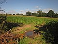 Maize near Hilderstone - geograph.org.uk - 3126259.jpg 640 × 480; 94 KB
-
 Manor House, Hilderstone - geograph.org.uk - 459470.jpg 640 × 480; 86 KB
-
 Moss Lane, Hilderstone - geograph.org.uk - 1868203.jpg 640 × 480; 103 KB
-
 Old Milepost (geograph 6098918).jpg 265 × 400; 31 KB
-
 Old track at Hilderstone - geograph.org.uk - 4936387.jpg 1,280 × 960; 725 KB
-
 Ordnance Survey Flush Bracket S9298 - geograph.org.uk - 5054957.jpg 4,000 × 3,000; 5.35 MB
-
-
 Stones Throw, Hilderstone.jpg 1,280 × 960; 370 KB
-
 Towards Brook Farm - geograph.org.uk - 3142581.jpg 640 × 416; 83 KB
-
 View from Garshall Green - geograph.org.uk - 2250275.jpg 640 × 428; 166 KB
-
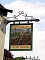 Bird in Hand - Sign, Hilderstone - geograph.org.uk - 111990.jpg 480 × 640; 125 KB
-
 Bird in Hand Public House, Hilderstone. - geograph.org.uk - 111989.jpg 640 × 480; 150 KB
-
 Cattle at Green Farm, Hilderstone - geograph.org.uk - 199457.jpg 640 × 480; 93 KB
-

-
 Hilderstone Crossroads towards Sandon - geograph.org.uk - 280455.jpg 640 × 429; 68 KB
-
 Hilderstone Crossroads towards Stone - geograph.org.uk - 272740.jpg 640 × 429; 66 KB
-
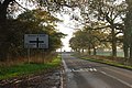
 Hilderstone Road into Sandon - geograph.org.uk - 272269.jpg 640 × 429; 61 KB
-
 Lane near Hilderstone - geograph.org.uk - 199447.jpg 640 × 480; 76 KB
-
 Lane to Hilderstone - geograph.org.uk - 280459.jpg 640 × 429; 115 KB
-
 Near Hilderstone - geograph.org.uk - 459408.jpg 640 × 480; 101 KB
-
 On the Way to Uttoxeter - geograph.org.uk - 280457.jpg 640 × 429; 63 KB
-


.jpg)


