Category:Hill End, County Durham
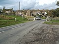
English: Hill End is a village in County Durham, in England. It is situated on the south side of Weardale, near Frosterley.
village in County Durham, United Kingdom  | |||||
| Upload media | |||||
| Instance of | |||||
|---|---|---|---|---|---|
| Location | Stanhope, County Durham, North East England, England | ||||
 | |||||
Media in category "Hill End, County Durham"
The following 19 files are in this category, out of 19 total.
-
 Bank Top House in Hill End - geograph.org.uk - 3080066.jpg 3,648 × 2,736; 3.25 MB
-

-
 Hill End - geograph.org.uk - 1422765.jpg 600 × 450; 77 KB
-
 Hill End - geograph.org.uk - 1422767.jpg 600 × 450; 87 KB
-
 Hill End - geograph.org.uk - 1422769.jpg 600 × 450; 83 KB
-
 Hill End - geograph.org.uk - 251748.jpg 640 × 480; 107 KB
-
 Hill End - geograph.org.uk - 425602.jpg 640 × 480; 110 KB
-
 Outbuildings at Hill End - geograph.org.uk - 1422778.jpg 600 × 450; 95 KB
-
 The (old) Weardale Way at Hill End - geograph.org.uk - 1725806.jpg 2,048 × 1,536; 1.52 MB
-
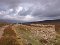
 Across Harnisha Flat - geograph.org.uk - 685825.jpg 640 × 480; 114 KB
-
 Copse - geograph.org.uk - 471227.jpg 640 × 480; 129 KB
-
 Copse behind caravan site - geograph.org.uk - 471427.jpg 640 × 480; 152 KB
-
 Drainage channel - geograph.org.uk - 471412.jpg 640 × 480; 139 KB
-
 Grouse butts above Black Burn - geograph.org.uk - 558851.jpg 640 × 480; 211 KB
-
 Harnisha Carrs - geograph.org.uk - 685813.jpg 640 × 480; 77 KB
-
 Harnisha Flat - geograph.org.uk - 685834.jpg 640 × 480; 134 KB
-
 Old shaft - geograph.org.uk - 685915.jpg 640 × 480; 129 KB
-
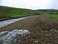
 Riverside track - geograph.org.uk - 471431.jpg 640 × 480; 131 KB
-
 Stream - geograph.org.uk - 471423.jpg 640 × 480; 142 KB


_Weardale_Way_at_Hill_End_-_geograph.org.uk_-_1725806.jpg)


