Category:Hill forts in Somerset
Wikimedia category | |||||
| Upload media | |||||
| Instance of | |||||
|---|---|---|---|---|---|
| |||||
Subcategories
This category has the following 13 subcategories, out of 13 total.
B
- Brent Knoll (44 F)
- Bury Castle, Somerset (4 F)
C
- Cadbury Camp (18 F)
- Cadbury Castle, Somerset (20 F)
- Cleeve Toot (3 F)
- Cow Castle, Somerset (5 F)
D
- Dolebury Warren (39 F)
H
- Ham Hill (25 F)
M
- Maes Knoll (12 F)
- Maesbury Castle (4 F)
N
- Norton Camp (5 F)
W
- Worlebury hill fort (23 F)
Media in category "Hill forts in Somerset"
The following 45 files are in this category, out of 45 total.
-
 Bank at Castle Neroche - geograph.org.uk - 168660.jpg 640 × 480; 153 KB
-
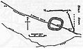
 Bathampton Down Somerset Map.jpg 1,042 × 688; 148 KB
-
 Black Down Camp Somerset Map.jpg 578 × 350; 33 KB
-
 Burledge Hillfort.jpg 640 × 387; 89 KB
-
 Carved Seat above Compton Dundon - geograph.org.uk - 892237.jpg 480 × 640; 136 KB
-
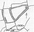
 Castle Neroche Somerset Map.jpg 1,027 × 731; 116 KB
-
 Charterhouse Camp Somerset Map.jpg 428 × 300; 26 KB
-
 Cynwits Castle Cannington Somerset Map.jpg 677 × 475; 42 KB
-
 Daws Castle Somerset Map.jpg 340 × 367; 34 KB
-
 Dowsborough Camp Somerset Map.jpg 580 × 510; 56 KB
-
 Dundon Camp Somerset Map.jpg 600 × 920; 92 KB
-
 Hill Fort near Little Down - geograph.org.uk - 598486.jpg 640 × 447; 81 KB
-
 Hillfort field - geograph.org.uk - 450543.jpg 640 × 480; 113 KB
-
 Kenwalch's Castle earthworks.jpg 2,592 × 1,944; 1.77 MB
-
 Kenwalchs Castle Somerset Map.jpg 360 × 457; 32 KB
-
 King's Weston Hillfort.jpg 640 × 480; 87 KB
-
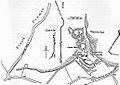
 Kings Castle Somerset Map.jpg 593 × 826; 97 KB
-
 Meadway Hall, Compton Dundon - geograph.org.uk - 81378.jpg 640 × 480; 76 KB
-
 Mounsey Castle Somerset Map.jpg 657 × 560; 66 KB
-
 Newbury, Wadbury and Tedbury camps 1836.png 478 × 333; 108 KB
-
 North Stoke Promontory Fort 01.jpg 4,000 × 3,000; 4.89 MB
-
 North Stoke Promontory Fort 02.jpg 4,000 × 3,000; 4.81 MB
-

-
 Oldberry Castle Somerset Map.jpg 530 × 400; 32 KB
-
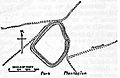 Park Plantation Somerset Map.jpg 480 × 310; 25 KB
-
 Plan of Hales Castle.jpg 259 × 241; 10 KB
-
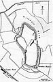
 Priddy Rings Somerset Map.jpg 870 × 1,500; 186 KB
-
 Roddenbury Camp Somerset Map.jpg 550 × 758; 58 KB
-
 Ruborough Camp Somerset Map.jpg 570 × 535; 48 KB
-
 Small Down Camp Somerset Map.jpg 702 × 594; 70 KB
-
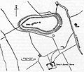
 Solisbury Camp Somerset Map.jpg 855 × 635; 114 KB
-
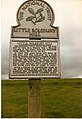 SolsburyHillSign.jpg 806 × 1,174; 673 KB
-
 Stantonbury Camp Somerset Map.jpg 818 × 436; 57 KB
-
 Staple Fitzpaine - Castle Neroche - geograph.org.uk - 280579.jpg 640 × 427; 311 KB
-
 Stokeleigh Camp in Leigh Woods.jpg 3,888 × 2,592; 8.25 MB
-
 Stowey Castle Somerset Map.jpg 460 × 330; 35 KB
-
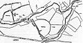 Tedbury Woodbury Somerset Map.jpg 930 × 480; 89 KB
-
 The ditch and bank at Roddenbury Hillfort.jpg 4,032 × 3,024; 6.99 MB
-
 Trendle Ring Somerset Map.jpg 420 × 374; 25 KB
-
 View towards Compton Dundon - geograph.org.uk - 892230.jpg 640 × 459; 92 KB
-
 Wain's Hill - geograph.org.uk - 671543.jpg 640 × 480; 120 KB
-
 Bank of hillfort - geograph.org.uk - 450549.jpg 640 × 480; 100 KB
-
 East Brent, Brent Knoll from the north - geograph.org.uk - 44047.jpg 640 × 423; 88 KB
-
 Edge of hillfort - geograph.org.uk - 450544.jpg 640 × 480; 139 KB
-
 The path to the hill fort - geograph.org.uk - 128515.jpg 640 × 480; 97 KB


