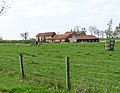
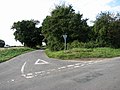
Category:Hindringham
English: Hindringham is a village and a civil parish in the English county of Norfolk.. The village is 8.5 miles north east of the town of Fakenham, 16.4 miles west of Cromer and 122 miles north of London. The nearest railway station is at Sheringham for the Bittern Line which runs between Sheringham, Cromer and Norwich. The nearest airport is Norwich International Airport.
village and civil parish in Norfolk, UK  | |||||
| Upload media | |||||
| Instance of | |||||
|---|---|---|---|---|---|
| Location | North Norfolk, Norfolk, East of England, England | ||||
| Population |
| ||||
| Area |
| ||||
| Said to be the same as | Hindringham (Wikimedia duplicated page, civil parish) | ||||
 | |||||
Subcategories
This category has the following 5 subcategories, out of 5 total.
C
- Church Farm, Hindringham (2 F)
H
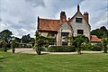
- Hindringham Hall (4 F)
- Hindringham Meadows (7 F)
- Hindringham War Memorial (3 F)
Media in category "Hindringham"
The following 159 files are in this category, out of 159 total.
-
 A farm cart on display at Hindringham - geograph.org.uk - 4581323.jpg 640 × 480; 181 KB
-
 Access road to Upper Hall - geograph.org.uk - 3947009.jpg 640 × 384; 105 KB
-
 American Lane, Lower Green - geograph.org.uk - 6638838.jpg 1,024 × 768; 198 KB
-
 Bale Road towards Bale - geograph.org.uk - 6638852.jpg 640 × 480; 80 KB
-
 Blakeney Road - geograph.org.uk - 6638822.jpg 1,024 × 768; 237 KB
-
 Blakeney Road towards Abbot Farm - geograph.org.uk - 3852694.jpg 2,912 × 1,937; 4.29 MB
-
 Blakeney Road towards Great Walsingham - geograph.org.uk - 6642467.jpg 1,600 × 1,040; 488 KB
-
 Brick and flint barn on Bale Road, Hindringham - geograph.org.uk - 6638849.jpg 1,024 × 649; 167 KB
-

-
 Bullocks in pasture - geograph.org.uk - 3946990.jpg 640 × 446; 105 KB
-
 Bullocks in pasture by Hindringham - geograph.org.uk - 3946987.jpg 640 × 480; 260 KB
-
 Cattle pasture by Hindringham - geograph.org.uk - 3946985.jpg 640 × 386; 143 KB
-
 Cottage on Moorgate Road - geograph.org.uk - 3849519.jpg 3,000 × 2,000; 5.68 MB
-
 Cottage on Moorgate Road, Hindringham - geograph.org.uk - 6638840.jpg 1,024 × 786; 195 KB
-
 Cottages near Hall Farm, Hindringham - geograph.org.uk - 2240650.jpg 640 × 480; 222 KB
-
 Cottages on Home Lane, Hindringham - geograph.org.uk - 6638845.jpg 1,024 × 638; 156 KB
-
 Crop field near Field House Cottages - geograph.org.uk - 6638824.jpg 1,024 × 768; 198 KB
-
 Cultivated fields by Hindringham - geograph.org.uk - 3947016.jpg 640 × 480; 198 KB
-
 Cultivated fields by Hindringham - geograph.org.uk - 3947021.jpg 640 × 480; 188 KB
-
 Detail of Hindringham village sign - geograph.org.uk - 2031423.jpg 640 × 480; 102 KB
-
 Direction Sign – Signpost - geograph.org.uk - 6529472.jpg 1,646 × 2,194; 676 KB
-
 Driveway to Birds Farm and Camping Site - geograph.org.uk - 571288.jpg 640 × 480; 117 KB
-

-
 Elizabeth II postbox on Blakeney Road - geograph.org.uk - 6642461.jpg 992 × 1,600; 480 KB
-
 Elizabeth II postbox on The Street, Hindringham - geograph.org.uk - 6642411.jpg 1,045 × 1,600; 606 KB
-
 Elizabeth II postbox on Wells Road, Hindringham - geograph.org.uk - 6642378.jpg 903 × 1,600; 433 KB
-
 Entrance to Foxburrow Farm - geograph.org.uk - 3852700.jpg 3,088 × 2,056; 3.28 MB
-
 Farm buildings, Mill Farm - geograph.org.uk - 6638837.jpg 640 × 413; 60 KB
-
 Farm track heading north - geograph.org.uk - 3851237.jpg 3,088 × 2,056; 3.65 MB
-
 Farmland near Field House Farm - geograph.org.uk - 6638818.jpg 1,024 × 768; 204 KB
-
 Field and hedgerow off Bale Road - geograph.org.uk - 6638850.jpg 1,024 × 768; 241 KB
-
 Field and hedgerow off Wells Road - geograph.org.uk - 6638910.jpg 1,024 × 768; 189 KB
-
 Fieldhouse farm - geograph.org.uk - 6419730.jpg 800 × 533; 139 KB
-
 Fields by Godfrey's Hall - geograph.org.uk - 3947024.jpg 640 × 443; 205 KB
-
 Fields by Hindringham - geograph.org.uk - 3947023.jpg 640 × 480; 186 KB
-
 Fields by Hindringham Hall - geograph.org.uk - 3947013.jpg 640 × 480; 121 KB
-
 Fields off Wells Road - geograph.org.uk - 6638912.jpg 1,024 × 768; 185 KB
-
 Flint-faced farmhouse - geograph.org.uk - 511036.jpg 640 × 480; 115 KB
-
 Godfey's Hall - geograph.org.uk - 5119719.jpg 4,175 × 3,131; 4.23 MB
-
 Grange Farm, Hindringham, Norfolk - geograph.org.uk - 2240681.jpg 640 × 480; 197 KB
-
 Grassland off Wells Road - geograph.org.uk - 6638917.jpg 1,024 × 768; 211 KB
-
 Great Crow Farm - geograph.org.uk - 6638813.jpg 1,024 × 600; 111 KB
-
 Hall Farm, Hindringham, Norfolk - geograph.org.uk - 2240647.jpg 640 × 480; 201 KB
-
 Harvest Lane, Hindringham - geograph.org.uk - 6638869.jpg 640 × 480; 108 KB
-

-
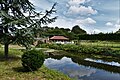
 Hindringham Fish Ponds.jpg 4,032 × 3,024; 5.2 MB
-
 Hindringham Hall - geograph.org.uk - 6244031.jpg 6,849 × 4,565; 7.17 MB
-
 Hindringham Hall - geograph.org.uk - 6244138.jpg 6,855 × 4,570; 5.96 MB
-
 Hindringham Hall from the Bog Area - geograph.org.uk - 6244149.jpg 6,008 × 4,005; 5.94 MB
-
 Hindringham Hall from the Bog Area - geograph.org.uk - 6244155.jpg 6,243 × 4,163; 7.49 MB
-
 Hindringham Hall from the entry to the Formal Garden - geograph.org.uk - 6244057.jpg 7,176 × 4,784; 6.44 MB
-
 Hindringham Hall from the Stiffkey Stream Garden - geograph.org.uk - 6244148.jpg 6,545 × 4,363; 7.72 MB
-
 Hindringham Hall from the Stiffkey Stream Garden - geograph.org.uk - 6244157.jpg 6,993 × 4,662; 6.5 MB
-
 Hindringham Hall, Building used as a holiday let - geograph.org.uk - 6244043.jpg 6,894 × 4,596; 6.33 MB
-
 Hindringham Hall, Circular tree seat - geograph.org.uk - 6244080.jpg 4,269 × 6,403; 6.79 MB
-
 Hindringham Hall, Clematis 1 - geograph.org.uk - 6244045.jpg 6,714 × 4,476; 5.79 MB
-
 Hindringham Hall, Clematis 2 - geograph.org.uk - 6244077.jpg 5,902 × 3,934; 4.37 MB
-
 Hindringham Hall, eastern aspect - geograph.org.uk - 6244068.jpg 6,940 × 4,626; 7.39 MB
-
 Hindringham Hall, eastern aspect - geograph.org.uk - 6244069.jpg 7,631 × 5,086; 7.69 MB
-
 Hindringham Hall, eastern aspect - geograph.org.uk - 6244071.jpg 6,429 × 4,286; 6.03 MB
-
 Hindringham Hall, Fuchsia - geograph.org.uk - 6244049.jpg 4,428 × 6,643; 7.47 MB
-
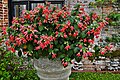 Hindringham Hall, Fuchsia - geograph.org.uk - 6244052.jpg 6,109 × 4,072; 5.7 MB
-
 Hindringham Hall, Kale growing in the Herb Garden - geograph.org.uk - 6244036.jpg 6,157 × 4,105; 7.26 MB
-
 Hindringham Hall, north western aspect - geograph.org.uk - 6244143.jpg 6,988 × 4,658; 7.43 MB
-
 Hindringham Hall, northern aspect - geograph.org.uk - 6244039.jpg 7,455 × 4,969; 7.58 MB
-
 Hindringham Hall, Outdoor seating for the tea room - geograph.org.uk - 6244024.jpg 6,661 × 4,440; 6.07 MB
-
 Hindringham Hall, South facing windows - geograph.org.uk - 6244066.jpg 5,571 × 3,714; 7.1 MB
-
 Hindringham Hall, southern aspect - geograph.org.uk - 6244060.jpg 6,397 × 4,265; 7.61 MB
-
 Hindringham Hall, southern aspect - geograph.org.uk - 6244063.jpg 6,520 × 4,346; 7.59 MB
-
 Hindringham Hall, southern aspect - geograph.org.uk - 6244161.jpg 7,061 × 4,707; 6.47 MB
-
 Hindringham Hall, Tea room - geograph.org.uk - 6244027.jpg 6,668 × 4,446; 4.81 MB
-
 Hindringham Hall, The moat - geograph.org.uk - 6244041.jpg 6,311 × 4,208; 5.15 MB
-
 Hindringham Hall, The moat - geograph.org.uk - 6244073.jpg 7,185 × 4,790; 7.6 MB
-
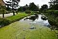 Hindringham Hall, The moat - geograph.org.uk - 6244163.jpg 6,677 × 4,452; 7.64 MB
-
 Hindringham Hall, Vegetables growing in the Herb Garden - geograph.org.uk - 6244033.jpg 6,047 × 4,030; 7.15 MB
-
 Hindringham Hall, Victorian Nut Walk - geograph.org.uk - 6244054.jpg 4,422 × 6,634; 6.66 MB
-
 Hindringham Hall, western aspect - geograph.org.uk - 6244144.jpg 6,437 × 4,291; 6.51 MB
-
 Hindringham Lower Green Windmill.jpg 640 × 480; 67 KB
-
 Hindringham Meadows nature reserve - geograph.org.uk - 3946983.jpg 640 × 480; 251 KB
-
 Hindringham tower mill (geograph 2031088).jpg 457 × 640; 156 KB
-
 Hindringham Village Hall - geograph.org.uk - 6638853.jpg 1,024 × 668; 138 KB
-
 Hindringham village sign - geograph.org.uk - 6813619.jpg 3,456 × 2,592; 3.85 MB
-
 Hindringham War Memorial - geograph.org.uk - 4583534.jpg 3,456 × 2,592; 3.88 MB
-
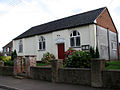
 Hindringham, the Village Hall, in Arts and Crafts style - geograph.org.uk - 1959565.jpg 2,560 × 1,920; 1.33 MB
-
 Home Farm - the farmhouse - geograph.org.uk - 3946951.jpg 640 × 480; 204 KB
-
 Home Guard shelter by Grove Farm - geograph.org.uk - 3946950.jpg 640 × 480; 172 KB
-
 House in Wells Road, Hindringham - geograph.org.uk - 3946964.jpg 640 × 480; 177 KB
-
 House on junction, Hindringham - geograph.org.uk - 6638846.jpg 1,600 × 1,129; 289 KB
-
 House, County Farm - geograph.org.uk - 6638827.jpg 1,024 × 768; 206 KB
-
 Houses on Blakeney Road - geograph.org.uk - 6642465.jpg 4,802 × 2,790; 2.88 MB
-
 Houses on The Street, Hindringham - geograph.org.uk - 6638856.jpg 1,024 × 682; 151 KB
-
 Houses on Wells Road, Hindringham - geograph.org.uk - 6638861.jpg 1,024 × 739; 153 KB
-
 K6 telephone box on junction, Hindringham - geograph.org.uk - 6638842.jpg 1,024 × 770; 205 KB
-

-
 Minor road - geograph.org.uk - 5119721.jpg 4,259 × 3,193; 3.87 MB
-
 Minor road towards Hindringham - geograph.org.uk - 6638825.jpg 1,024 × 768; 165 KB
-
 Minor road towards Hindringham - geograph.org.uk - 6638831.jpg 1,024 × 768; 237 KB
-
 Minor road towards Hindringham - geograph.org.uk - 6638835.jpg 1,024 × 768; 206 KB
-
 Monkey Puzzle Tree on Wells Road - geograph.org.uk - 3854766.jpg 2,056 × 3,088; 2.89 MB
-

-
 Newly planted crop towards woodland - geograph.org.uk - 6638833.jpg 1,024 × 768; 167 KB
-
 Playing Field at Hindringham - geograph.org.uk - 4180577.jpg 640 × 480; 90 KB
-
 Ploughing at Hindringham - geograph.org.uk - 2031117.jpg 640 × 473; 80 KB
-
 Ploughman's Lane (track) - geograph.org.uk - 3851247.jpg 3,088 × 2,056; 3.87 MB
-
 Primitive Methodist Chapel - geograph.org.uk - 570127.jpg 640 × 480; 58 KB
-
 Pumphouse by Hall Farm - geograph.org.uk - 3947020.jpg 640 × 480; 219 KB
-
 Road Junction - geograph.org.uk - 6420010.jpg 800 × 533; 166 KB
-
 Rosehips in a hedgerow - geograph.org.uk - 570188.jpg 640 × 480; 74 KB
-
 Sad, dishevelled Robin^ - geograph.org.uk - 2031433.jpg 640 × 480; 91 KB
-
 Sign for the Pavilion, Hindringham - geograph.org.uk - 6638865.jpg 939 × 1,024; 135 KB
-
 Summer Green Barn - geograph.org.uk - 6638907.jpg 1,024 × 645; 148 KB
-
 Summer Green Farm - geograph.org.uk - 6638873.jpg 1,024 × 648; 204 KB
-
 Telephone Box - geograph.org.uk - 313196.jpg 640 × 480; 176 KB
-
 The Elms, Hindringham - geograph.org.uk - 3946963.jpg 640 × 437; 156 KB
-
 The graveyard to the north of Hindringham church - geograph.org.uk - 5616244.jpg 3,456 × 2,592; 3.94 MB
-
 The old windmill at Hindringham - geograph.org.uk - 4180586.jpg 640 × 480; 109 KB
-
 The Pavilion, Hindringham - geograph.org.uk - 6638862.jpg 1,024 × 632; 128 KB
-
 The Street, Hindringham - geograph.org.uk - 3946946.jpg 640 × 480; 206 KB
-
 The Street, Hindringham - geograph.org.uk - 6638847.jpg 1,600 × 1,030; 277 KB
-
 The Street, Hindringham - geograph.org.uk - 6638858.jpg 1,024 × 648; 122 KB
-
 Tree line - geograph.org.uk - 6420022.jpg 800 × 533; 120 KB
-
 Upper Hall, Hindringham - geograph.org.uk - 3947007.jpg 640 × 355; 99 KB
-
 Upper Mill, Hindringham - geograph.org.uk - 3946956.jpg 640 × 480; 206 KB
-

-
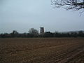
 View east across ploughed field - geograph.org.uk - 570243.jpg 640 × 480; 90 KB
-
 View north across farmland - geograph.org.uk - 570184.jpg 640 × 480; 203 KB
-
 View NW across farmland - geograph.org.uk - 570239.jpg 640 × 480; 81 KB
-
 View NW from Ploughman's Lane - geograph.org.uk - 570117.jpg 640 × 480; 64 KB
-
 View towards Upper Hall - geograph.org.uk - 3947002.jpg 640 × 495; 166 KB
-
 Village homes - geograph.org.uk - 246388.jpg 640 × 480; 139 KB
-
 Village Sign, Hindringham, Norfolk - geograph.org.uk - 1780523.jpg 640 × 481; 154 KB
-

-

-
 Wells Road - geograph.org.uk - 6638909.jpg 1,024 × 768; 210 KB
-
 Wells Road - geograph.org.uk - 6638913.jpg 1,024 × 768; 166 KB
-
 Wells Road towards Wighton - geograph.org.uk - 6638915.jpg 1,024 × 768; 154 KB
-
 Wells Road towards Wighton - geograph.org.uk - 6638918.jpg 1,024 × 768; 209 KB
-
 Wells Road, Hindringham - geograph.org.uk - 3946966.jpg 640 × 424; 139 KB
-
 Wells Road, Hindringham - geograph.org.uk - 6642384.jpg 4,094 × 2,694; 3.05 MB
-
 Wheat crop by Hindringham Hall - geograph.org.uk - 3947010.jpg 640 × 480; 203 KB
-

-
 Young crop field towards Bird's Farm - geograph.org.uk - 6638830.jpg 1,024 × 768; 211 KB
-
 Cottage on Lower Green - geograph.org.uk - 570169.jpg 640 × 480; 64 KB
-
 County Farm - geograph.org.uk - 571284.jpg 640 × 480; 75 KB
-
 Driveway to Snoring Barn - geograph.org.uk - 571223.jpg 640 × 480; 70 KB
-
 Entrance to the cemetery - geograph.org.uk - 550555.jpg 640 × 480; 71 KB
-

-
 Farm road to Coldmoor Plantation - geograph.org.uk - 571291.jpg 640 × 480; 73 KB
-
 Heading east on Hindringham Road - geograph.org.uk - 570230.jpg 640 × 480; 81 KB
-
 Heading west on Hindringham Road - geograph.org.uk - 570248.jpg 480 × 640; 111 KB
-

-
 Large agricultural shed - geograph.org.uk - 570259.jpg 640 × 480; 54 KB
-
 Orchard House - geograph.org.uk - 550563.jpg 640 × 480; 90 KB
-
 Road junction near Thursford Common - geograph.org.uk - 571228.jpg 640 × 480; 68 KB
-
 Road to Hindringham - geograph.org.uk - 335041.jpg 640 × 480; 97 KB
-
 Snoring Barn - geograph.org.uk - 571225.jpg 640 × 480; 36 KB
-
 Track past a horse pasture - geograph.org.uk - 570176.jpg 640 × 480; 68 KB
-
 Track to Folly Farm - geograph.org.uk - 570179.jpg 480 × 640; 88 KB
-
 Winter solitude - geograph.org.uk - 313210.jpg 640 × 480; 102 KB


.jpg)


_-_geograph.org.uk_-_571233.jpg)


_-_geograph.org.uk_-_3851247.jpg)


