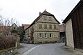
Category:Hintere Gasse 4 (Biebelried)
This is the category of the Bavarian Baudenkmal (cultural heritage monument) with the ID D-6-75-113-20 (Wikidata)
|
| Object location | | View all coordinates using: OpenStreetMap |
|---|
cultural heritage monument D-6-75-113-20 (0) in Biebelried, Bavaria | |||||
| Upload media | |||||
| Instance of | |||||
|---|---|---|---|---|---|
| Location | Biebelried, Kitzingen, Lower Franconia, Bavaria, Germany | ||||
| Street address |
| ||||
| Has part(s) |
| ||||
| Heritage designation | |||||
 | |||||
Media in category "Hintere Gasse 4 (Biebelried)"
The following 4 files are in this category, out of 4 total.
-
 Biebelried, Kaltensondheim, Hintere Gasse 4, 001.jpg 4,928 × 3,264; 7.72 MB
-
 Kaltensondheim, Hintere Gasse 4 Biebelried 20210306 001.jpg 4,016 × 6,016; 10.64 MB
-
 Kaltensondheim, Hintere Gasse 4 Biebelried 20210306 002.jpg 6,016 × 4,016; 12.71 MB
-
 Kaltensondheim, Hintere Gasse 4, 2 Biebelried 20210306 001.jpg 6,016 × 4,016; 12.32 MB


