Category:Hinterrheinbrücke Crestawald
| Object location | | View all coordinates using: OpenStreetMap |
|---|

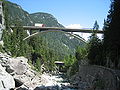
road bridge in Grisons, Switzerland  | |||||
| Upload media | |||||
| Instance of | |||||
|---|---|---|---|---|---|
| Location | Grisons, Switzerland | ||||
| Length |
| ||||
| Follows | |||||
 | |||||
Media in category "Hinterrheinbrücke Crestawald"
The following 4 files are in this category, out of 4 total.
-
 Crestabrücke Sufers.jpg 2,572 × 1,792; 1.55 MB
-
 Crestabrücke Sufers1.jpg 2,592 × 1,944; 1.53 MB
-
 Crestawald A13 Autobahnbrücke über den Hinterrhein, Sufers GR20180821-jag9889.jpg 4,608 × 3,456; 11.12 MB
-
 Sufers Hinterrheinbruecke Crestawald.jpg 3,888 × 2,592; 2.54 MB


