Category:Hinthamerstraat 12, 's-Hertogenbosch
| Object location | | View all coordinates using: OpenStreetMap |
|---|
building in 's-Hertogenbosch, Netherlands  | |||||
| Upload media | |||||
| Instance of | |||||
|---|---|---|---|---|---|
| Location | 's-Hertogenbosch, North Brabant, Netherlands | ||||
| Street address |
| ||||
| Heritage designation |
| ||||
 | |||||
|
This is a category about rijksmonument number 21625
|
| Address |
|
Media in category "Hinthamerstraat 12, 's-Hertogenbosch"
The following 4 files are in this category, out of 4 total.
-
 's-Hertogenbosch Rijksmonument 21625 stadsmuu2 in Hinthamerstraat 12.JPG 3,648 × 2,736; 3.45 MB
-
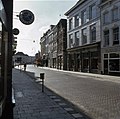
 Overzicht - 's-Hertogenbosch - 20109990 - RCE.jpg 1,185 × 1,200; 301 KB
-
 Overzicht - 's-Hertogenbosch - 20109991 - RCE.jpg 1,200 × 1,200; 304 KB
-