Category:Historical flag maps
English: Note:National states with secured borders and actual national flags did mostly not exist in antiquity and the middle ages. Accordingly, maps in this category should be challenged and possibly deleted for not being in educational scope if:
- the "flags" have been reconstructed by laypeople enthusiasts and are not properly sourced.
- the "borders" are not properly sourced, especially if they deviate visibly from mainstream map reconstructions.
Subcategories
This category has the following 71 subcategories, out of 71 total.
- Historical SVG flag maps (230 F)
*
A
- Flag maps of Austria-Hungary (3 F)
B
C
- Historical flag maps of Canada (12 F)
- Flag maps of Gran Colombia (3 F)
D
E
F
- Historical flag maps of France (62 F)
G
H
- Flag maps of Hanover (1 F)
I
- Historical flag maps of Iraq (1 F)
J
K
- Flag maps of Kingdom of France (15 F)
L
M
- Historical flag maps of Mexico (11 F)
N
O
- Flag maps of the Ottoman Empire (20 F)
P
R
- Flag maps of the Russian Empire (16 F)
S
- Flag maps of Sardinia (2 F)
- Historical flag maps of Spain (26 F)
T
- Flag maps of the Third Reich (1 F)
U
Y
Media in category "Historical flag maps"
The following 137 files are in this category, out of 137 total.
-
 American East Indies Flag Map.png 1,308 × 482; 53 KB
-
 Bukhara 1814.png 1,600 × 1,037; 196 KB
-
 First Persian Empire (550 BC–330 BC) flag map.png 932 × 536; 88 KB
-
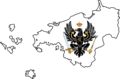
 Flag map of Austria-Hungary (1917).png 415 × 322; 11 KB
-
 Flag map of Batavian Republic.png 1,373 × 1,386; 39 KB
-
 Flag map of Belgium and the Netherlands (1830).png 464 × 635; 9 KB
-
 Flag map of Belgium and the Netherlands (1831).png 464 × 635; 9 KB
-
 Flag Map of British Canada (1866).png 1,346 × 1,095; 73 KB
-
 Flag Map of British Canada (1867).png 1,346 × 1,095; 73 KB
-
 Flag Map of British Canada (1868).png 1,346 × 1,095; 78 KB
-
 Flag map of British North Africa (1914).png 2,079 × 2,774; 146 KB
-
 Flag map of Bulgaria (1914).png 577 × 427; 6 KB
-
 Flag Map Of Czechoslovakia.png 800 × 340; 19 KB
-
 Flag map of democratic republic of Georgia.png 1,706 × 990; 94 KB
-
 Flag map of Emirate of Diriyah.png 624 × 493; 21 KB
-
 Flag map of european nato (2023).png 1,738 × 1,468; 120 KB
-
 Flag map of France (1815–1830).png 1,224 × 1,336; 22 KB
-
 Flag map of France (1919).png 1,225 × 1,339; 20 KB
-
 Flag map of France 1873 - 1918.png 968 × 927; 90 KB
-
 Flag map of Free city of Danzig.png 800 × 518; 40 KB
-
 Flag map of French North America.png 484 × 464; 107 KB
-
 Flag map of French Syria (1920–1939).png 626 × 804; 9 KB
-
 Flag Map of Germany (1940).png 2,478 × 3,564; 131 KB
-
 Flag Map Of Germany Nazi (Version1).svg 512 × 518; 107 KB
-
 Flag Map Of Germany Nazi (Version2).svg 512 × 511; 76 KB
-
 Flag map of Goryeo.png 222 × 340; 40 KB
-
 Flag map of Great Britan (1707–1801).png 985 × 1,178; 43 KB
-
 Flag map of Great Moravia.png 1,200 × 800; 66 KB
-
 Flag map of Iceland (United States).png 2,560 × 1,759; 95 KB
-
 Flag map of Italy (1940).png 1,424 × 852; 16 KB
-
 Flag Map of Kievan Rus (862).png 359 × 555; 12 KB
-
 Flag map of Kingdom of Benin.png 356 × 279; 19 KB
-
 Flag map of Kingdom of France (1337).png 721 × 1,101; 96 KB
-
 Flag map of Kingdom of France (1444).png 790 × 966; 40 KB
-
 Flag map of Kingdom of France (1598).png 518 × 538; 24 KB
-
 Flag map of Kingdom of France (1618).png 1,067 × 1,106; 671 KB
-
 Flag map of Kingdom of France (1648).png 1,120 × 1,344; 768 KB
-
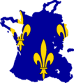
 Flag map of Kingdom of France (1750).png 1,148 × 1,149; 751 KB
-
 Flag map of Kingdom of Hanover (1814–1866).png 250 × 270; 46 KB
-
 Flag Map of Kingdom of Hanover (United Kingdom).png 389 × 352; 8 KB
-
 Flag Map of Malaysia (United Kingdom).png 2,560 × 849; 59 KB
-
 Flag Map of Manchuria (Soviet Union).png 1,024 × 1,052; 46 KB
-
 Flag map of Mongol Empire (Tug Banner flag).png 1,195 × 580; 77 KB
-
 Flag map of NATO (1949).png 1,115 × 1,649; 145 KB
-
 Flag map of Neutral Moresnet.svg 324 × 1,031; 3 KB
-
 Flag map of Nootka Territory (Great Britain, 1791).png 426 × 920; 14 KB
-
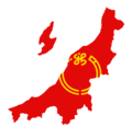
 Flag map of Poland (1863).png 549 × 678; 63 KB
-
 Flag map of Sardinia (1814–1848).png 406 × 1,012; 8 KB
-
 Flag map of Sardinia (1848).png 406 × 1,012; 9 KB
-
 Flag map of Slovakia (1939-1945).png 2,048 × 1,000; 83 KB
-
 Flag map of Spain (1701–1760).png 1,221 × 1,248; 227 KB
-
 Flag map of Spain (1760–1785).png 1,221 × 1,248; 207 KB
-
 Flag map of Spain (Cross of Burgundy).png 2,492 × 2,048; 43 KB
-
 Flag map of Sweden (1595).png 454 × 616; 7 KB
-
 Flag Map of Teutonic Order (1402).png 1,114 × 948; 25 KB
-
 Flag map of the 13 Original Colonies.png 1,618 × 2,403; 175 KB
-
 Flag map of the Abbasid Caliphate.png 1,372 × 798; 142 KB
-
 Flag map of the Almohad Dynasty in Al-Andalus.png 315 × 380; 68 KB
-
 Flag map of the Almoravid Dynasty in Al-Andalus.png 315 × 380; 67 KB
-
 Flag map of the Austrian Empire (1789).png 2,069 × 1,017; 21 KB
-
 Flag map of the Austrian Empire (With puppets).png 517 × 588; 36 KB
-
 Flag map of the Ayyubid Dynasty.png 494 × 331; 42 KB
-
 Flag map of the Democratic Republic of the Congo (2003–2006).png 2,073 × 2,048; 79 KB
-
 Flag map of the Durrani Empire.png 772 × 572; 57 KB
-
 Flag map of the Dutch Republic (1610).png 949 × 886; 12 KB
-
 Flag map of the First French Empire (1803).png 2,028 × 2,145; 78 KB
-
 Flag map of the First French Empire (1807).png 882 × 659; 10 KB
-
 Flag Map of the French Mandate of Syria (1920).png 846 × 796; 41 KB
-
 Flag map of the German Colonial Empire.png 1,079 × 656; 5 KB
-
 Flag map of the Ghaznavid Empire (Version 1).png 688 × 438; 42 KB
-
 Flag map of the Hafsid Dynasty.png 549 × 309; 16 KB
-
 Flag map of the Holy Roman Empire in 1792 (with states).png 1,378 × 1,378; 727 KB
-
 Flag map of the Italian Empire.png 919 × 1,099; 91 KB
-
 Flag map of the Kalmar Union (Mainland).png 471 × 624; 55 KB
-
 Flag Map Of The Kazakh Khanate.png 476 × 238; 5 KB
-
 Flag map of the kingdom of Imereti.png 1,093 × 812; 52 KB
-
 Flag map of the kingdom of italy (1861-1865).svg 5,188 × 6,464; 128 KB
-
 Flag Map of the Kingdom of Mosquita (1834-1860).png 1,280 × 796; 95 KB
-
 Flag map of the Kingdom of Prussia (1795).png 1,426 × 942; 139 KB
-
 Flag Map Of The Old Swiss Confederacy.png 2,869 × 1,818; 416 KB
-
 Flag map of the Republic of Niigata.png 2,048 × 1,981; 267 KB
-
 Flag Map of the Russian Empire (1814).png 577 × 474; 6 KB
-
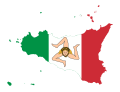 Flag map of the Sicilian Kingdom (1848-1849).svg 2,900 × 2,200; 39 KB
-
 Flag map of the Teutonic Order.png 814 × 776; 68 KB
-
 Flag map of the Tokugawa Shogunate.png 646 × 636; 9 KB
-
 Flag map of the Umayyad Caliphate.png 1,098 × 567; 103 KB
-
 Flag Map Of The Union Of African States.png 800 × 600; 18 KB
-
 Flag map of the United Kingdom (1801–1919).png 985 × 1,178; 67 KB
-
 Flag Map Of Third Reich Occupied Europe.png 1,930 × 2,002; 431 KB
-
 Flag map of Tsardom of Russia (1571–1586).png 517 × 605; 125 KB
-
 Flag map of Umayyad caliphate.png 2,138 × 1,067; 79 KB
-
 Flag map of Viceroyalty of New Spain (1794).png 2,055 × 1,786; 169 KB
-
 Flag map of Wallachia.png 1,309 × 678; 62 KB
-
 Flag-map of Abbasid caliphate.png 685 × 455; 111 KB
-
 Flag-map of Almoravid Kingdom.png 996 × 1,071; 68 KB
-
 Flag-map of Canada (1964).png 2,422 × 2,048; 100 KB
-
 Flag-map of Christmas Island (1952-1958).png 941 × 850; 74 KB
-
 Flag-Map Of Ecuador-(1832).svg 512 × 150; 293 KB
-
 Flag-map of Golden Horde Globe.png 561 × 304; 14 KB
-
 Flag-map of Iraq (1924-1959).png 2,058 × 2,048; 156 KB
-
 Flag-map of Kazakh Khanate Globe.png 1,417 × 1,105; 95 KB
-
 Flag-map of Kingdom of France (1517).png 414 × 468; 18 KB
-
 Flag-map of Serbian Empire.png 1,200 × 999; 121 KB
-
 Flag-map of Srivijaya Empire.png 559 × 424; 32 KB
-
 Flag-map of the Ottoman Empire (1792).png 1,127 × 978; 278 KB
-
 Flag-map of the Swedish Empire (1799).png 1,288 × 1,961; 28 KB
-
 Flag-Map of Third Reich (Nazi Germany)-(1942).svg 512 × 519; 124 KB
-
 Flag-map of Umayyad Caliphate.png 738 × 421; 53 KB
-
 Georgian SSR flag map.png 2,082 × 979; 87 KB
-
 Golden Horde Flag Map 1440.png 640 × 439; 23 KB
-
 Golden Horde Flag map.png 1,000 × 583; 44 KB
-
 Grau Peru.png 205 × 220; 4 KB
-
 Historical Mingrelia flag map.png 375 × 358; 12 KB
-
 Khariido.jpg 2,480 × 2,340; 152 KB
-
 Khiva Khanate 19th century.png 1,600 × 1,037; 280 KB
-
 Kievan Rus flag map 882-1240.png 1,378 × 1,378; 135 KB
-
 Kingdom of Bohemia (1198–1918) Flag Map.png 1,256 × 1,024; 211 KB
-
 Kingdom of Dahomey c. c. 1600–1904) flag map.png 450 × 400; 44 KB
-
 Kingdom of Georgia flag map.png 1,638 × 1,217; 125 KB
-
 Kingdom of Imereti flag map.png 1,093 × 812; 50 KB
-
 Kingdom of Kartli-Kakheti flag map.png 2,736 × 2,213; 52 KB
-
 Kingdom of Wallachia Flag Map.svg 729 × 600; 30 KB
-
 KingdomOfIberia(Karli).png 983 × 710; 17 KB
-
 Kokand Khanate 1850.png 1,600 × 1,037; 256 KB
-
 Lower and Upper Silesia.png 445 × 319; 20 KB
-
 Mali Empire (c. 1230–c. 1670) flag map.png 550 × 270; 11 KB
-
 Map of Bukhara before Russian conqueror.png 1,600 × 1,037; 344 KB
-
 Map of Treaty of Zuhab (1639).jpg 1,646 × 1,079; 1.64 MB
-
 Median Empire Flag Map.png 1,280 × 720; 263 KB
-
 Orange Free State (1854–1902) flag map.png 420 × 280; 21 KB
-
 Ottoman Empire flag map 1683.png 1,378 × 1,378; 73 KB
-
 Papal States Flag Map.png 2,048 × 2,048; 442 KB
-
 Sevres Treaty.jpg 1,471 × 800; 289 KB
-
 Schlesienportal.png 225 × 160; 24 KB
-
 Turkestan autonomous.png 1,600 × 1,037; 162 KB
-
 Umayyad Caliphate Flag Map (Remastered).png 400 × 208; 21 KB
-
 United arab republic flag map.png 1,200 × 674; 25 KB

_flag_map.png)
.png)

.png)
.png)
.png)
.png)
.png)
.png)
.png)


.png)
.png)
.png)


.png)
.png)
.svg)
.svg)

.png)

.png)
.png)
.png)

.png)
.png)
.png)
.png)
.png)
.png)
.png)
.png)
.png)
.png)
.png)
.png)
.png)
.png)
.png)
.png)
.png)
.png)
.png)


.png)
.png)

.png)

.png)
.png)
.png)
.png)

.png)

.png)

.png)


.svg)
.png)
.png)


.png)
.svg)


.png)

.png)

.png)


.png)
.png)

.png)

.png)


.png)
.png)
-(1942).svg)


_Flag_Map.png)
_flag_map.png)


.png)


_flag_map.png)

.jpg)

_flag_map.png)


.png)

.png)
.png)
.png)
.svg)