Category:Historical maps of Victorian Legislative Assembly electoral districts
Media in category "Historical maps of Victorian Legislative Assembly electoral districts"
The following 70 files are in this category, out of 70 total.
-

-
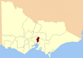
 Electoral district of Alberton, Victoria.png 400 × 279; 16 KB
-
 Electoral district of Anglesey.png 800 × 558; 76 KB
-
 Electoral district of Ararat, Victoria - 1859.png 800 × 558; 99 KB
-
 Electoral district of Avoca, Victoria.png 800 × 558; 99 KB
-
 Electoral district of Ballaarat East, Victoria - 1859.png 800 × 558; 99 KB
-
 Electoral district of Ballaarat West, Victoria - 1859.png 800 × 558; 99 KB
-
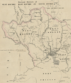
 Electoral district of Belfast, Victoria. (Port Fairy).tif 2,782 × 2,020; 11.78 MB
-
 Electoral district of Brighton 1859.png 489 × 571; 15 KB
-
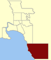
 Electoral district of Brighton.tif 5,108 × 2,939; 30.39 MB
-
 Electoral district of Castlemaine Boroughs, Victoria.png 800 × 558; 76 KB
-
 Electoral district of Castlemaine, Victoria.png 800 × 558; 108 KB
-
 Electoral district of Colac, Victoria.png 800 × 558; 76 KB
-
 Electoral district of Collingwood 1859.png 489 × 571; 14 KB
-
 Electoral district of Creswick, Victoria.png 800 × 558; 108 KB
-
 Electoral district of Crowlands, Victoria - Location.png 800 × 558; 107 KB
-
 Electoral district of Crowlands, Victoria.jpg 1,089 × 2,055; 1.25 MB
-
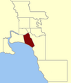
 Electoral district of Dundas and Follett.PNG 400 × 279; 18 KB
-
 Electoral district of East Bourke Boroughs 1859.png 489 × 571; 14 KB
-
 Electoral district of East Bourke, Victoria.png 400 × 279; 16 KB
-
 Electoral district of East Melbourne 1859.png 489 × 571; 15 KB
-
 Electoral district of Emerald Hill 1859.png 489 × 571; 14 KB
-
 Electoral district of Emerald Hill, Victorian Legislative Assembly c.1859.tif 5,155 × 6,272; 70.48 MB
-
 Electoral district of Evelyn, Victoria - 1859.png 800 × 558; 99 KB
-
 Electoral district of Geelong East, Victoria - 1859.png 800 × 558; 99 KB
-
 Electoral district of Geelong West, Victoria - 1859.png 800 × 558; 98 KB
-
 Electoral district of Geelong, 1856.tif 1,897 × 2,673; 10.58 MB
-
-
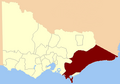
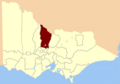
 Electoral district of Gippsland North.png 400 × 279; 16 KB
-
 Electoral district of Kilmore, Victoria.png 800 × 558; 108 KB
-
 Electoral district of Kyneton Boroughs, Victoria.png 800 × 558; 108 KB
-
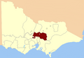
 Electoral district of Loddon, Victorian Legislative Assembly.png 800 × 558; 76 KB
-
 Electoral district of Maldon, Victoria.png 800 × 558; 108 KB
-
 Electoral district of Mandurang, Victoria.png 800 × 558; 108 KB
-
 Electoral district of Maryborough, Victoria.png 800 × 558; 108 KB
-
 Electoral district of Melbourne 1856.png 231 × 233; 6 KB
-
 Electoral district of Mornington, Victoria - 1859.png 800 × 558; 97 KB
-
 Electoral district of Murray Boroughs, Victoria.png 800 × 558; 108 KB
-

-
 Electoral district of North Grant, Victoria.png 800 × 558; 75 KB
-
 Electoral district of North Grenville.png 400 × 279; 16 KB
-
 Electoral district of North Melbourne 1859.png 489 × 571; 15 KB
-
 Electoral district of Ovens, Victoria.png 800 × 558; 76 KB
-
 Electoral district of Polwarth and South Grenville, Victoria.png 400 × 279; 16 KB
-

-
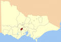
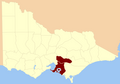
 Electoral District of Portland, Victoria.png 1,011 × 1,403; 1.71 MB
-
 Electoral district of Richmond 1859.png 489 × 571; 15 KB
-
 Electoral district of Rodney, Victoria - 1856.png 800 × 558; 76 KB
-
 Electoral district of Sandhurst, Victoria.png 800 × 558; 108 KB
-
 Electoral district of Sandridge 1859.png 489 × 571; 14 KB
-
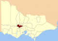
 Electoral district of South Bourke, Victoria.png 400 × 279; 16 KB
-
 Electoral district of South Melbourne, 1856.png 231 × 233; 6 KB
-
 Electoral district of St Kilda 1859.png 489 × 571; 15 KB
-
 Electoral district of Talbot, Victoria.png 800 × 558; 76 KB
-
 Electoral district of Villiers and Heytesbury, Victoria - 1856.png 800 × 558; 102 KB
-
 Electoral district of Warrenheip, Victoria (1913).png 645 × 764; 118 KB
-
 Electoral district of Warrnambool, Victorian Legislative Assembly 1856.tif 4,337 × 2,098; 26.09 MB
-
 Electoral district of West Bourke, Victoria.png 400 × 279; 17 KB
-

-
 Electoral district of Williamstown 1859.png 489 × 571; 14 KB
-
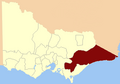
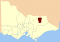
 Electoral district of Wimmera, Victorian Legislative Assembly.png 400 × 279; 16 KB
-
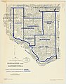 Electoral districts of Burwood and Camberwell 1956.jpg 5,510 × 7,000; 7.71 MB
-

-
 Electoral districts of West Bourke, East Bourke and South Bourke.tif 2,213 × 2,613; 13.32 MB
-
 Evelyn and Mornington Victoria.png 400 × 279; 18 KB
-
 Polwarth, Victoria.png 400 × 279; 18 KB
-
 Ripon and Hampden, Victoria.png 400 × 279; 18 KB
-
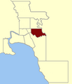
 VIC Kew District 1967-76.png 2,401 × 2,401; 237 KB
-
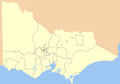
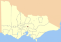
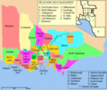
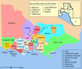 Victorian Legislative Assembly districts 1856-1859.png 810 × 690; 117 KB
-
 Victorian Legislative Assembly districts 1859-1877.png 810 × 690; 140 KB


.png)


