Category:Historical maps of ethnic groups in Hungary
Subcategories
This category has the following 3 subcategories, out of 3 total.
A
Media in category "Historical maps of ethnic groups in Hungary"
The following 59 files are in this category, out of 59 total.
-
 1910年奧匈帝國民族組成.svg 1,360 × 1,052; 919 KB
-
 Austria hungary 1911 and post war borders.jpg 1,525 × 1,166; 389 KB
-
 Austria hungary 1911.gif 907 × 687; 397 KB
-
 Austria hungary 1911.jpg 1,521 × 1,155; 1.76 MB
-
 Austria Hungary ethnic UK.svg 512 × 396; 287 KB
-
 Austria Hungary ethnic-ar.svg 1,360 × 1,052; 1,000 KB
-
 Austria Hungary ethnic-pt.svg 1,360 × 1,052; 911 KB
-
 Austria Hungary ethnic.svg 1,360 × 1,052; 1.56 MB
-
 Austria-Hungary (ethnic).JPG 5,150 × 3,395; 4.73 MB
-
 Austria-Hungary (ethnic).jpg 4,314 × 2,820; 3.63 MB
-
 Austria-Hungary ethnic map.jpg 1,623 × 1,276; 312 KB
-
 Austro-Ungaria si Romania (harta etnica).jpg 6,245 × 3,505; 6.73 MB
-
 Bunjevci migrations hu.svg 937 × 900; 88 KB
-
 Bunjevci migrations-sr.png 937 × 900; 107 KB
-
 Bunjevci migrations.png 937 × 900; 128 KB
-
 Carte ethnographique de L’Europe Centrale.jpg 3,000 × 2,300; 1.64 MB
-

-
 Csangos.PNG 724 × 500; 43 KB
-
 Ethnic Germans in Hungary and parts of adjacent Austrian territories.JPG 3,930 × 2,842; 4.68 MB
-
 Ethnic map of 11th century.jpg 806 × 526; 236 KB
-
 Ethno Hung.1910.png 1,103 × 1,039; 473 KB
-
 Ethnographic map of austrian monarchy czoernig 1855.jpg 7,997 × 5,862; 23.73 MB
-
 Ethnographic map of Czoernig.jpg 1,202 × 910; 372 KB
-
 Ethnographic map of hungary 1910 by teleki carte rouge.jpg 4,962 × 3,509; 5.18 MB
-
 Ethnographical map of Hungary based on density of population, Census of 1910.jpg 12,000 × 9,751; 25.69 MB
-
 Ethnographische Karte der Österreichischen Monarchie - Kartenteil 1.png 9,410 × 7,131; 73.76 MB
-
 Ethnographische Karte der Österreichischen Monarchie - Kartenteil 2.png 9,429 × 7,116; 81.38 MB
-
 Ethnographische Karte der Österreichischen Monarchie - Kartenteil 3.png 9,429 × 7,116; 71.65 MB
-
 Ethnographische Karte der Österreichischen Monarchie - Kartenteil 4.png 9,429 × 7,116; 67.8 MB
-
 Great serb migration-es.svg 8,584 × 7,087; 300 KB
-
 Great serb migration-pt.svg 8,584 × 7,087; 143 KB
-
 Great serb migration-sr.png 1,601 × 1,534; 123 KB
-
 Great serb migration.png 1,601 × 1,534; 150 KB
-
 Hu-sk-1910enthnographics-with-current-borders.png 527 × 539; 117 KB
-
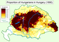 Hungarians in Hungary (1890).png 1,064 × 766; 159 KB
-
 HungariansInHungary1890.png 1,892 × 1,422; 467 KB
-
 Hungary 1941 ethnic hu.svg 860 × 490; 339 KB
-
 Hungary 1941 ethnic.svg 860 × 490; 475 KB
-
 Hungary b. 10th century.png 875 × 560; 151 KB
-
 Hungary-ethnic groups.jpg 2,913 × 2,250; 2.18 MB
-
 Kingdom of Hungary - Ethnic Map - 1495.jpg 4,771 × 3,337; 11.96 MB
-
 Kingdom of Hungary - Ethnic Map - 1784.jpg 4,771 × 3,337; 11.87 MB
-
 Kogutowicz Károly Magyarország Néprajzi Térképe.jpg 2,062 × 1,372; 4.06 MB
-
 Krain ETHNIC 1910 Pict 1.JPG 208 × 232; 14 KB
-
 Magiarizzazione in Ungheria (1890).png 1,064 × 766; 193 KB
-
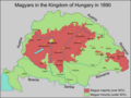
 Magyars (Hungarians) in Hungary, census 1890.jpg 1,064 × 800; 760 KB
-
 Magyars in Austro-Hungarian Empire 1911.gif 967 × 519; 385 KB
-
 Meyers b12 s0486a.jpg 2,048 × 1,683; 1.35 MB
-
 Peuple magyar en 1900.jpg 321 × 165; 26 KB
-
 Romanians before WW1.jpg 800 × 640; 229 KB
-

-
-
 Szekelys-in-hungary(hun).png 606 × 393; 145 KB
-
 Szekelys-in-hungary.png 606 × 393; 130 KB
-
 Szeklers-in-hungary.jpg 642 × 469; 79 KB
-
 Trianon consequences.png 1,140 × 774; 192 KB
-
 Walachians (Romanians) in Hungary, census 1890.jpg 1,062 × 789; 654 KB
-
 Węgrzy1920-1940.png 444 × 421; 13 KB
-
 Zarubezhnaia Rus.jpg 5,125 × 3,689; 3.38 MB


.JPG)
.jpg)

.jpg)


.png)


.png)
_in_Hungary,_census_1890.jpg)


-it.jpg)
.jpg)
.png)


_in_Hungary,_census_1890.jpg)

