Category:Historische Landkarten von Bad Gams
Media in category "Historische Landkarten von Bad Gams"
The following 9 files are in this category, out of 9 total.
-
 Aufnahmeblatt 5254-2.jpg 9,668 × 7,380; 34.46 MB
-
 Aufnahmeblatt 5254-4 1878.jpg 9,684 × 7,366; 33.08 MB
-
 Deutschlandsberg und Wolfsberg 5254.jpg 6,792 × 5,095; 15.73 MB
-
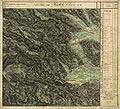 Franziszeische Landesaufnahme Landsberg Osterwitz.jpg 7,632 × 6,962; 17.93 MB
-
 Franziszeische Landesaufnahme Stainz bis Schwarzkogel.jpg 6,387 × 5,796; 16.61 MB
-
 Josephinische Landesaufnahme 114 Deutschlandsberg.jpg 8,448 × 5,483; 17.74 MB
-
 Kreiseinteilung Graz Marburg 1855.jpg 1,245 × 780; 512 KB
-
 Landgerichtskarte Marburg.jpg 5,821 × 4,398; 22.11 MB
-
 Marburger Kreis 1760.jpg 7,417 × 5,386; 16.87 MB


