Category:Historische Landkarten von Trahütten
Media in category "Historische Landkarten von Trahütten"
The following 13 files are in this category, out of 13 total.
-
 Aufnahmeblatt 5254-4 1878.jpg 9,684 × 7,366; 33.08 MB
-
 Deiggitsch Alben2.jpg 1,517 × 1,061; 748 KB
-
 Deutschlandsberg Stainz Schwanberg Hebalm Speik ca 1881.jpg 18,016 × 13,606; 162.39 MB
-
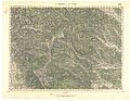
 Deutschlandsberg und Wolfsberg 1937 schwarzweiß.jpg 7,071 × 5,409; 20.85 MB
-
 Deutschlandsberg und Wolfsberg 5254.jpg 6,792 × 5,095; 15.73 MB
-
 Josephinische Landesaufnahme 097 Hebalm Rosenkogel.jpg 8,416 × 5,486; 17.48 MB
-
 Josephinische Landesaufnahme 114 Deutschlandsberg.jpg 8,448 × 5,483; 17.74 MB
-
 Landgericht Deutschlandsberg.jpg 1,240 × 879; 2.45 MB
-
 Landgerichtskarte Marburg.jpg 5,821 × 4,398; 22.11 MB
-
 Marburger Kreis 1760.jpg 7,417 × 5,386; 16.87 MB
-
 Schröfl See gross.jpg 774 × 562; 245 KB
-
 Schwarzkogelzug.jpg 1,985 × 1,257; 1.74 MB
-
 Spezialkarte 5254 1937 grün mit Meldenetzraster rot.jpg 7,044 × 5,460; 14.33 MB


