Category:Historischer Wasserspeicher Möggenweiler
| Object location | | View all coordinates using: OpenStreetMap |
|---|
Media in category "Historischer Wasserspeicher Möggenweiler"
The following 4 files are in this category, out of 4 total.
-
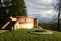
 Gehrenberg-4115 1.jpg 3,121 × 2,699; 7.46 MB
-
 Wasserspeicher Markdorf 013.jpg 1,930 × 1,930; 3.8 MB
-
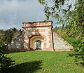
 Wasserspeicher Markdorf Moeggenweiler.jpg 3,072 × 2,048; 2.53 MB
-
 Wasserspeicher Möggenweiler.jpg 1,024 × 768; 274 KB


