Category:Hitzhofen
municipality of Germany    | |||||
| Upload media | |||||
| Instance of |
| ||||
|---|---|---|---|---|---|
| Part of |
| ||||
| Location | Eichstätt, Upper Bavaria, Bavaria, Germany | ||||
| Head of government |
| ||||
| Population |
| ||||
| Area |
| ||||
| Elevation above sea level |
| ||||
| official website | |||||
 | |||||
Subcategories
This category has the following 3 subcategories, out of 3 total.
Media in category "Hitzhofen"
The following 11 files are in this category, out of 11 total.
-
 Wappen Hitzhofen.svg 964 × 1,087; 87 KB
-
 Wappen von Hitzhofen.png 395 × 400; 24 KB
-
 Hitzhofen - Lage im Landkreis.png 281 × 185; 32 KB
-
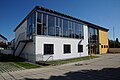 Hitzhofen EI 001.jpg 6,000 × 4,000; 6.84 MB
-
 Hitzhofen EI 002.jpg 6,000 × 4,000; 6.06 MB
-
 Hitzhofen EI 003.jpg 4,000 × 6,000; 4.05 MB
-
 Hitzhofen EI 004.jpg 6,000 × 4,000; 4.01 MB
-
 Hitzhofen EI 005.jpg 6,000 × 4,000; 3.76 MB
-
 HITZHOFEN HOFSTETTEN nieder.png 480 × 360; 5 KB
-
 HITZHOFEN HOFSTETTEN nieder.svg 512 × 427; 21 KB
-
 Hitzhofen in EI.svg 804 × 580; 1.12 MB


