Category:Hoekmolen
| Object location | | View all coordinates using: OpenStreetMap |
|---|
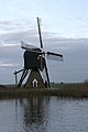
windmill in Hei- en Boeicop, Netherlands  | |||||
| Upload media | |||||
| Instance of | |||||
|---|---|---|---|---|---|
| Location | Hei- en Boeicop, Vijfheerenlanden, Utrecht, Netherlands | ||||
| Street address |
| ||||
| Located on street |
| ||||
| Has use |
| ||||
| Heritage designation |
| ||||
| Source of energy | |||||
 | |||||
|
This is a category about rijksmonument number 21344
|
| Address |
|
Media in category "Hoekmolen"
The following 26 files are in this category, out of 26 total.
-
 Detail, de brug met watertoevoer - Hei- en Boeicop - 20421238 - RCE.jpg 1,200 × 800; 211 KB
-
 Detail, waterrad - Hei- en Boeicop - 20421233 - RCE.jpg 1,200 × 800; 193 KB
-
 Detail, waterrad - Hei- en Boeicop - 20421234 - RCE.jpg 1,200 × 800; 206 KB
-
 Gebouw bij wipmolen - AMR Molenfoto - 20538500 - RCE.jpg 1,200 × 900; 106 KB
-
 Gebouw naast wipmolen - AMR Molenfoto - 20538501 - RCE.jpg 1,200 × 900; 198 KB
-
 Hei- en Boeicop - Hoekmolen.jpg 1,000 × 1,500; 847 KB
-
 Hoekmolen en een weidemolentje aan de Huibert in Hei -en Boeicop.jpg 4,770 × 3,177; 4.3 MB
-
 Hoekmolen met gemaal aan de Huibert in Hei-en Boeicop.jpg 4,770 × 3,177; 4.35 MB
-
 Hoekmolen, Hei- en Boeicop, South Holland, Netherland - panoramio.jpg 1,600 × 1,200; 894 KB
-
 Hoekmolen, Hei- en Boeicop, South Holland, Netherlands - panoramio.jpg 1,171 × 1,600; 621 KB
-
 Hoekmolen. Bij Hei- en Boeicop in de streek Vijfheerenlanden.jpg 5,254 × 3,334; 3.42 MB
-
 Interieur wipmolen - AMR Molenfoto - 20538502 - RCE.jpg 1,200 × 900; 161 KB
-
 Interieur wipmolen - AMR Molenfoto - 20538503 - RCE.jpg 1,200 × 900; 201 KB
-
 Interieur wipmolen - AMR Molenfoto - 20538504 - RCE.jpg 1,200 × 900; 114 KB
-
 Interieur wipmolen - AMR Molenfoto - 20538505 - RCE.jpg 1,200 × 900; 175 KB
-
 Interieur wipmolen - AMR Molenfoto - 20538506 - RCE.jpg 900 × 1,200; 143 KB
-
 Overzicht - Ameide - 20376502 - RCE.jpg 1,200 × 1,200; 266 KB
-
 Overzicht van de achterkant - Hei- en Boeicop - 20421235 - RCE.jpg 1,200 × 800; 151 KB
-
 Overzicht van de ingang - Hei- en Boeicop - 20421232 - RCE.jpg 1,200 × 800; 218 KB
-
 Overzicht van de voorkant - Hei- en Boeicop - 20421230 - RCE.jpg 1,200 × 800; 175 KB
-
 Overzicht van de zijkant - Hei- en Boeicop - 20421231 - RCE.jpg 1,200 × 800; 135 KB
-

-

-

-

-


