Category:Hofkerk, Goor
| Object location | | View all coordinates using: OpenStreetMap |
|---|
 | |||||
| Upload media | |||||
| Instance of |
| ||||
|---|---|---|---|---|---|
| Location | Goor, Hof van Twente, Overijssel, Netherlands | ||||
| Street address |
| ||||
| Heritage designation |
| ||||
 | |||||
Nederlands: Petrus- of Hofkerk, Goor - anno 1600
Kerk
|
This is a category about rijksmonument number 16532
|
Toren
|
This is a category about rijksmonument number 16533
|
| Address |
|
Subcategories
This category has only the following subcategory.
H
Media in category "Hofkerk, Goor"
The following 44 files are in this category, out of 44 total.
-
 2020-09-13 — Eerbetoon Bert Haanstra (Nicolas Dings, 1999).jpg 4,000 × 3,000; 4.64 MB
-
 Exterieur INGANGSPARTIJ (NEOGOTISCH) - Goor - 20297705 - RCE.jpg 1,200 × 1,195; 326 KB
-
 Exterieur INGANGSPARTIJ (NEOGOTISCH) - Goor - 20297706 - RCE.jpg 1,188 × 1,200; 283 KB
-
 Exterieur NOORDGEVEL - Goor - 20297703 - RCE.jpg 949 × 1,200; 263 KB
-
 Exterieur NOORDGEVEL, OOSTGEVEL - Goor - 20297702 - RCE.jpg 1,200 × 960; 270 KB
-
 Exterieur overzicht, ontpleisterde zuidgevel - Goor - 20324296 - RCE.jpg 1,185 × 1,200; 434 KB
-
 Exterieur overzicht, ontpleisterde zuidgevel - Goor - 20324297 - RCE.jpg 1,181 × 1,200; 443 KB
-
 Exterieur overzicht, ontpleisterde zuidgevel - Goor - 20324298 - RCE.jpg 1,186 × 1,200; 429 KB
-
 Exterieur ZUIDGEVEL - Goor - 20297704 - RCE.jpg 1,200 × 941; 363 KB
-
 Exterieur, ontpleisterde zuidgevel - Goor - 20324299 - RCE.jpg 1,195 × 1,200; 464 KB
-
 Exterieur, ontpleisterde zuidgevel, detail - Goor - 20324300 - RCE.jpg 783 × 1,200; 238 KB
-
 Exterieur, ontpleisterde zuidgevel, detail - Goor - 20324301 - RCE.jpg 1,185 × 1,200; 405 KB
-
 Exterieur, ontpleisterde zuidgevel, detail steunbeer - Goor - 20324304 - RCE.jpg 1,200 × 783; 266 KB
-
 Exterieur, ontpleisterde zuidgevel, detail venster - Goor - 20324302 - RCE.jpg 1,200 × 741; 232 KB
-
 Exterieur, ontpleisterde zuidgevel, detail venster - Goor - 20324303 - RCE.jpg 783 × 1,200; 235 KB
-
 Gebeeldhouwde portiek van grafkelder - Goor - 20080087 - RCE.jpg 962 × 1,200; 204 KB
-
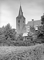
 Goor, Hofkerk in straatzicht foto2 2010-07-18 13.05.JPG 3,456 × 2,592; 6.9 MB
-
 Goor, Kerkstraat 23 - Petrus 11.jpg 2,848 × 4,272; 866 KB
-
 Goor, Kerkstraat 23 - Petrus 12.jpg 2,848 × 4,272; 1.7 MB
-
 Goor, Kerkstraat 23 - Petrus 3.jpg 2,848 × 4,272; 924 KB
-
 Goor, Kerkstraat 23 - Petrus 4.jpg 4,272 × 2,848; 1.95 MB
-
 Goor, Kerkstraat 23 - Petrus 6.jpg 2,848 × 4,272; 1.06 MB
-
 Goor, Kerkstraat 23 - Petrus 8.jpg 2,848 × 4,272; 1.13 MB
-
 Goor, Kerkstraat 23 - Petrus 9.jpg 2,848 × 4,272; 2.05 MB
-
 Goor, Kerkstraat 23 - Petrus.jpg 4,272 × 2,848; 1.95 MB
-
 Hofkerk Goor.jpg 600 × 800; 112 KB
-
 Interieur naar het noorden - Goor - 20080086 - RCE.jpg 1,200 × 953; 176 KB
-
 Interieur naar het oosten - Goor - 20080082 - RCE.jpg 1,200 × 956; 185 KB
-
 Interieur naar het westen - Goor - 20080083 - RCE.jpg 1,200 × 952; 184 KB
-
 Interieur naar het westen - Goor - 20080084 - RCE.jpg 1,200 × 950; 191 KB
-
 Interieur naar het zuiden - Goor - 20080085 - RCE.jpg 952 × 1,200; 169 KB
-
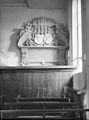
 Interieur, preekstoel - Goor - 20080072 - RCE.jpg 887 × 1,200; 134 KB
-
 Interieur, preekstoel - Goor - 20080073 - RCE.jpg 883 × 1,200; 130 KB
-
 Interieur, preekstoel - Goor - 20080074 - RCE.jpg 890 × 1,200; 131 KB
-
 Inwendig naar het westen - Goor - 20080071 - RCE.jpg 909 × 1,200; 250 KB
-
 Noord-zijde - Goor - 20080076 - RCE.jpg 1,200 × 803; 287 KB
-
 Noord-zijde portaal - Goor - 20080077 - RCE.jpg 807 × 1,200; 260 KB
-
 Noord-zijde, detail - Goor - 20080078 - RCE.jpg 835 × 1,200; 346 KB
-
 Omlijsting toegang grafkapel - Goor - 20080075 - RCE.jpg 890 × 1,200; 158 KB
-
 Oost-zijde - Goor - 20080079 - RCE.jpg 814 × 1,200; 242 KB
-
 Overzicht zuidgevel met kerktoren - Goor - 20351586 - RCE.jpg 956 × 1,200; 389 KB
-
 Toren naar het noord-westen - Goor - 20080070 - RCE.jpg 891 × 1,200; 258 KB
-
 Toren zuid-zijde - Goor - 20080081 - RCE.jpg 817 × 1,200; 308 KB
-
 Zuid-zijde - Goor - 20080080 - RCE.jpg 1,200 × 811; 320 KB
.jpg)
_-_Goor_-_20297705_-_RCE.jpg)
_-_Goor_-_20297706_-_RCE.jpg)


