Category:Hofstraat 7, Montfoort
| Object location | | View all coordinates using: OpenStreetMap |
|---|
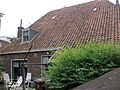
house in Montfoort, Netherlands  | |||||
| Upload media | |||||
| Instance of | |||||
|---|---|---|---|---|---|
| Location | Montfoort, Utrecht, Netherlands | ||||
| Street address |
| ||||
| Located on street | |||||
| Heritage designation |
| ||||
 | |||||
|
This is a category about rijksmonument number 30049
|
| Address |
|
Media in category "Hofstraat 7, Montfoort"
The following 6 files are in this category, out of 6 total.
-
 Linkerzijde - Montfoort - 20160697 - RCE.jpg 1,192 × 1,200; 281 KB
-
 Rechterzijde - Montfoort - 20160698 - RCE.jpg 1,193 × 1,200; 291 KB
-
 Rijksmonument Montfoort Hofstraat 7 02.JPG 2,976 × 3,968; 2.61 MB
-
 Rijksmonument Montfoort Hofstraat 7 03.JPG 3,968 × 2,976; 2.54 MB
-
 Rijksmonument Montfoort Hofstraat 7 Schildje.JPG 3,968 × 2,976; 2.51 MB
-
 Rijksmonument Montfoort Hofstraat 7.JPG 3,968 × 2,976; 2.56 MB


