Category:Hohes Rad
mountain _von_S%C3%BCden.jpg) | |||||
| Upload media | |||||
| Instance of | |||||
|---|---|---|---|---|---|
| Location | |||||
| Mountain range | |||||
| Topographic isolation |
| ||||
| Elevation above sea level |
| ||||
 | |||||
Media in category "Hohes Rad"
The following 26 files are in this category, out of 26 total.
-
 13-Bielerhöhe-S.jpg 4,240 × 2,832; 7.07 MB
-
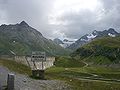 Bielerhöhe Schild.jpg 2,816 × 2,112; 3.61 MB
-
 Bieltal-Hohes Rad-01.jpg 4,592 × 1,913; 1.07 MB
-
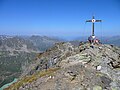
 Bieltal-Hohes Rad-Gipfelkreuz-01.jpg 2,528 × 1,651; 523 KB
-
 Bild bID1382.jpg 1,000 × 626; 128 KB
-
 Embankment dam.jpg 3,770 × 2,000; 4.88 MB
-
 Gaschurn Silvretta-Stausee Staumauer A.jpg 5,000 × 2,882; 10.43 MB
-
 Gaschurn-Partenen-Bielerhoehe-Hohes Rad (Radkopf)-01ASD.jpg 4,624 × 3,468; 3.61 MB
-
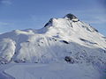
 Hohes Rad (Silvretta) von Süden.jpg 4,000 × 3,000; 6.19 MB
-
 Hohes Rad - Gipfelkreuz 01.jpg 4,592 × 3,448; 7.35 MB
-
 Hohes Rad - Radschulter 01.jpg 4,540 × 2,914; 8.79 MB
-
 Hohes Rad 01.JPG 3,456 × 2,592; 2.6 MB
-
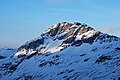
 Hohes Rad N.JPG 3,648 × 2,736; 5.4 MB
-
 Hohes Rad S.JPG 3,872 × 2,592; 4.28 MB
-
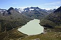
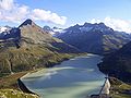 Hohes Rad und Stausee.jpg 3,072 × 2,304; 1.98 MB
-
 Hohes Rad vorn, Walserkamm rechts hinten, Zamangsp. ganz rechts.jpg 3,264 × 2,448; 1.81 MB
-
 HohesRad BuinsFromN.jpg 1,000 × 672; 46 KB
-
 Klostertaler Bach.JPG 1,944 × 2,592; 2.73 MB
-
 KlPizBuin-Fuorcla del Cunfin-Signalhorn-Silvrettahorn-Hohes Rad-mP-06.jpg 4,592 × 1,929; 1.17 MB
-
 Mountain Silvretta (75124147).jpeg 2,048 × 464; 508 KB
-
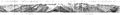 Panorama vom Hohen Rad.jpg 23,675 × 2,991; 18.11 MB
-
 Partenen-Silvrettastausse-Druckrohleitung-01.jpg 4,592 × 2,576; 3.63 MB
-
 Radsattel vorm Kleinen Piz Buin.jpg 4,608 × 2,592; 2.92 MB
-
 Radsee unterm Vermuntkopf.jpg 3,648 × 2,736; 1.72 MB
-
 Silvrettasee.jpg 4,272 × 2,848; 3.29 MB
-
 Vermunt.jpg 4,592 × 3,056; 4.68 MB


-01ASD.jpg)


.jpeg)