Category:Holmleigh, Liverpool
| Object location | | View all coordinates using: OpenStreetMap |
|---|
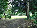
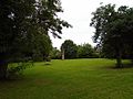
This grassy plot and a set of gate piers is all that remains of Holmleigh, a 19th century house which in about 1911 became La Sagesse Convent school. The school merged in the 1980s to become St Julie's, Woolton, but I don't know when the buildings were demolished.
Subcategories
This category has only the following subcategory.
G
Media in category "Holmleigh, Liverpool"
The following 2 files are in this category, out of 2 total.
-
 Holmleigh 1.jpg 5,152 × 3,864; 7.43 MB
-
 Holmleigh 2.jpg 5,152 × 3,864; 7.34 MB

