Category:Holy Name church, Boyton
| Object location | | View all coordinates using: OpenStreetMap |
|---|
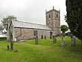
listed church building in Boyton, Cornwall, England  | |||||
| Upload media | |||||
| Instance of | |||||
|---|---|---|---|---|---|
| Location | Boyton, Cornwall, South West England, England | ||||
| Diocese | |||||
| Heritage designation |
| ||||
| Religion or worldview | |||||
 | |||||
Media in category "Holy Name church, Boyton"
The following 2 files are in this category, out of 2 total.
-
 Church of the Holy Name, Boyton.jpg 4,128 × 3,096; 5.26 MB
-
 Holy Name church, Boyton, Cornwall (geograph 3207394).jpg 1,067 × 1,600; 377 KB
.jpg)