Category:Hoofdstraat 8, Beetsterzwaag
| Object location | | View all coordinates using: OpenStreetMap |
|---|
 | |||||
| Upload media | |||||
| Instance of | |||||
|---|---|---|---|---|---|
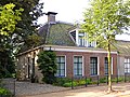
| Location | Beetsterzwaag, Friesland, Netherlands | ||||
| Located on street | |||||
| Heritage designation |
| ||||
 | |||||
|
This is a category about rijksmonument number 31824
|
| Address |
|
Media in category "Hoofdstraat 8, Beetsterzwaag"
The following 4 files are in this category, out of 4 total.
-
 Aanzicht - Beetsterzwaag - 20030071 - RCE.jpg 1,200 × 816; 250 KB
-
 Hoofdstraat8 Beetsterzwaag.jpg 1,824 × 1,368; 905 KB
-
 Voorm. pastorie, Hoofdstraat 8, Beetsterzwaag.JPG 4,608 × 3,456; 3.47 MB
-
 Voorm.Pastorie..JPG 4,608 × 3,456; 1.65 MB


