Category:Horringer
village and civil parish in Suffolk, United Kingdom  | |||||
| Upload media | |||||
| Instance of | |||||
|---|---|---|---|---|---|
| Location |
| ||||
| Said to be the same as | Horringer (Wikimedia duplicated page, civil parish) | ||||
 | |||||
Subcategories
This category has the following 4 subcategories, out of 4 total.
Media in category "Horringer"
The following 117 files are in this category, out of 117 total.
-
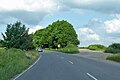
 A143 at B1066 junction - geograph.org.uk - 5797931.jpg 1,024 × 684; 270 KB
-
 A143 The Street, Horringer - geograph.org.uk - 4192886.jpg 3,072 × 2,304; 1.93 MB
-
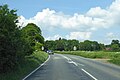
 A143 towards Bury St Edmunds - geograph.org.uk - 5797244.jpg 1,024 × 684; 194 KB
-
 A143 towards Bury St Edmunds - geograph.org.uk - 5797885.jpg 1,024 × 684; 212 KB
-
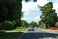 A143, Horringer - geograph.org.uk - 5797908.jpg 1,024 × 684; 247 KB
-
 A143, Horringer - geograph.org.uk - 5797919.jpg 1,024 × 684; 304 KB
-
 A143, Poulter's Lane - geograph.org.uk - 5842340.jpg 1,600 × 1,067; 440 KB
-
 Bend on The Street (A143), Horringer - geograph.org.uk - 6256679.jpg 800 × 600; 178 KB
-
 Bird Scarer - geograph.org.uk - 2274908.jpg 1,600 × 1,200; 436 KB
-
 Blue Cottage - geograph.org.uk - 2784551.jpg 1,024 × 768; 247 KB
-
 Bridlepath And Country Road - geograph.org.uk - 2784547.jpg 1,024 × 768; 127 KB
-
 Bungalow on Sharpe's Lane, Horringer - geograph.org.uk - 6256668.jpg 800 × 503; 108 KB
-

-
 Corner of Ickworth Park behind Horringer Church - geograph.org.uk - 1992686.jpg 2,848 × 2,136; 2.84 MB
-
 Cycle Tour of Britain 2010 - geograph.org.uk - 2579867.jpg 3,361 × 2,619; 4.32 MB
-
 Cycle Tour of Britain 2010 passes through - geograph.org.uk - 2579879.jpg 1,661 × 1,202; 1.5 MB
-
 Deer Protection - geograph.org.uk - 2274862.jpg 1,600 × 1,200; 369 KB
-
 Ditch and Pasture near The Hopleys - geograph.org.uk - 5712577.jpg 2,104 × 1,184; 458 KB
-
 Drainage ditch in Ickworth Park - geograph.org.uk - 4464991.jpg 6,000 × 4,000; 6.15 MB
-
 Entering Horringer on the A143 Horringer Road - geograph.org.uk - 4192866.jpg 2,965 × 2,228; 1.21 MB
-
 Entering Horringer Village - geograph.org.uk - 6256664.jpg 800 × 519; 129 KB
-
 Farm at Great Horringer Hall, Suffolk - geograph.org.uk - 4280655.jpg 4,320 × 3,240; 5.89 MB
-
 Farm building, Horsecroft Farm - geograph.org.uk - 5525760.jpg 640 × 480; 50 KB
-
 Farm buildings at Great Horringer Hall - geograph.org.uk - 2078634.jpg 3,648 × 2,736; 1.54 MB
-

-
 Farm Track to Horsecroft Hall - geograph.org.uk - 5712575.jpg 2,104 × 1,184; 481 KB
-
 Farmland and trees near Horringer House, Suffolk - geograph.org.uk - 4280600.jpg 4,320 × 3,240; 5.76 MB
-
 Farmland near Horringer - geograph.org.uk - 1394147.jpg 640 × 427; 107 KB
-
 Farmland north of Sharp's Lane near Horringer - geograph.org.uk - 4280611.jpg 4,320 × 3,240; 5.62 MB
-
 Farmland north of Sharp's Lane, Horringer, Suffolk - geograph.org.uk - 4282894.jpg 4,320 × 3,240; 5.52 MB
-
 Field towards Whitshaw Wood - geograph.org.uk - 6256256.jpg 800 × 600; 138 KB
-
 Fields of rape near Bury St Edmunds - geograph.org.uk - 395646.jpg 640 × 427; 66 KB
-
 Footpath Junction near Horringer - geograph.org.uk - 5712584.jpg 2,104 × 1,184; 685 KB
-
 Frozen pond in Adkin's Wood - geograph.org.uk - 1628493.jpg 427 × 640; 122 KB
-
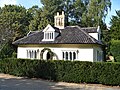
 Gate house lodge, Ickworth House - geograph.org.uk - 6256704.jpg 640 × 375; 74 KB
-
 Horringer features (2) (geograph 6760877).jpg 3,239 × 4,319; 2.7 MB
-
 Horringer Green by night - geograph.org.uk - 2727861.jpg 4,048 × 3,040; 5.48 MB
-
 Horringer Green looking south - geograph.org.uk - 1992689.jpg 2,848 × 2,136; 2.68 MB
-
 Horringer houses (10) (geograph 6760841).jpg 4,320 × 3,240; 3.19 MB
-
 Horringer houses (11) (geograph 6760875).jpg 4,003 × 3,001; 2.49 MB
-
 Horringer houses (16) (geograph 6761496).jpg 4,320 × 3,240; 3.12 MB
-
 Horringer houses (17) (geograph 6761498).jpg 4,092 × 3,069; 3.98 MB
-
 Horringer houses (19) (geograph 6761501).jpg 4,223 × 3,167; 2.63 MB
-
 Horringer houses (2) (geograph 6760802).jpg 4,035 × 3,027; 3.02 MB
-
 Horringer houses (20) (geograph 6761504).jpg 4,320 × 3,240; 3.69 MB
-
 Horringer houses (21) (geograph 6761508).jpg 4,320 × 3,240; 3.38 MB
-
 Horringer houses (5) (geograph 6760821).jpg 4,207 × 3,155; 2.18 MB
-
 Horringer houses (6) (geograph 6760822).jpg 4,223 × 3,167; 1.7 MB
-
 Horringer houses (7) (geograph 6760829).jpg 4,320 × 3,240; 2.92 MB
-
 Horringer houses (geograph 6760801).jpg 4,207 × 3,155; 3.15 MB
-
 Horringer houses (geograph 6760805).jpg 4,101 × 3,075; 3.5 MB
-
 Horringer houses (geograph 6760836).jpg 4,207 × 3,155; 4.18 MB
-
 Horringer houses (geograph 6761109).jpg 4,207 × 3,155; 3.16 MB
-
 Horringer houses (geograph 6761126).jpg 4,101 × 3,075; 2.33 MB
-
 Horringer houses (geograph 6761493).jpg 3,240 × 4,320; 3.98 MB
-
 Horringer houses (geograph 6761494).jpg 4,191 × 3,143; 3.22 MB
-
 Horringer houses (geograph 6761500).jpg 4,223 × 3,167; 2.78 MB
-
 Horringer Village Name sign - geograph.org.uk - 4192868.jpg 3,072 × 2,304; 1.94 MB
-
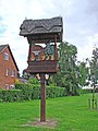 Horringer village sign - geograph.org.uk - 4292874.jpg 480 × 640; 140 KB
-
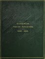 Horringer Parish Registers (IA horringerparishr01horr).pdf 956 × 1,260, 422 pages; 19.58 MB
-
 Horsecroft Road - geograph.org.uk - 5525759.jpg 640 × 480; 66 KB
-

-
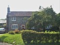
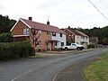
 Houses at Horringer - geograph.org.uk - 2078172.jpg 640 × 480; 74 KB
-
 Houses in Horringer, Suffolk - geograph.org.uk - 4279812.jpg 4,320 × 3,240; 5.26 MB
-
 Houses on College Close, Horringer - geograph.org.uk - 6256682.jpg 800 × 600; 100 KB
-
 Houses on Hornings Park, Horringer - geograph.org.uk - 6256709.jpg 800 × 600; 91 KB
-
 Houses on Hornings Park, Horringer - geograph.org.uk - 6256712.jpg 800 × 495; 74 KB
-
 Ickworth House and grounds (1) (geograph 6759991).jpg 4,320 × 3,240; 3.79 MB
-
 Ickworth House and grounds (2) (geograph 6759992).jpg 4,320 × 3,240; 4.27 MB
-
 Keep out - geograph.org.uk - 663204.jpg 480 × 640; 116 KB
-
 Lane and Footpath, Horringer - geograph.org.uk - 5712579.jpg 1,184 × 2,104; 702 KB
-
 Leaving Horringer on the A143 - geograph.org.uk - 6256717.jpg 800 × 600; 174 KB
-
 Locked gates, Hardwick Manor - geograph.org.uk - 1181776.jpg 640 × 480; 176 KB
-
 Long Wood - geograph.org.uk - 21934.jpg 640 × 427; 83 KB
-
 Looking South Down Horsecroft Road - geograph.org.uk - 5688625.jpg 1,136 × 1,864; 983 KB
-
 Minor road towards the A143 - geograph.org.uk - 5525839.jpg 640 × 480; 90 KB
-
 Nearly dry pond behind Horringer church - geograph.org.uk - 1992687.jpg 2,848 × 2,136; 4.57 MB
-
 Old A143 - geograph.org.uk - 2274920.jpg 1,600 × 1,200; 443 KB
-
 Ordnance Survey Flush Bracket 10733 - geograph.org.uk - 4292218.jpg 4,000 × 3,000; 3.9 MB
-
 OS Flush Bracket 10733 - geograph.org.uk - 1856258.jpg 1,024 × 819; 360 KB
-
 Part of Horsecroft Road - geograph.org.uk - 2295633.jpg 3,648 × 2,736; 1.82 MB
-
 Part of Manor Lane - geograph.org.uk - 1409097.jpg 640 × 480; 99 KB
-

-
 Sharpe's Lane, Horringer - geograph.org.uk - 6256669.jpg 800 × 600; 170 KB
-
 Sharps Lane in Horringer - geograph.org.uk - 2078627.jpg 3,648 × 2,736; 1.48 MB
-
 Small wood east of Horringer, Suffolk - geograph.org.uk - 4280647.jpg 4,320 × 3,240; 5.27 MB
-
 Snowman With Hat - geograph.org.uk - 2794795.jpg 1,024 × 768; 121 KB
-
 Speed Restriction - geograph.org.uk - 2763088.jpg 1,024 × 768; 238 KB
-
 Steep Hill - geograph.org.uk - 1823149.jpg 1,600 × 1,200; 468 KB
-
 Stubble field off Horsecroft Road - geograph.org.uk - 5525755.jpg 640 × 480; 79 KB
-
 Stubble field, Harram Hill - geograph.org.uk - 6256252.jpg 640 × 480; 62 KB
-
 The drive to Ickworth House in Suffolk - geograph.org.uk - 4282901.jpg 4,320 × 3,240; 6.06 MB
-
 The gate lodge at Ickworth House, Suffolk - geograph.org.uk - 4282897.jpg 4,320 × 3,240; 5.99 MB
-
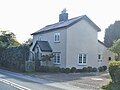
 The Hopleys, Horringer - geograph.org.uk - 22450.jpg 640 × 430; 106 KB
-
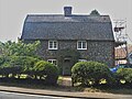
 The Old School House Horringer - geograph.org.uk - 1764894.jpg 3,264 × 2,448; 2.62 MB
-
 Toward The Lodge at Ickworth Park - geograph.org.uk - 5714021.jpg 2,104 × 1,184; 443 KB
-

-
 Track through Adkin's Wood, Horringer - geograph.org.uk - 1628484.jpg 421 × 640; 128 KB
-
 Track to Harram House - geograph.org.uk - 6256253.jpg 800 × 600; 99 KB
-
 Trees in field, Harram Bottom - geograph.org.uk - 6256247.jpg 800 × 600; 126 KB
-
 Village green and thatched cottages, Horringer - geograph.org.uk - 4465010.jpg 6,000 × 4,000; 4.16 MB
-
 Westley Bottom near Bury St Edmunds - geograph.org.uk - 4279811.jpg 4,320 × 3,240; 5.48 MB
-
 Westley Lane - geograph.org.uk - 1409197.jpg 640 × 480; 71 KB
-
 Whepstead Road (B1066) - geograph.org.uk - 6256661.jpg 800 × 600; 120 KB
-
 Whepstead Road (B1066), Harram Hill - geograph.org.uk - 6256254.jpg 800 × 600; 135 KB
-
 Adkins Wood - geograph.org.uk - 287853.jpg 480 × 640; 171 KB
-
 Clarice House, Bury St Edmunds - geograph.org.uk - 22453.jpg 640 × 417; 113 KB
-
 Dovedenhall Wood - geograph.org.uk - 21913.jpg 640 × 427; 88 KB
-
 Entrance Kiosk - geograph.org.uk - 287866.jpg 640 × 480; 124 KB
-
 Entrance Sign - geograph.org.uk - 287858.jpg 640 × 480; 148 KB
-
 Horringer House - geograph.org.uk - 22458.jpg 640 × 422; 67 KB
-
 Horsecroft Hall, Horringer - geograph.org.uk - 22455.jpg 640 × 419; 85 KB
-
 Ickworth Hotel paddock - geograph.org.uk - 705912.jpg 640 × 427; 103 KB
-
 Lady Katherine's Wood - geograph.org.uk - 21917.jpg 640 × 427; 74 KB
-
 Pond near Ickworth House - geograph.org.uk - 202830.jpg 640 × 480; 109 KB
-
 The Round house - geograph.org.uk - 663129.jpg 640 × 480; 136 KB
-
 Winter Colours - geograph.org.uk - 287845.jpg 640 × 480; 76 KB


,_Horringer_-_geograph.org.uk_-_6256679.jpg)


_(geograph_6760877).jpg)


_(geograph_6760841).jpg)
_(geograph_6760875).jpg)
_(geograph_6761496).jpg)
_(geograph_6761498).jpg)
_(geograph_6761501).jpg)
_(geograph_6760802).jpg)
_(geograph_6761504).jpg)
_(geograph_6761508).jpg)
_(geograph_6760821).jpg)
_(geograph_6760822).jpg)
_(geograph_6760829).jpg)
.jpg)
.jpg)
.jpg)
.jpg)
.jpg)
.jpg)
.jpg)
.jpg)


_(geograph_6759991).jpg)
_(geograph_6759992).jpg)


_-_geograph.org.uk_-_5525845.jpg)


_-_geograph.org.uk_-_6256661.jpg)
,_Harram_Hill_-_geograph.org.uk_-_6256254.jpg)


