Category:Hounslow (town)
suburban district of West London  | |||||
| Upload media | |||||
| Instance of | |||||
|---|---|---|---|---|---|
| Location | London Borough of Hounslow, Greater London, London, England | ||||
| Area |
| ||||
| Different from | |||||
 | |||||
Subcategories
This category has the following 17 subcategories, out of 17 total.
B
- Barrio Fiesta sa London 2009 (4 F)
- Blenheim Centre, Hounslow (18 F)
H
- Hounslow railway station (31 F)
- Hounslow (town) in art (3 F)
- Hounslow bus garage (27 F)
- Hounslow bus station (11 F)
- Hounslow House (1 F)
L
- Lampton Park (35 F)
M
- Myrtle road, Hounslow (7 F)
T
- Treaty Centre, Hounslow (9 F)
Media in category "Hounslow (town)"
The following 191 files are in this category, out of 191 total.
-
 Abbey and Bradford and Bingley.JPG 2,304 × 1,728; 1.76 MB
-
 Andrew Holmes and Sons Funeral Director in Hounslow - panoramio.jpg 2,771 × 2,190; 3.19 MB
-
 Au Morandarte Flickr DSC00553 (9565079246).jpg 3,072 × 2,304; 2.73 MB
-
 Au Morandarte Flickr DSC00816 (11588127543).jpg 3,072 × 2,304; 3.15 MB
-
 Au Morandarte Flickr DSC00817 (11587433775).jpg 3,072 × 2,304; 2.66 MB
-
 Au Morandarte Flickr IMG 7404 (14413703820).jpg 3,888 × 2,592; 4.32 MB
-
 Au Morandarte Flickr London United DE116 on Route 110, Hounslow (9562294249).jpg 3,072 × 2,304; 2.67 MB
-
 Au Morandarte Flickr London United SLE59 on Route 281, Hounslow (9562223539).jpg 3,072 × 2,304; 2.79 MB
-
 Barrack Road, Hounslow - geograph.org.uk - 4125749.jpg 2,304 × 1,728; 890 KB
-
 Basildene Road, Hounslow - geograph.org.uk - 3972225.jpg 2,560 × 1,920; 2.01 MB
-
 Beavers Crescent, Hounslow - geograph.org.uk - 2765619.jpg 640 × 480; 86 KB
-
 Beavers Lane, Hounslow - geograph.org.uk - 3972226.jpg 2,560 × 1,920; 2.03 MB
-
 Beavers Lane, Hounslow - geograph.org.uk - 3973044.jpg 2,560 × 1,920; 2.01 MB
-
 Beavers Lane, Hounslow - geograph.org.uk - 5872024.jpg 2,884 × 1,834; 2.97 MB
-
 Bell Road, Hounslow - geograph.org.uk - 3601354.jpg 640 × 480; 166 KB
-
 Bridge on Sutton Lane - geograph.org.uk - 2279261.jpg 640 × 480; 123 KB
-
 Bridge on Sutton Lane - geograph.org.uk - 2279264.jpg 640 × 372; 110 KB
-
 Bulstrode Avenue - geograph.org.uk - 2279255.jpg 640 × 406; 118 KB
-
 Bus on Martindale Road, Hounslow - geograph.org.uk - 5878638.jpg 2,034 × 1,356; 1.81 MB
-
 Bus stop, Lampton Road, Hounslow - geograph.org.uk - 3600922.jpg 640 × 480; 178 KB
-
 Cambridge Road, Hounslow - geograph.org.uk - 3973035.jpg 2,560 × 1,920; 1.98 MB
-
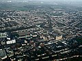
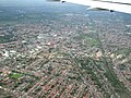
 Central Hounslow from the air - geograph.org.uk - 4604593.jpg 640 × 409; 201 KB
-
 Chinchilla Drive, Hounslow - geograph.org.uk - 6274283.jpg 3,098 × 2,218; 2.79 MB
-
 Clare Road at the junction of Cambridge Road - geograph.org.uk - 4125731.jpg 2,304 × 1,728; 823 KB
-
 Clifford Avenue, Hounslow - geograph.org.uk - 2651022.jpg 4,320 × 3,240; 3.77 MB
-
 Dale Avenue, Hounslow - geograph.org.uk - 2651204.jpg 4,320 × 3,240; 4.1 MB
-
 Demobilisation of the British Army BU12298.jpg 799 × 800; 95 KB
-
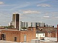
 East Hounslow from the air - geograph.org.uk - 4604587.jpg 625 × 640; 260 KB
-
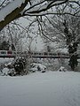
 February 2009 snow in Hounslow.JPG 1,728 × 2,304; 1.81 MB
-
 Flats on Pears Road, Hounslow - geograph.org.uk - 3825393.jpg 2,304 × 1,728; 830 KB
-
 Former Hounslow Post Office - geograph.org.uk - 4551979.jpg 640 × 528; 136 KB
-
 Former Hounslow Post Office - geograph.org.uk - 4551988.jpg 640 × 406; 115 KB
-
 Former Hounslow Post Office - geograph.org.uk - 4551990.jpg 640 × 414; 124 KB
-
 Former Hounslow Post Office - geograph.org.uk - 4551991.jpg 640 × 480; 135 KB
-
 Former Hounslow Post Office - geograph.org.uk - 4551995.jpg 640 × 480; 156 KB
-
 Former Hounslow Post Office - geograph.org.uk - 4551999.jpg 403 × 640; 146 KB
-
 Former public house, Kingsley Road, Hounslow - geograph.org.uk - 2125927.jpg 4,320 × 3,240; 3.91 MB
-
 Four Victorian Houses - geograph.org.uk - 5217224.jpg 3,479 × 2,487; 1.7 MB
-
 Frampton Road, Hounslow - geograph.org.uk - 5872026.jpg 2,976 × 1,984; 2.18 MB
-
 Gates to Cavalry Barracks - geograph.org.uk - 6047007.jpg 4,858 × 3,796; 2.42 MB
-
 Green Lane at the junction of Staines Road, Hounslow - geograph.org.uk - 3717917.jpg 2,560 × 1,920; 2.02 MB
-
 Green Lane, Hounslow - geograph.org.uk - 3718237.jpg 2,560 × 1,920; 2.04 MB
-
 Green Lane, Hounslow - geograph.org.uk - 3718304.jpg 2,560 × 1,920; 2.03 MB
-
 Group 4 Securicor van 1.JPG 2,304 × 1,728; 1.68 MB
-
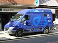 Group 4 Securicor van 2.JPG 2,304 × 1,728; 1.61 MB
-
 Hanworth road steps.jpg 1,680 × 2,061; 445 KB
-
 Harte Road - geograph.org.uk - 4547375.jpg 640 × 480; 168 KB
-
 Holloway Street - geograph.org.uk - 4552002.jpg 640 × 480; 132 KB
-
 Holy Trinity Hounslow.jpg 3,024 × 4,032; 2.85 MB
-
 Holy Trinity Church Tower and Blenheim Centre in Hounslow - panoramio.jpg 3,648 × 2,736; 1.69 MB
-
 Hounslow - geograph.org.uk - 2440421.jpg 1,519 × 1,873; 464 KB
-
 Hounslow - Upton Road - geograph.org.uk - 5102012.jpg 4,608 × 3,456; 6.07 MB
-
 Hounslow 15 mile radius.png 1,138 × 1,060; 104 KB
-
 Hounslow 2.jpg 3,434 × 953; 1.2 MB
-
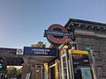 Hounslow Central (50294743553).jpg 4,032 × 3,024; 3.84 MB
-
 Hounslow Central (50295446071).jpg 4,032 × 3,024; 4.38 MB
-
 Hounslow Central (50295446386).jpg 4,032 × 3,024; 5.27 MB
-
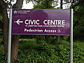 Hounslow Civic Centre-sign-2012.jpg 3,264 × 2,448; 1.01 MB
-
 Hounslow Flats - panoramio.jpg 3,648 × 2,736; 3.45 MB
-
 Hounslow from the air - geograph.org.uk - 4396945.jpg 640 × 480; 180 KB
-
 Hounslow from the air - geograph.org.uk - 4396951.jpg 640 × 480; 173 KB
-
 Hounslow from the air - geograph.org.uk - 4396961.jpg 640 × 480; 176 KB
-
 Hounslow from the air - geograph.org.uk - 4396972.jpg 640 × 480; 161 KB
-
 Hounslow from the air - geograph.org.uk - 6080465.jpg 1,024 × 715; 859 KB
-
 Hounslow from the air - geograph.org.uk - 6080468.jpg 1,024 × 768; 809 KB
-
 Hounslow from the air - geograph.org.uk - 6080471.jpg 1,024 × 768; 872 KB
-
 Hounslow London UK labelled ward map 2002.svg 1,390 × 921; 112 KB
-
 Hounslow mosque.jpg 2,048 × 1,536; 1.38 MB
-
 Hounslow police station - geograph.org.uk - 4547825.jpg 640 × 463; 124 KB
-
 Hounslow town with all modes of transport available in the town visible in the caption.jpg 6,016 × 4,000; 9.29 MB
-
 Hounslow West from the air - geograph.org.uk - 4544589.jpg 640 × 480; 233 KB
-
 Hounslow West from the air - geograph.org.uk - 4544595.jpg 640 × 480; 221 KB
-
 Hounslow West from the air - geograph.org.uk - 4544602.jpg 640 × 480; 202 KB
-
 Hounslow West from the air - geograph.org.uk - 6080480.jpg 1,024 × 768; 819 KB
-
 Hounslow- Cedar Road - geograph.org.uk - 5085651.jpg 3,264 × 2,448; 2.42 MB
-
 Hounslow.jpg 3,838 × 2,180; 2.93 MB
-
 Houses in Kingsley Avenue - geograph.org.uk - 5216926.jpg 4,000 × 2,533; 2.63 MB
-
 Houses in Montague Road Hounslow - geograph.org.uk - 4250878.jpg 640 × 480; 89 KB
-
 Houses opposite Hounslow Station - geograph.org.uk - 2621534.jpg 1,024 × 680; 179 KB
-
 Ivanhoe Road, Hounslow - geograph.org.uk - 2651059.jpg 4,320 × 3,240; 3.8 MB
-
 Kingsley Road - geograph.org.uk - 2245390.jpg 640 × 480; 144 KB
-
 Kingsley Road - geograph.org.uk - 2245396.jpg 640 × 480; 154 KB
-
 Kingsley Road - geograph.org.uk - 2245423.jpg 640 × 420; 121 KB
-
 Kingsley Road - geograph.org.uk - 4552032.jpg 640 × 480; 125 KB
-
 Kingsley Road, Hounslow - geograph.org.uk - 2125924.jpg 4,320 × 3,240; 4 MB
-
 Kingsley Road, Hounslow - geograph.org.uk - 3492542.jpg 800 × 600; 157 KB
-
 Leaving London England - Flickr - brewbooks.jpg 4,608 × 3,456; 4.47 MB
-
 London , Hounslow - City Scenery - geograph.org.uk - 5118444.jpg 6,000 × 4,000; 7.01 MB
-
 London , Hounslow - City Scenery - geograph.org.uk - 5118445.jpg 5,729 × 3,819; 7.06 MB
-
 London Borough of Hounslow , City Scenery - geograph.org.uk - 5897345.jpg 6,000 × 4,000; 7.33 MB
-
 London Borough of Hounslow , City Scenery - geograph.org.uk - 5897346.jpg 6,000 × 4,000; 7.02 MB
-
 London Borough of Hounslow depot from the air - geograph.org.uk - 6080462.jpg 1,024 × 768; 758 KB
-
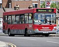 London Bus route H37.jpg 960 × 768; 121 KB
-
 London Red Buses on a Stop in Grove Road in Hounslow - panoramio.jpg 3,524 × 2,564; 4.66 MB
-
 London Road, Hounslow - geograph.org.uk - 108845.jpg 640 × 480; 206 KB
-
 London United ADE35 on Route 222, Hounslow, 25-02-14 (12776670304).jpg 3,264 × 2,448; 2.73 MB
-
 London United DE22 on Route 116, Hounslow.jpg 3,072 × 1,842; 3.77 MB
-
 London United DLE1 on Route H98, Hounslow Treaty Centre (14167608501).jpg 3,264 × 2,448; 2.6 MB
-
 London United DLE21 on Route H98, Hounslow, 25-02-14 (12776638234).jpg 3,264 × 2,448; 2.83 MB
-
 London United DPS727 on Route 110, Hounslow.jpg 3,072 × 2,304; 2.7 MB
-
 London United SP102 (LU 2000s Livery) on Route 281, Hounslow Treaty Centre (14660542821).jpg 3,264 × 2,448; 2.64 MB
-

-
 London United TA246 on Route H32, Hounslow-Treaty Centre (14168210932).jpg 3,264 × 2,448; 2.88 MB
-
 Manor Avenue, Hounslow - geograph.org.uk - 2649461.jpg 4,320 × 3,240; 3.78 MB
-
 Martindale Road - geograph.org.uk - 2279060.jpg 640 × 480; 125 KB
-
 Martindale Road, Hounslow - geograph.org.uk - 2651203.jpg 4,320 × 3,240; 3.84 MB
-
 Martindale Road, Hounslow - geograph.org.uk - 5872025.jpg 2,976 × 1,984; 1.9 MB
-
 Martindale Road, Hounslow - geograph.org.uk - 5878645.jpg 1,356 × 2,034; 933 KB
-
 Martindale Road, Hounslow - geograph.org.uk - 5879135.jpg 2,034 × 1,356; 1.87 MB
-
 Martindale Road, Hounslow - geograph.org.uk - 6041330.jpg 4,840 × 3,777; 1.8 MB
-
 Montague Road - geograph.org.uk - 4547744.jpg 640 × 431; 137 KB
-
 Montague Road at Balfour Road - geograph.org.uk - 4547724.jpg 640 × 379; 100 KB
-
 Myrtle Road - geograph.org.uk - 2245454.jpg 640 × 430; 123 KB
-
 Myrtle Road - geograph.org.uk - 4552017.jpg 640 × 480; 142 KB
-
 Myrtle Road - geograph.org.uk - 4552022.jpg 640 × 480; 159 KB
-
 Myrtle Road - geograph.org.uk - 4552025.jpg 640 × 480; 134 KB
-
 Myrtle Road, Hounslow - geograph.org.uk - 2125926.jpg 4,320 × 3,240; 3.45 MB
-
 Old Farm Close - geograph.org.uk - 2507112.jpg 640 × 480; 115 KB
-
 Olympics come to Hounslow.jpg 3,264 × 2,448; 1.86 MB
-
 Orchard Road - geograph.org.uk - 2507117.jpg 640 × 480; 93 KB
-
 Orchard Road - geograph.org.uk - 2507120.jpg 640 × 480; 81 KB
-
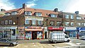
 Parade of shops in Hounslow - geograph.org.uk - 2303348.jpg 1,280 × 960; 617 KB
-
 Parkside Road, Hounslow - geograph.org.uk - 6025863.jpg 4,782 × 3,469; 1.93 MB
-
-
 Pears Road, Hounslow - geograph.org.uk - 3825388.jpg 2,304 × 1,728; 869 KB
-
 Pears Road, Hounslow - geograph.org.uk - 3825397.jpg 2,304 × 1,728; 862 KB
-
 Perfect Oneeleven Ruined... (14393894616).jpg 3,264 × 2,448; 2.67 MB
-
 Plane over Cambridge Road, Hounslow - geograph.org.uk - 4126377.jpg 2,304 × 1,728; 889 KB
-
 Platts Shop Sign above Argos Store in Hounslow High Street - panoramio.jpg 3,648 × 2,736; 2.9 MB
-
 Prince Regent Road - geograph.org.uk - 4552014.jpg 640 × 480; 103 KB
-
 Prospect Close - geograph.org.uk - 2279296.jpg 640 × 480; 129 KB
-
 Prospect Close - geograph.org.uk - 2507141.jpg 640 × 480; 88 KB
-
 Queenswood Avenue - geograph.org.uk - 2279292.jpg 640 × 480; 151 KB
-
 Renfrew Rd off Bath Rd - geograph.org.uk - 2602935.jpg 640 × 406; 63 KB
-
 Rosebys, Hounslow, 27-09-08.JPG 2,304 × 1,728; 1.84 MB
-
 Rosemary Avenue, Hounslow - geograph.org.uk - 2649450.jpg 4,320 × 3,240; 3.85 MB
-
 Rosemary Avenue, Hounslow - geograph.org.uk - 2649451.jpg 4,320 × 3,240; 3.74 MB
-
 Rosemary Avenue, Hounslow - geograph.org.uk - 3972224.jpg 2,560 × 1,920; 2 MB
-
 Sanders Lane, Hounslow - geograph.org.uk - 5872030.jpg 2,976 × 1,984; 3.23 MB
-
 Sandson Palais.JPG 1,280 × 960; 540 KB
-
 Sarsen Avenue - geograph.org.uk - 2279320.jpg 640 × 447; 136 KB
-
 Selwyn Close, Hounslow - geograph.org.uk - 4125771.jpg 2,304 × 1,728; 823 KB
-
 Shops on Bath Road Hounslow - geograph.org.uk - 1584165.jpg 640 × 480; 75 KB
-
 Solar traffic light 3.jpg 2,323 × 1,742; 502 KB
-
 Springwell Rd - geograph.org.uk - 2602947.jpg 640 × 430; 67 KB
-
 Stirling Grove, Hounslow - geograph.org.uk - 4666045.jpg 1,024 × 768; 174 KB
-
 Stratton Close - geograph.org.uk - 2279317.jpg 640 × 480; 161 KB
-
 Streets of Hounslow (50298955333).jpg 4,032 × 3,024; 3.9 MB
-
 Sunnycroft Road - geograph.org.uk - 4547683.jpg 640 × 480; 149 KB
-
 Sutton Lane - geograph.org.uk - 2279083.jpg 640 × 480; 136 KB
-
 Sutton Lane - geograph.org.uk - 2279300.jpg 640 × 415; 120 KB
-
 Sutton Lane - geograph.org.uk - 2279355.jpg 640 × 406; 115 KB
-
 Sutton Lane at the junction of Bath Road - geograph.org.uk - 3606296.jpg 2,048 × 1,536; 1.48 MB
-
 Sutton Lane, Hounslow - geograph.org.uk - 3606496.jpg 2,048 × 1,536; 1.52 MB
-

-

-

-
 The 281 bus in Hounslow, London, September 1998.jpg 3,348 × 2,370; 1.95 MB
-
 The Blenheim Centre from the air - geograph.org.uk - 4355458.jpg 640 × 480; 186 KB
-
 The former Warren pub - geograph.org.uk - 3132057.jpg 640 × 480; 98 KB
-
 The Greenway at the junction of Wellington Road North - geograph.org.uk - 3606425.jpg 2,048 × 1,536; 1.44 MB
-
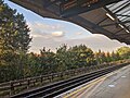
 Tube train in snow.JPG 1,728 × 2,304; 1.7 MB
-
 Unnamed road leading to a car park - geograph.org.uk - 972405.jpg 640 × 480; 82 KB
-
 Up the pole, Parkside Road - geograph.org.uk - 6025834.jpg 3,758 × 4,840; 2.67 MB
-
 Vicarage Farm Road Bus Stop - geograph.org.uk - 5217220.jpg 1,024 × 768; 200 KB
-
 View from roof house.JPG 640 × 480; 100 KB
-
 View looking down.JPG 480 × 640; 94 KB
-
 Waiting for the H22 bus - geograph.org.uk - 3144779.jpg 640 × 480; 133 KB
-
 Walking around Hounslow (50294744083).jpg 4,032 × 3,024; 4.43 MB
-
 Walking around Hounslow (50294746898).jpg 4,032 × 3,024; 4.52 MB
-
 Walking around Hounslow (50294750188).jpg 4,032 × 3,024; 4.56 MB
-
 Walking around Hounslow (50295424006).jpg 4,032 × 3,024; 4.23 MB
-
 Walking around Hounslow (50295424476).jpg 4,032 × 3,024; 5.34 MB
-
 Walking around Hounslow (50295426231).jpg 4,032 × 3,024; 4.11 MB
-
 Walking around Hounslow (50295427321).jpg 4,032 × 3,024; 5.25 MB
-
 Walking around Hounslow (50295574557).jpg 4,032 × 3,024; 3.47 MB
-
 Welcome to Hounslow (50294168063).jpg 4,032 × 3,024; 4.21 MB
-
 Welcome to Hounslow (50294848301).jpg 4,032 × 3,024; 4.06 MB
-
 Welcome to Hounslow (50295000017).jpg 4,032 × 3,024; 3.96 MB
-
 Welcome to Hounslow (50295002247).jpg 4,032 × 3,024; 4.22 MB
-
 Wellington Road North, Hounslow - geograph.org.uk - 3606419.jpg 2,048 × 1,536; 1.49 MB
-
 Wesley Avenue at the junction of Sutton Lane - geograph.org.uk - 3606291.jpg 2,048 × 1,536; 1.56 MB
-
 Wesley Avenue at the junction of Sutton Lane - geograph.org.uk - 4126303.jpg 2,304 × 1,728; 797 KB
-
 West Hounslow from the air - geograph.org.uk - 5085062.jpg 640 × 480; 207 KB
-
 West Hounslow from the air - geograph.org.uk - 5085071.jpg 640 × 480; 160 KB
-
 WH Smith Hounslow.JPG 2,304 × 1,728; 1.63 MB
-

-
 Whitton Road, Hounslow - geograph.org.uk - 3572363.jpg 3,456 × 4,608; 6.34 MB
-
 Windmill and Solar Panel Electricity Generators near Hounslow High Street - panoramio.jpg 3,636 × 2,720; 4.73 MB
-
 Woolworths Hounslow - Closing Down Sale - Exterior.jpg 2,304 × 1,728; 1.78 MB
-
 Zebra crossing on Sutton Lane - geograph.org.uk - 2279243.jpg 640 × 480; 159 KB


.jpg)
.jpg)
.jpg)
.jpg)
.jpg)
.jpg)


.jpg)
.jpg)
.jpg)


.jpg)

.jpg)
.jpg)

_on_Route_281,_Hounslow_Treaty_Centre_(14660542821).jpg)
_on_Route_281,_Hounslow_Treaty_Centre._(14683660933).jpg)
.jpg)


.jpg)


.jpg)


.jpg)
.jpg)
.jpg)


.jpg)
.jpg)
.jpg)
.jpg)
.jpg)
.jpg)
.jpg)
.jpg)
.jpg)
.jpg)
.jpg)
.jpg)


