Category:Hoylandswaine
English: Hoylandswaine is a village in the county of South Yorkshire.
village in South Yorkshire, England, UK  | |||||
| Upload media | |||||
| Instance of | |||||
|---|---|---|---|---|---|
| Location | Penistone, Barnsley, South Yorkshire, Yorkshire and the Humber, England | ||||
 | |||||
Subcategories
This category has the following 2 subcategories, out of 2 total.
Media in category "Hoylandswaine"
The following 48 files are in this category, out of 48 total.
-

-
 Abstract agriculture - geograph.org.uk - 113578.jpg 640 × 426; 122 KB
-

-

-

-

-
 Barnsley Road Hoylandswaine - geograph.org.uk - 858276.jpg 640 × 480; 69 KB
-

-
 British Isles rural and coastal (3225594650).jpg 4,256 × 2,832; 1.8 MB
-
 Close-up of Kidfield House Farm - geograph.org.uk - 934834.jpg 640 × 480; 74 KB
-
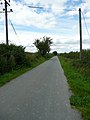
 Coach Gate lane junction - geograph.org.uk - 1440381.jpg 640 × 480; 70 KB
-

-

-

-

-

-
 Holiday home near Hoylandswaine - geograph.org.uk - 1056888.jpg 640 × 416; 66 KB
-
 House on hillside near Renald Lane - geograph.org.uk - 934819.jpg 640 × 480; 61 KB
-

-
 Hoylandswaine village amenities - geograph.org.uk - 947681.jpg 640 × 480; 78 KB
-

-

-

-
 Keep in low gear - geograph.org.uk - 570860.jpg 640 × 429; 84 KB
-
 Kidfield House Farm - geograph.org.uk - 934825.jpg 640 × 480; 98 KB
-

-

-
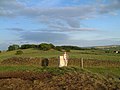
 Looking out over Hoylandswaine - geograph.org.uk - 948559.jpg 640 × 480; 63 KB
-

-
 Near Guyder Bottom - geograph.org.uk - 113541.jpg 640 × 426; 129 KB
-

-

-
 Pye Flats from Whin Moor Lane - geograph.org.uk - 939084.jpg 640 × 480; 108 KB
-

-

-
 The A629 near Penistone - geograph.org.uk - 168073.jpg 640 × 480; 110 KB
-

-

-

-
 The methodist chapel Hoylandswaine - geograph.org.uk - 947703.jpg 640 × 480; 78 KB
-

-

-
 The Rose and Crown, Hoylandswaine - geograph.org.uk - 947639.jpg 640 × 458; 60 KB
-
-
-

-

-


.jpg)


